- Kozani Prefecture
Infobox Pref GR
name = Kozani
name_local = Νομός Κοζάνης
"Nomos Kozanis"
flag_reg = Flag of Greek Macedonia.svg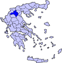
periph =West Macedonia
capital =Kozani
population = 156,807
population_as_of = 2005
pop_rank = 18th
pop_dens = 44.6
popdens_rank = 35th
area = 3,516
area_rank = 11th
postal_code = 50x xx
area_code = 246x0
licence = provinces = 3
municip = 16
commun = 3
ISO = GR-58
website = [http://www.kozani.gr/ www.kozani.gr]Kozani ( _el. Κοζάνη) is a prefecture in Greece, located in western Macedonia. Its capital is the city of
Kozani .Boundaries
It is bounded by the prefectures of Kastoria to the west and northwest, Florina to the north, Pella to the northeast, Imathia and
Pieria to the east, Larissa (part ofThessaly ) to the southeast, and Grevena to the south.Provinces
Kozani has three provinces: Kozani,
Eordaia andVoio .Municipalities and communities
Geography
Its geography features a small valley that stretches from the northern part of the prefecture down to the
Aliakmon River andLake Polyfytos . The mountains are to the west and east especially the area of Kozani, they includeAskio to the west,Vermio to the northeast andVoio to the southwest. The northern portion are mined and the western and the eastern portions are forested as well as grassy and barren.Climate
Its climate ranges from continental to mountainous. Kozani has warm to hot summers and cool winters, cooler than Thessaloniki, the mountainous, the western and the eastern portion receives cold winters and features snow. Its sunshine days are days shorter than the south and by the coastline, it is more rainier than the south. Temeperatures ranges from 25 to 30 C during the summer months.
History
Early years
The area of the prefecture were made up of several kingdoms including the ancient
Eordaia , it was later ruled by theKingdom of Macedonia and later, theRoman Empire after theThird Macedonian War , it later became a part of theByzantine Empire after the break up into the West and the East, in the early 14th to the 15th century, it was ruled by theOttoman Empire and lasted until theBalkan Wars of 1913. The modern prefecture was created later on and included the modern Florina, Grevena and the Kastoria prefecture.Modern times
Refugees from
Asia Minor andPontus during the Greco-Turkish War of 1919 to 1922 brought refugees to the area including Kozani and villages and towns that removed the Turkish population to the country which later became only known as Turkey. The economy boomed and was disrupted later on. AfterWorld War II and theGreek Civil War , most of the bulildings were repaired. Kozani opened its airport and later its hospital.In 1996, an earthquake rumbled a part of the prefecture. Between 1998 and 2006, the Via Egnatia was under construction and contains tunnels, it was finally opened after the completion.
The prefecture was affected by a small forest fire that burnt forests in the vicinity of Velventos near Lake Polyfytos, it consumed a part of the area but it was a minor wildfire that lasted hours. An earthquake shook the area south of the city of Kozani on Friday
February 29 ,2008 , it caused only minor damages mainly to older architecture. It measured 4.4 on the Richter scale, a lighter measurement that was to be seen since late-2007 including Methoni and Erymanthos quakes with the exception of the time of the forty earthquakes a few days earlier.Economy
Kozani has been a prosperous area in the course of its history. Its merchants are once known to have dominated the
commerce of the Balkan peninsula, expanding their trade activities to the north and along theDanube . Kozani nowadays is still among the most prosperous areas of the Greek province, but for a different reason, its richmining industry . Kozani produceslignite , which is the main source of the electric power produced in Greece, nitrous salts which are processed intofertilizer s, andchromium . There was also anasbestos mine that remained operational until the mid-1990s, which has now ceased its operation. In the prefecture of Kozani there is also theartificial lake andhydroelectric dam ofPolyfytos , which further contributes to the electricity production of Greece. The region's vast industrial advancement in a short period of time has raisedenvironmentalist concerns.Transport
*National Roads
**Greece Interstate 3 , SE, Cen., N
**Greece Interstate 15 , SW, W
**Greece Interstate 20 , SW, W, Cen.
**Via Egnatia
*Air transport:
**Kozani National Airport "Filippos" , 4km fromKozani (flights toKastoria ,Athens ).
*Rail transport:
**Kozani-Amyntaio railway line Athletic Clubs
*
Lignitorychi - Ptolemaidaee also
*
List of settlements in the Kozani prefecture
Wikimedia Foundation. 2010.