- Saona Island
Infobox Islands
name = Saona
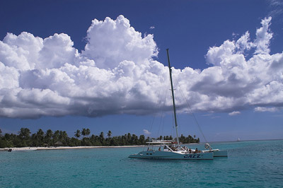
image caption =
image size =
locator
Location map|Dominican Republic|lat=18.1555|long=-68.6994
map_custom = yes
native name = "Isla Saona"
native name link = Spanish language
nickname =
location =
coordinates = coord|18|09|20|N|68|41|58|W
archipelago =
total islands =
major islands =
area = convert|110|km2|sqmi
length = convert|25|km|mi
width = convert|5|km|mi
coastline =
highest mount =
elevation = convert|35|m|ft
country = Dominican Republic
country admin divisions title = Province
country admin divisions =La Altagracia Province
country admin divisions title 1 =
country admin divisions 1 =
country admin divisions title 2 =
country admin divisions 2 =
country capital =
country largest city =
country largest city population =
country leader title =
country leader name =
country 1 =
country 1 admin divisions title =
country 1 admin divisions =
country 1 capital city =
country 1 largest city =
country 1 largest city population =
country 1 leader title =
country 1 leader name =
country 2 =
country 2 admin divisions title =
country 2 admin divisions =
country 2 capital city =
country 2 largest city =
country 2 largest city population =
country 2 leader title =
country 2 leader name =
population = 300
population as of =
density = 2.73
ethnic groups =
additional info =Saona Island or "Isla Saona" is a
tropical island located a short distance from the mainland on the south-east tip of theDominican Republic , nearLa Altagracia Province . It is a government protectednature reserve and a popular destination fortourists from all over the Dominican Republic, who arrive in fleets ofcatamarans and smallmotorboat s on organised excursions every day. The Island is famous for the natural beauty of itsbeaches , and has been used on many occasions by film-makers and advertisers looking for a stereotypical 'desert island' setting for their film or product. It is promoted amongstEurope an visitors as the setting for the famous Bounty chocolate bar adverts. Before it was part of the Province of ColónWith an area of 42 sq miles (110 sq km) Saona is the largest Dominican offshore island and forms part of the National Park of the East (Parque Nacional del Este).
The seas around the Island are rich in
wildlife , with many species ofbirds and tropical marinefish , and there are large areas where naturalsandbars offshore bring the depth to just a few feet. These are once again popular with the tourist trade, with small boats stopping hundreds of metres off the beach and disgorging tourists into the waist-deep shallows where they snorkel, drink and check out the fields ofstarfish indigenous to the region.The island was baptized "Saona" by
Christopher Columbus , who discovered it in May 1494 on his way to theAmericas . The name was meant to honor the commune ofSavona , where Columbus lived at the time. Columbus namedMichele da Cuneo , his friend and a savonese himself, first governor of the island. Saona Island and the modern city Savona, inItaly , still have twinning relationships; the smallpowerplant in Saona Island is a gift of Savona.External links
* [http://www.robarspages.ca/caribbean-travel-tips.com Caribbean Travel Tips] Caribbean Travel Tips Including Saona Island
* [http://video.google.com/videoplay?docid=-7741984551799338922&hl=en-GB The Saona Island Experience] The Saona Island Experience (Excursion Home Video)
* [http://www.dominicanairporttransfers.com Dominican Airport Transfers] Offers the Saona Island Tour
Wikimedia Foundation. 2010.