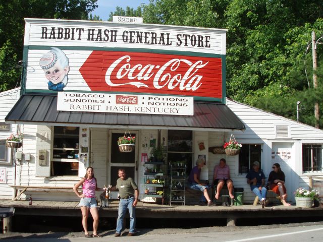
- Rabbit Hash Historic District
Infobox_nrhp
name = Rabbit Hash Historic District
nrhp_type =

caption = Rabbit Hash General Store
location= Rabbit Hash,Kentucky
lat_degrees = 38
lat_minutes = 56
lat_seconds = 32
lat_direction = N
long_degrees = 84
long_minutes = 50
long_seconds = 45
long_direction = W
locmapin = Kentucky
area =
architect = Unknown
architecture =
added =December 4 ,2003
governing_body =
mpsub =
refnum=03001231cite web|url=http://www.nr.nps.gov/|title=National Register Information System|date=2008-08-24|work=National Register of Historic Places|publisher=National Park Service] TheRabbit Hash Historic District was added to theNational Register of Historic Places onDecember 4 ,2003 . It includes 330 acres, 12 buildings, 6 structures, and 3 objects around 10021-10410 Lower River Rd. [cite web|url=http://www.nps.gov/nr/listings/20031212.htm|title=National Register of Historic Places Listings December 12, 2003:|publisher=National Park Service|accessdate=2008-08-24] [cite web|url=http://www.nationalregisterofhistoricplaces.com/KY/Boone/districts.html|title=KENTUCKY - Boone County - Historic Districts |accessdate=2008-08-24] TheRabbit Hash General Store , one of the addresses in the District, had already been listed sinceFebruary 2 ,1989 . [cite web |url=http://www.nr.nps.gov/ |title=National Register Information System |publisher=National Park Service|accessdate=2008-08-24]References
Wikimedia Foundation. 2010.
