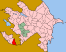
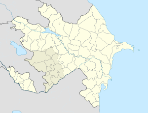
- Dəstə
-
Dəstə — Municipality — Coordinates: 38°53′00″N 45°54′40″E / 38.8833333°N 45.91111°ECoordinates: 38°53′00″N 45°54′40″E / 38.8833333°N 45.91111°E Country  Azerbaijan
Autonomous republic Nakhchivan Rayon Ordubad Population[citation needed] - Total 4,282 Time zone AZT (UTC+4) - Summer (DST) AZT (UTC+5) Dəstə (also, Dosti, Dasta, Dastak) is a village and the most populous municipality, after the capital Ordubad, in the Ordubad Rayon of Nakhchivan, Azerbaijan. It has a population of 4,282.
History
During the period of late antiquity, Dəstə, known by the Armenian name of Dasta (Դաստա; also, Dastak, Դաստակ), was an Armenian-populated village in the Kingdom of Armenia and was administratively a part of the province of Vaspurakan's district of Goght'n.[1] In later centuries, its Armenian population emigrated and settled in nearby settlements, especially Agulis and Shusha.[1]
In the early twentieth century, it had a population of about 1,500, most of whom were Muslims.[1] By 1971, its population had risen to 4,500.[1]
The remains of two partially-destroyed Armenian churches were still preserved at the end of the Soviet period.[1]
Notes
External links
Ağrı · Anabad · Anaqut · Aşağı Əndəmic · Aşağı Əylis · Aza · Azadkənd · Baş Dizə · Başkənd · Behrud · Biləv · Bist · Çapayevka · Çənnəb · Darkənd · Dəstə · Dırnıs · Dizə · Düylün · Düylündizə · Ələhi · Gənzə, Nakhchivan · Gilançay · Kələki · Kələntər Dizə · Kotam · Məzrə · Nəsirvaz · Nürgüt · Nüsnüs · Parağa · Parağaçay · Pəzməri · Qoruqlar · Qoşadizə · Sabirkənd · Şəhriyar · Tivi · Unus · Üstüpü · Vələver · Vənənd · Xanağa · Xurs · Yuxarı Əndəmic · Yuxarı Əylis
 Categories:
- Populated places in Ordubad Rayon
- Nakhchivan geography stubs
Wikimedia Foundation. 2010.

