Düzyurd

Düzyurd
Düzyurd
—  Municipality  —
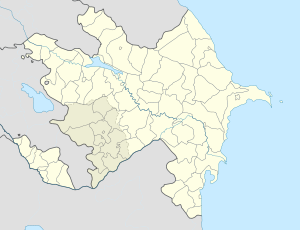
Düzyurd is located in Azerbaijan
Düzyurd
Coordinates: 40°32′41″N 45°48′28″E / 40.54472°N 45.80778°E / 40.54472; 45.80778Coordinates: 40°32′41″N 45°48′28″E / 40.54472°N 45.80778°E / 40.54472; 45.80778
Country  Azerbaijan
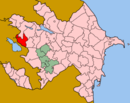
Rayon Gadabay
Population[citation needed]
 – Total 2,091
Time zone AZT (UTC+4)
 – Summer (DST) AZT (UTC+5)

Düzyurd (also, Dyuzyurd and Dyuz-Yurt) is a village and municipality in the Gadabay Rayon of Azerbaijan. It has a population of 2,091. The municipality consists of the villages of Düzyurd and Ayıtala.[1]

References


Wikimedia Foundation. 2010.

Игры ⚽ Поможем написать курсовую

Look at other dictionaries:

  • Kiçik Düzyürd — Infobox Settlement official name =Kiçik Düzyürd native name = pushpin pushpin mapsize =300 subdivision type = Country subdivision name = flag|Azerbaijan subdivision type1 = Rayon subdivision name1 =Gadabay leader title = leader name = established …   Wikipedia

  • Cəfərli, Gadabay — Coordinates: 40°34′N 45°38′E / 40.567°N 45.633°E / 40.567; 45.633 …   Wikipedia

  • Motudərə — Coordinates: 40°36′N 45°28′E / 40.6°N 45.467°E / 40.6; 45.467 …   Wikipedia

  • Dördlər, Gadabay — Coordinates: 40°37′N 45°27′E / 40.617°N 45.45°E / 40.617; 45.45 …   Wikipedia

  • Novospasovka — Coordinates: 40°37′N 45°54′E / 40.617°N 45.9°E / 40.617; 45.9 …   Wikipedia

  • Novoqorelovka — Coordinates: 40°38′N 45°53′E / 40.633°N 45.883°E / 40.633; 45.883 …   Wikipedia

  • Arısu — Disambiguation: Arisu redirects here. For the fictional character see Arisu Seno. Coordinates: 40°29′27″N 45°43′51″E / 40.49083°N 45.73083°E / 40.49083; 45.73083 …   Wikipedia

  • Çalburun —   Municipality   …   Wikipedia

  • Çaldaş —   Municipality   …   Wikipedia

  • Dəyəqarabulaq —   Municipality   …   Wikipedia

Share the article and excerpts

Direct link
Do a right-click on the link above
and select “Copy Link”