- Daşgəsən
-
Coordinates: 39°25′37″N 47°06′27″E / 39.42694°N 47.1075°E
Daşgəsən 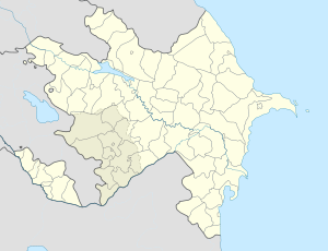
 Daşgəsən
Coordinates: 39°25′37″N 47°06′27″E / 39.42694°N 47.1075°E Country  Azerbaijan
Rayon Jabrayil Time zone AZT (UTC+4) – Summer (DST) AZT (UTC+5) Daşgəsən (also, Daşkəsən, Dashkesan, Deshkesen, and Doshkesen) is a village in the Jabrayil Rayon of Azerbaijan.
Notable natives
- Vugar Huseynov — National Hero of Azerbaijan[1].
References
Ağtəpə, Alıkeyxalı, Aşağı Maralyan, Aşağı Mərcanlı, Aşağı Sirik, Balyand, Böyük Mərcanlı, Çaprand, Çaxırlı, Cəfərabad, Çələbilər, Çərəkən, Chapand, Chullu, Çocuq Mərcanlı, Çullu, Dağ Maşanlı, Dağ Tumas, Daş Veysəlli, Daşbaşı, Daşgəsən, Dəcəl, Derzili, Doşulu, Əfəndilər, Əmirvarlı, Əsgərxanlı, Fuqanlı, Göyərçin Veysəlli, Hacı İsaqlı, Hacılı, Hacılı, Hasənli, Havuslu, Həsənqaydı, Horovlu, Hüseynalılar, İmambağı, Isaqlı, Kabaglyar, Karadara, Karxulu, Kavdar, Kechalmamedli, Khalafli, Kürdlər, Mahmudlu, Maşanlı, Mehdili, Mərcanlı, Məstalıbəyli, Məzrə, Minbaşılı, Mirək, Mollahəsənli, Niyazqulular, Nüsüs, Nuzgər, Papı, Qalacıq, Qaraağac, Qaracallı, Qaradağlı, Qazanzəmi, Qərər, Qışlaq, Qoşabulaq, Qovşudlu, Qumlaq, Qurbantəpə, Quycaq, Şahvəlili, Sarıcalı, Sədi, Səfərşa, Şəybəy, Sirik, Şıxalıağalı, Şıxlar, Sofulu, Soltanlı, Söyüdlü, Şükürbəyli, Süleymanlı, Tatar, Tinli, Tulus, Xələfli, Xubyarlı, Xudafərin, Xudaverdili, Yanarxaj, Yarəhmədli, Yuxarı Maralyan, Yuxarı Məzrə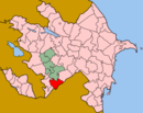 Categories:
- Populated places in Jabrayil Rayon
- Jabrayil Rayon geography stubs


Wikimedia Foundation. 2010.