Pond Lane Flood Gates

Pond Lane Flood Gates

Infobox Waterlock
lock_name=Pond Lane Flood Gates


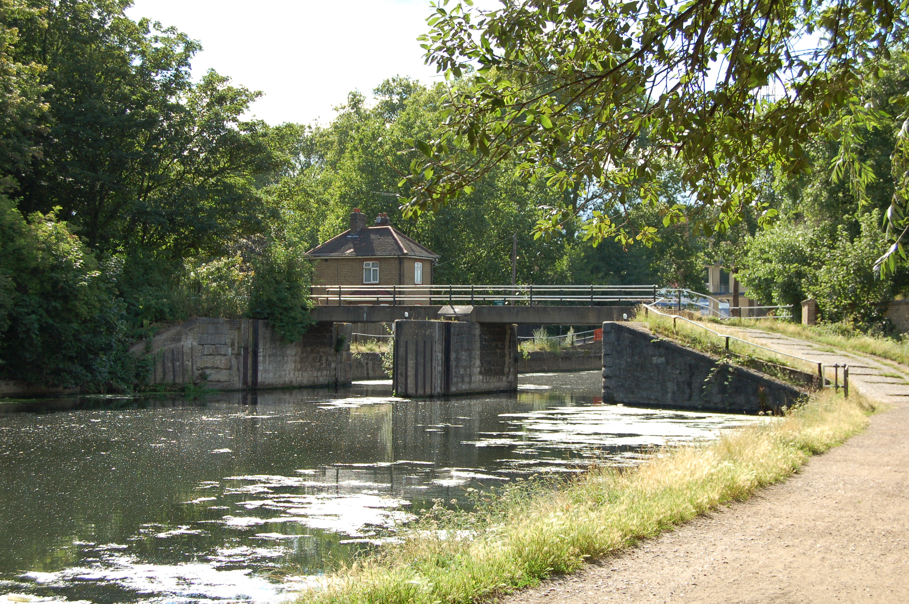
caption=Redundant flood gates, at the top of Hackney Cut, on the Lee Navigation.
waterway=River Lee Navigation
county=Hackney
Greater London
operation=redundant
first=
length=
width=
fall=
enda=Bow Creek
distenda=convert|3.0|mi|km|1|lk=on
endb=Hertford Castle Weir
distendb=convert|23.3|mi|km|1
coordinates=
lat= 51.560858
long=-0.043645

Pond Lane Flood Gates (No18) is redundant lock on the River Lee Navigation in the London Borough of Hackney, at Lea Bridge Road.

History

The flood gates were built as part of a scheme to control the navigation in the Bow Back Rivers and to protect the area above this point against flooding from the River Thames. They were originally used in conjunction with a tidal lock on Marshgate Lane. With the alteration of the Bow Back River system in the 1930s, new locks were added at Carpenter's Road and City Mill – mainly to provide barge access to Temple Mills.

The disuse of the Bow Back River locks in the 1960s, and the construction of the Thames Barrier caused the flood gates to become redundant and they were finally removed in 1987. [ [http://www2.mihalis.net/canal/cgi-bin/gazette.cgi?where=$9td3 Pond Lane flood gates] Retrieved July 14 2008] The footbridge over the lock still remains.

Location

The remains of the flood gates are located south of the Lea Bridge Road at Lea Bridge and adjacent to the former Middlesex Filter Beds now a nature reserve.

Public transport

Clapton railway station

Public access

Walking and cycling access via the Lea Valley Walk

References

External links

* [http://www.leevalleypark.org.uk/EN/default.aspx?n1=3&n2=65&n3=67 Middlesex Filter Beds]
* [http://www.mike-stevens.co.uk/metrocuts/lee/pondlane.htm Pond Lane flood gates]


Wikimedia Foundation. 2010.

Игры ⚽ Поможем решить контрольную работу

Look at other dictionaries:

  • Old Ford Lock — For other places with the same name, see Old Ford Lock (disambiguation). Old Ford Lock Old Ford Lock, Lee Navigation Waterway …   Wikipedia

  • Bow Back Rivers — The Bow Back Rivers are part of the River Lee in the London Borough of Newham, East London, and form a complex system of waterways. The River Lee was originally tidal as far as Hackney Wick, man made changes to the River had changed this… …   Wikipedia

  • Lea Valley Walk — Infobox Hiking trail Name=Lea Valley Walk Photo=WardownLake.jpg Caption=The trail goes through Wardown Park Location= South East England Designation= Length=Convert|50|mi|km|0 Start/End Points=Leagrave Limehouse Basin Use=Hiking,Cycling,Angling,… …   Wikipedia

  • Dobbs Weir — Fish and Eels public house Weir pool with bridge …   Wikipedia

  • Hertford Union Canal — Junction of Hertford Union Canal and River Lee Navigation Original owner Sir George Duckett Principal engineer …   Wikipedia

  • City Mill River — City Mill Lock The Waterworks River. To the left is the lock leading to City Mill River Waterway Bow Back Rivers River Lee …   Wikipedia

  • Newmans Weir — is a River Lea weir located near Enfield Lock. The weir has wooden sluice gates within cast iron guide frames. Reconstructed in 1907 in succession to a series of timber weirs.[1] The view above the weir, the weir keeper s cottage stands on the… …   Wikipedia

  • Dobbs Weir Lock — Looking north Waterway River Lee Navigation County …   Wikipedia

  • Old River Lea — River Country United Kingdom …   Wikipedia

  • Cheshunt Lock — Waterway River Lee Navigation County Hertfordshire …   Wikipedia

Share the article and excerpts

Direct link
Do a right-click on the link above
and select “Copy Link”