Narrow Island, Falkland Islands
- Narrow Island, Falkland Islands
-
Coordinates: 51°20′56″S 59°44′49″W / 51.3489°S 59.7469°W / -51.3489; -59.7469
| Narrow Island |
| Location |
|
|
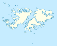
| Narrow Island shown within the Falkland Islands. |
| Names |
| English name: |
Narrow Island |
| Spanish name: |
|
| Area and Summit |
| Area: |
|
| Highest elevation: |
|
| Population |
| Population (2001): |
|
 |
| References: |
|
| If shown, area and population ranks are for all islands and all inhabited islands in the Falklands respectively. |
Narrow Island is one of the Falkland Islands, in Byron Sound. It is between Golding Island and Middle Island, and to the west of East Island. As its name implies, it is slender, and extends for several miles east-west, while only being about 500 yards in width at is widest point.[citation needed]
References
Categories:
- Islands of the Falkland Islands
- Falkland Islands geography stubs
Wikimedia Foundation.
2010.
Look at other dictionaries:
Falkland Islands — Falklands and Malvinas redirect here. For other uses of Falklands, see Falkland (disambiguation). For other uses of Malvinas, see Malvinas (disambiguation). Falkland Islands … Wikipedia
Port William, Falkland Islands — Disambiguation: you may be looking for Port William, Scotland Port William (French: Baye Choiseul Dom Pernety, Antoine Joseph. Journal historique d un voyage fait aux Iles Malouïnes en 1763 et 1764 pour les reconnoître et y former un… … Wikipedia
Climate of the Falkland Islands — Map of the Falkland Islands showing the elevations of different parts of the archipelago The climate of the Falkland Islands is cool and temperate, regulated by the large oceans which surround it. The Falkland Islands are located over 300 mi … Wikipedia
Island fox — Island fox[1] Conservation status … Wikipedia
island — islandish, islandlike, adj. islandless, adj. /uy leuhnd/, n. 1. a tract of land completely surrounded by water, and not large enough to be called a continent. 2. something resembling an island, esp. in being isolated or having little or no direct … Universalium
East Falkland — ▪ island, Atlantic Ocean one of the two major islands of the Falkland Islands in the South Atlantic Ocean. It is 90 miles (140 km) long and 55 miles (88 km) wide and rises to 2,312 feet (705 metres) at Mount Usborne. The coastline is deeply … Universalium
East Falkland — Infobox Falkland island latitude= 51.8061 longitude= 58.7872 coordinates= coord|51|48|22|S|58|47|14|W|display=inline,title english name= East Falkland spanish name= Isla Soledad meaning of name=Spanish: Isle of Solitude area=Unit sqkm|6605|0 area … Wikipedia
Sea Lion Island — Infobox Falkland island MapCaption= latitude= 52.4333 longitude= 59.0833 coordinates= coord|52|26|S|59|05|W|type:isle|display=inline,title island group= english name= Sea Lion Island spanish name= Isla de los Leones Marinos meaning of name= area … Wikipedia
Christmas Island — This article is about the Australian territory in the Indian Ocean. For other uses, see Christmas Island (disambiguation). Territory of Christmas Island … Wikipedia
Auckland Islands — Motu Maha or Maungahuka (Māori) Topographical map of the Auckland Islands … Wikipedia
 Narrow Island