Haihte Range

Haihte Range

Geobox | Range
name=Haihte Range
other_name=


image_size=
image_caption=
country=Canada
region=British Columbia
parent=Vancouver Island Ranges
geology=
geology1=
geology2=
orogeny=
highest=
highest_elevation=
highest_lat_d=|highest_lat_m=|highest_lat_s=|highest_lat_NS=N
highest_long_d=|highest_long_m=|highest_long_s=|highest_long_EW=W
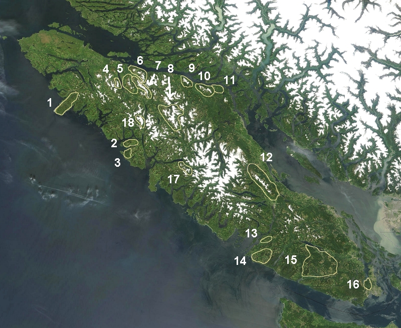


map_caption=The Somerset Range is marked 18 on map.
map_size=275

The Haihte Range is a small mountain range on central Vancouver Island, British Columbia, Canada. It has an area of 75 km2 and is a subrange of the Vancouver Island Ranges which in turn form part of the Insular Mountains. [http://www.bivouac.com/ArxPg.asp?ArxId=1528 Haihte Range] in the Canadian Mountain Encyclopedia]

The Haihte Range contains some of the largest remaining glaciers on Vancouver Island.

ee also

*List of mountain ranges

References


Wikimedia Foundation. 2010.

Игры ⚽ Поможем решить контрольную работу

Look at other dictionaries:

  • Rugged Mountain — Infobox Mountain Name = Rugged Mountain Elevation = 1861 m (6106 ft) Location = Vancouver Island, British Columbia, Canada Range = Haihte Range Prominence = 1571 m Coordinates = coor dms|50|01.5|31|N|126|40|40|W|type:mountain region:CA… …   Wikipedia

  • List of mountain ranges — Physiographic world map with mountain ranges and highland areas in brown and gray colors This is a list of mountain ranges organized alphabetically by continent. Ranges on other astronomical bodies are listed afterward. Contents …   Wikipedia

  • Insular Mountains — Geobox | Range name=Insular Mountains image caption=Golden Hinde, south aspect, August 2006. country=Canada region type=Province region=British Columbia parent=Pacific Cordillera highest=Golden Hinde highest elevation=2195 highest lat… …   Wikipedia

  • Vancouver Island Ranges — Geobox|Range name=Vancouver Island Ranges image caption=Golden Hinde, south aspect, August 2006. country=Canada region type=Province region=British Columbia parent=Insular Mountains highest=Golden Hinde highest elevation=2195 highest lat… …   Wikipedia

  • Woss Lake Provincial Park — Infobox protected area | name = Woss Lake Provincial Park iucn category = caption = Location of Woss Lake Provincial Park in British Columbia locator x = 115 locator y = 216 location = British Columbia, Canada nearest city = Woss lat degrees = 50 …   Wikipedia

Share the article and excerpts

Direct link
Do a right-click on the link above
and select “Copy Link”