- Tambaga
Infobox Settlement
official_name = Tambaga
native_name =
nickname =
settlement_type =
motto =
imagesize = 300px
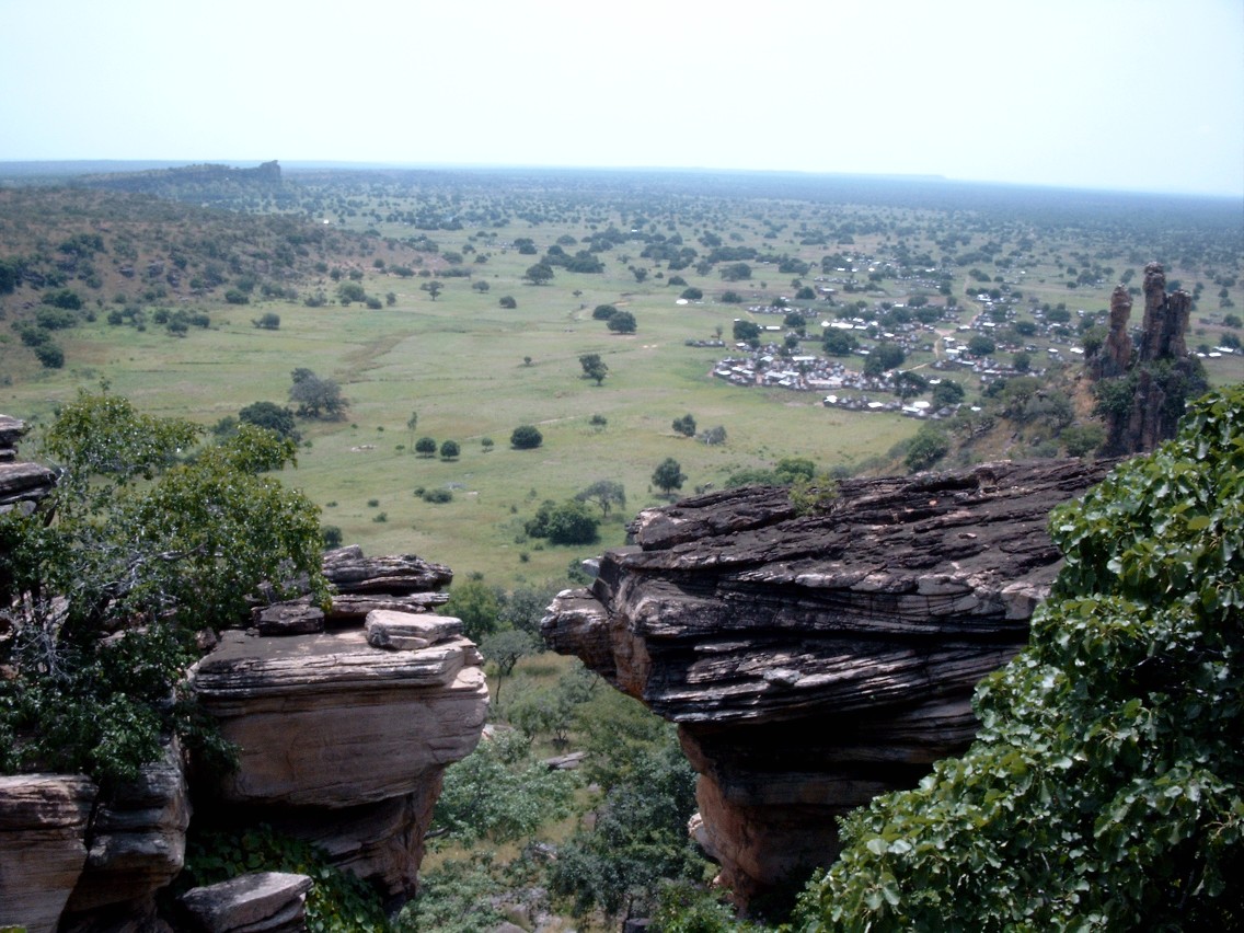
image_caption = Panorama of Tambarga
flag_size =
image_
seal_size =
image_shield =
shield_size =
image_blank_emblem =
blank_emblem_type =
blank_emblem_size =
mapsize =
map_caption =
mapsize1 =
map_caption1 =
image_dot_
dot_mapsize =
dot_map_caption =
dot_x = |dot_y =
pushpin_
pushpin_label_position =bottom
pushpin_mapsize =300
pushpin_map_caption =Location in Burkina Faso
subdivision_type = Country
subdivision_name = flag|Burkina Faso
subdivision_type1 = Region
subdivision_name1 =Est Region
subdivision_type2 = Province
subdivision_name2 =Tapoa Province
subdivision_type3 = Department
subdivision_name3 =Tambaga Department
subdivision_type4 =
subdivision_name4 =
leader_name =
leader_title1 =
area_total_km2 =
population_as_of =2005 est.
population_footnotes =
population_note =
population_total =28,633
population_density_km2 =
population_density_sq_mi =
population_blank1_title =Ethnicities
population_blank1 =
population_blank2_title =Religions
population_blank2 =
population_density_blank1_km2 =
population_density_blank1_sq_mi =
timezone =
utc_offset =
timezone_DST =
utc_offset_DST =
latd=11 |latm=47 |lats=45 |latNS=N
longd=1|longm=44|longs=30 |longEW=W
elevation_footnotes =
elevation_m =
elevation_ft =
postal_code_type =
postal_code =
area_code =
blank_name =
blank_info =
blank1_name =
blank1_info =
website =
footnotes =Tambaga or Tambarga is a
town and seat of theTambaga Department inTapoa Province in south-easternBurkina Faso . As of 2005, the village has a population of 28,633 although current estimates are nearer 36,000. [ [http://www.inforoute-communale.gov.bf/WebVillage/TAPOA.htm Burkinabé government inforoute communale] ]References
External links
* [http://www.maplandia.com/burkina-faso/tapoa/tambaga/tambarga/ Satellite map at Maplandia.com]
Wikimedia Foundation. 2010.

