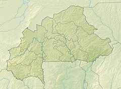
- Mount Tenakourou
-
Mount Tenakourou 
stones at the top of the TenakourouElevation 747 m (2,451 ft) [1] Listing Country high point Location Location in Burkina Faso (on the border with Mali) Location  Burkina Faso –
  Mali border
Coordinates 10°45′00″N 5°25′00″W / 10.75°N 5.4166667°WCoordinates: 10°45′00″N 5°25′00″W / 10.75°N 5.4166667°W Geology Type Hill Mount Tenakourou is the highest point in the west-African nation of Burkina Faso. It is a hill located on the border of the Cascades Region of Burkina Faso and the Sikasso Region of the country of Mali. Tenakourou has an elevation of 747 metres (2,451 ft).
References
- ^ "Téna Kourou" on Peakbagger.com Retrieved 30 September 2011
Categories:- Mountains of Burkina Faso
- Mountains of Mali
- Burkina Faso–Mali border
- International mountains of Africa
- Mali geography stubs
- Burkina Faso geography stubs
Wikimedia Foundation. 2010.


