- Ayeyarwady River
Geobox River
name = Ayeyarwaddy
native_name = _my. ဧရာဝတီမြစ်
other_name = Irrawaddy
other_name1 =
image_size =
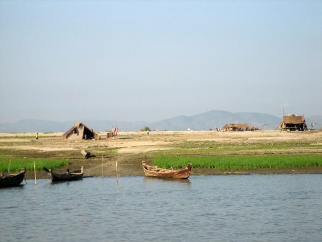
image_caption = Temporary farming settlements on islands of Ayeyarwady River
country =Burma
country1 =
state =
state1 =
region =
region1 =
district =
district1 =
city =Mandalay
city1 =Bagan
city2 =Bhamo
length = 2170
watershed = 411000
discharge_location =
discharge =
discharge_max =
discharge_min =
discharge1_location =
discharge1 =
source_name =Mali River
source_location =
source_district =
source_region =
source_state =
source_country =
source_lat_d =
source_lat_m =
source_lat_s =
source_lat_NS =
source_long_d =
source_long_m =
source_long_s =
source_long_EW =
source_elevation =
source_length =
source1_name = N'Mai
source1_location =
source1_district =
source1_region =
source1_state =
source1_country =
source1_lat_d =
source1_lat_m =
source1_lat_s =
source1_lat_NS =
source1_long_d =
source1_long_m =
source1_long_s =
source1_long_EW =
source1_elevation =
source1_length =
source_confluence_location =
source_confluence_district =
source_confluence_region =
source_confluence_state =Kachin State
source_confluence_country =
source_confluence_lat_d =
source_confluence_lat_m =
source_confluence_lat_s =
source_confluence_lat_NS =
source_confluence_long_d =
source_confluence_long_m =
source_confluence_long_s =
source_confluence_long_EW =
source_confluence_elevation =
mouth_name = Indian Ocean
mouth_location =
mouth_district =
mouth_region =
mouth_state =
mouth_country =
mouth_lat_d =
mouth_lat_m =
mouth_lat_s =
mouth_lat_NS =
mouth_long_d =
mouth_long_m =
mouth_long_s =
mouth_long_EW =
mouth_elevation =
tributary_left =
tributary_left1 =
tributary_right =
tributary_right1 =
free_name =
free_value =

map_size = 162
map_caption =The Ayeyarwady River or Irrawaddy River (MYname|MY=ဧရာဝတီမြစ်|MLCTS=ei: ra wa. ti mrac) is a
river that flows from north to south ofBurma (Myanmar). It is the country's largest river (about 1350 miles or 2170 km long) and its most important commercialwaterway , with adrainage area of about 158,700 square miles (411,000 km²).Etymology
The names Irrawaddy and Ayeyarwady are believed to have derived either from the
Sanskrit nameIravati , a sacred river and minor goddess in Indian mythology, or from her sonAiravata , the elephant mount ofIndra .The Irrawaddy gives its name to a
dolphin , theIrrawaddy dolphin ("Orcaella brevirostris"), which is found in the upper reaches of the river and known to help fishermen who practise cast-net fishing. Though sometimes called the Irrawaddy River Dolphin, it is not a trueriver dolphin , since it is also found at sea. [cite book|url=http://books.google.co.uk/books?id=7UEJcYiT5eoC&pg=PA173&lpg=PA173&dq=ayeyarwady+river+bridges&source=web&ots=f3lrzEzgC1&sig=I8YRQYYfXoHCsdldo5GZb9zMcCU&hl=en&sa=X&oi=book_result&resnum=1&ct=result#PPA173,M1|title=Asian Marine Biology 1997:Investigation of Cetaceans in the Ayeyarwady River and Northern Coastal Waters of Myanmar|author=Brian D Smith et al|publisher=Hong Kong University Press|page=173|accessdate=2008-10-06] [cite web|url=http://tinttun.mm.googlepages.com/irrawaddydolphin|title=Irrawaddy Dolphin|author=Tint Tun|accessdate=2008-10-06]ource
The Ayeyarwaddy starts in the north of
Kachin State , at the confluence of theMali Hka andN'Mai Hka rivers. The western Mali Hka branch arises from the end of the southernHimalaya s, north ofPutao , and (like the main river) is called Nam Kiu in theShan language .Course
The Ayeyarwaddy River bisects the country from north to south and empties through a nine-armed
Irrawaddy Delta into theIndian Ocean . In colonial times, before railways and automobiles, the river was known as the "Road toMandalay ". Although navigable by large vessels toMyitkyina for a distance over 1600 km from the ocean, the river is also full of sandbanks and islands, making such navigation difficult.Defiles
The upper reaches of the Ayeyarwady is well known for its three narrow gorges between Myitkyina and Mandalay.
#The first defile lies 65 km (40 miles) downstream from Myitkyina.
#The second defile, after it leavesBhamo and makes a sharp turn west to cut throughlimestone rocks. It is about 90 m (300 ft) wide at its narrowest, and flanked by vertical cliffs from 60 to 90 m (200-300 ft) high.
#The third defile lies about 100 km (60 miles) north of Mandalay nearMogok . [cite web|url=http://www.britannica.com/EBchecked/topic/294719/Irrawaddy-River/48020/Physical-features|title=Irrawaddy River|publisher="Encyclopaedia Britannica " online|accessdate=2008-10-05]Tributaries
#
Shweli River
#Myitnge River
#Mu River
#Chindwin River Economy and Politics
Major cities and towns
The river flows through the following cities:
*
Putao
*Myitkyina
*Bhamo
* Katha
*Kyaukmyaung
*Mandalay
*Sagaing
*Chauk
*Bagan
*Nyaung-U
*Magway
*Pyay
*Hinthada
*Pantanaw Bridges
The
Ava (Innwa) Bridge, a 16 span rail and roadcantilever bridge built by the British colonial government in 1934, was the only bridge to span the Ayeyarwady until recent times when a spate of bridge construction has been carried out by the government. [cite web|url=http://www.myanmar.gov.mm/Perspective/persp2000/8-2000/big.htm|title="Big Push" for Sustained Development|publisher="Perspective", August 2000|accessdate=2008-10-06] [cite web|url=http://www.usda.org.mm/eng/index.php?option=com_content&task=view&id=1054&Itemid=156|title=Roads and Bridges|publisher=Union Solidarity and Development Association April 7, 2006|accessdate=2008-10-06]
#Ayeyarwady Bridge (Yadanabon) just upstream from the old Ava Bridge at Sagaing
#Bala Min Htin Bridge over the N'Mai Hka at Myitkyina, November 1998
#Anawrahta Bridge at Chauk, April 2001 [cite news|url=http://www.myanmargeneva.org/01nlm/n010405.htm#(1)|title=Sr General Than Shwe attends opening of Anawrahta Bridge linking Chauk and Seikphyu on Ayeyawady River|publisher="The New Light of Myanmar ", April 5, 2001|accessdate=2008-10-06]
#Ayeyarwady-Magway Bridge at Magway
#Bo Myat Tun Bridge atNyaungdon , November 1999
#Nawaday Bridge at Pyay, September 1997
#Maubin Bridge atMaubin , February 1998
#Ayeyarwady-Dedaye Bridge atDedaye [cite web|url=http://www.myanmar.gov.mm/Perspective/persp1999/11-99/bridge.htm|title=The Nation's Longest Bridge Inaugurated|publisher="Perspective", November 1999|accessdate=2008-10-06]Gallery
Notes
External links
* [http://www.pandaw.com/cruises-myanmar-c-21_22.html Pandaw Irrawaddy River Cruises]
* [http://earthobservatory.nasa.gov/NaturalHazards/shownh.php3?img_id=13663 NASA Earth Observatory]
* [http://images.google.co.uk/images?client=firefox-a&rls=org.mozilla:en-GB:official&channel=s&hl=en&q=irrawaddy+river&um=1&ie=UTF-8&sa=X&oi=image_result_group&resnum=1&ct=title Google image search]
* [http://earth.jsc.nasa.gov/sseop/efs/photoinfo.pl?PHOTO=STS030-151-62 Earth from SpaceNASA image]
Wikimedia Foundation. 2010.