- Wolleka
Infobox Settlement
official_name = Wolleka
other_name =
native_name =
nickname =
settlement_type =
motto =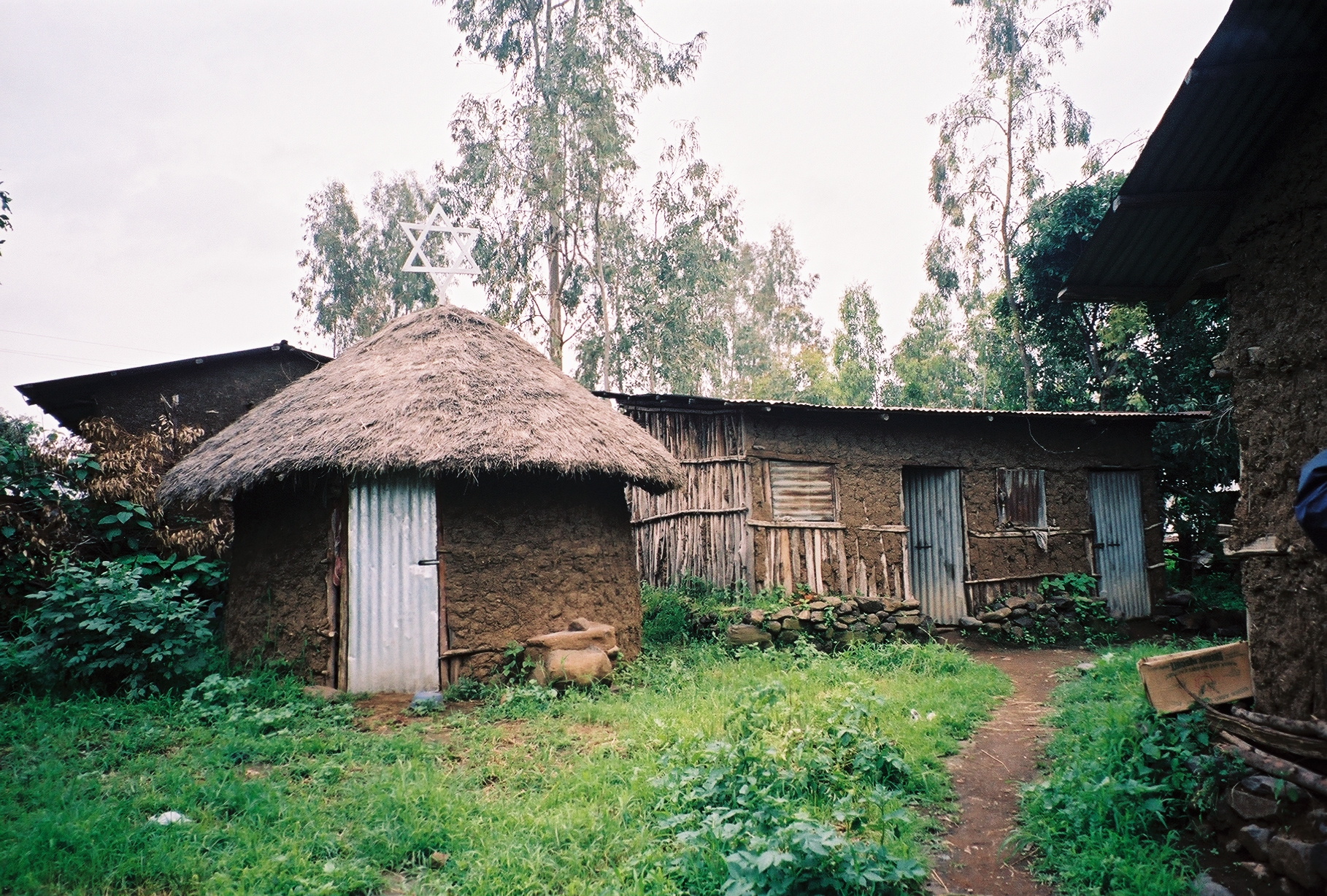
imagesize = 300px
image_caption =
flag_size =
image_
seal_size =
image_shield =
shield_size =
city_logo =
citylogo_size =
mapsize =
map_caption =
mapsize1 =
map_caption1 =
image_dot_
dot_mapsize =
dot_map_caption =
dot_x = |dot_y =
pushpin_
pushpin_label_position = right
pushpin_map_caption = Location within Ethiopia
pushpin_mapsize =
subdivision_type = Country
subdivision_name =Ethiopia
subdivision_type1 = Region
subdivision_name1 = Amhara
subdivision_type2 = Zone
subdivision_name2 =Semien Gondar Zone
subdivision_type3 =
subdivision_name3 =
subdivision_type4 =
subdivision_name4 =
government_footnotes =
government_type =
leader_title =
leader_name =
leader_title1 =
leader_name1 =
leader_title2 =
leader_name2 =
leader_title3 =
leader_name3 =
leader_title4 =
leader_name4 =
established_title =
established_date =
established_title2 =
established_date2 =
established_title3 =
established_date3 =
area_magnitude =
unit_pref =
area_footnotes =
area_total_km2 =
area_land_km2 =
area_water_km2 =
area_total_sq_mi =
area_land_sq_mi =
area_water_sq_mi =
area_water_percent =
area_urban_km2 =
area_urban_sq_mi =
area_metro_km2 =
area_metro_sq_mi =
population_as_of =
population_footnotes =
population_note =
population_total =
population_density_km2 =
population_density_sq_mi =
population_metro =
population_density_metro_km2 =
population_density_metro_sq_mi =
population_urban =
population_density_urban_km2 =
population_density_urban_sq_mi =
population_blank1_title =
population_blank1 =
population_density_blank1_km2 =
population_density_blank1_sq_mi =
timezone = EAT
utc_offset = +3
timezone_DST =
utc_offset_DST =
latd=12|latm=38 |latNS=N
longd=37 |longm=29 |longEW=E
elevation_footnotes =
elevation_m =
elevation_ft =
postal_code_type =
postal_code =
area_code =
blank_name =
blank_info =
blank1_name =
blank1_info =
website =
footnotes =Wolleka is a village in
Ethiopia , nearGondar , with a latitude and longitude of coord|12|38|N|37|29|E. The village is located in theSemien Gondar Zone of theAmhara Region .Wolleka is the main centre of the
Beta Israel - EthiopianJew s. Although its population has declined, it is still known for itssynagogue and forpottery . This may be same village of the Bet Israel thatSamuel Gobat visited in1830 ; although he does not name the village, from his account the village he visited was clearly close enough to Gondar for him to travel there, speak to several of its inhabitants, then return to Gondar all in the same day. [Samuel Gobat, "Journal of Three Years' Residence in Abyssinia", 1851 (New York: Negro Universities Press, 1969), pp. 277ff]The Central Statistical Agency has not published an estimate for its 2005 population.
Notes

Wikimedia Foundation. 2010.