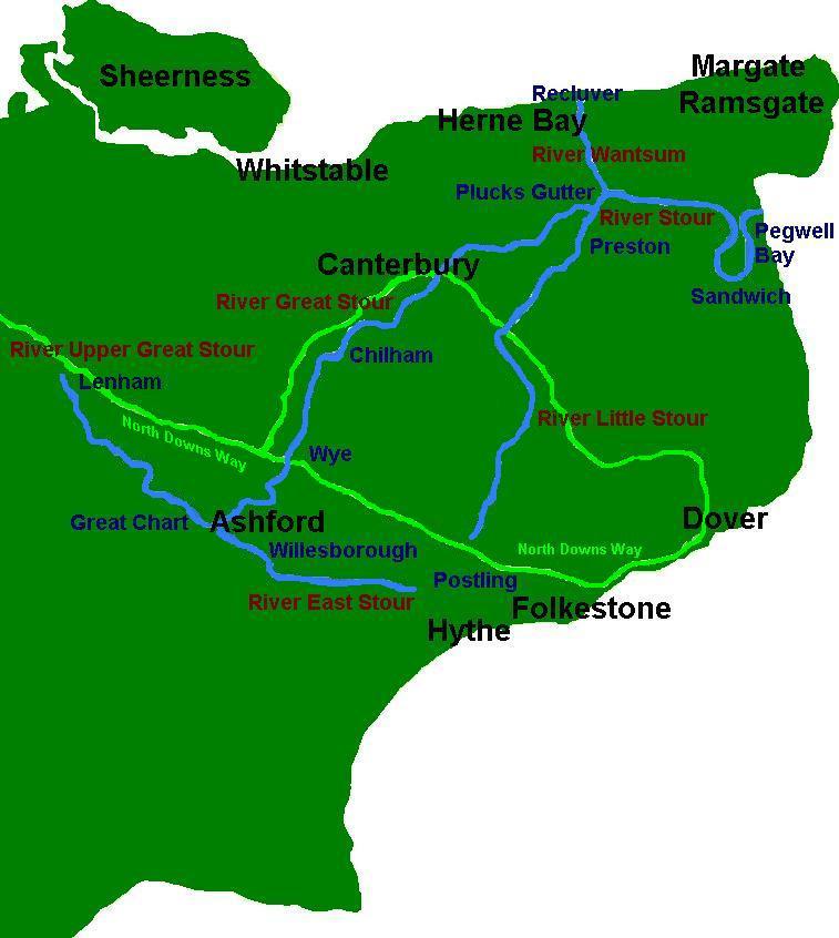
- River Upper Great Stour
Infobox River
river_name = River Upper Great Stour

image_size =
caption = River Stour and Tributaries
origin =Lenham
mouth =River Great Stour
basin_countries =
length =
elevation =
mouth_elevation =
discharge =
watershed = The River Upper Great Stour,ref label|Upper|Note|Naming (sometimes referred to as the River West Stour) is actually named onOrdnance Survey maps as theRiver Great Stour inKent .It rises south of the village of
Lenham nearMaidstone and joins with theRiver East Stour , either side of Pledge’s Mill at the bottom of "East Hill", Ashford. The combined rivers then continue as theRiver Great Stour . The Great Stour then joins theRiver Little Stour to become the River Stour.This part of the river flows through rural countryside, passing the villages of
Charing Heath andLittle Chart (where there is awatermill ), before entering Ashford nearGreat Chart . In Ashford it helps form part of theAshford Green Corridor .The route of the
Stour Valley Walk follows the river.Notes
:note label|Upper|Note|NamingThe
Environment Agency has two documents referring to "Upper Great Stour"" [http://www.environment-agency.gov.uk/commondata/acrobat/stour_cfmp_2_1018400.pdf] , [http://www.environment-agency.gov.uk/commondata/acrobat/stourupdatejan2005_931345.pdf] and none referring to the "West Stour" in Kent
Wikimedia Foundation. 2010.
