- Vila Franca de Xira
Infobox_Municipality_pt
official_name = Vila Franca de Xira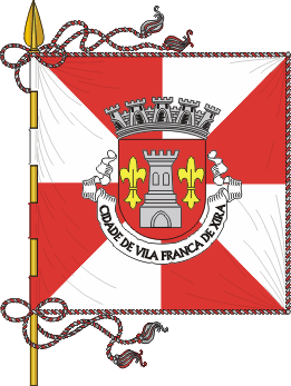
image_coat_of_arms = VFX1.png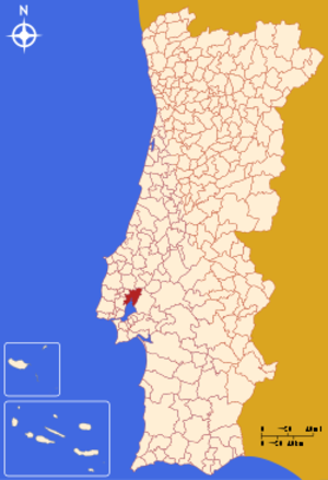
Region = Lisboa
Subregion =Greater Lisbon
District = Lisbon
Mayor_name =Maria da Luz Rosinha
Mayor_party = PS
area_total = 317.7
population_total = 133,224
population_density = 419
Parishes = 11
coor = 38º57'N 8º59'W
params = 38_57_N_8_59_W
occasion =Ascension Day
day = date varies
website = http://www.cm-vfxira.pt
footnotes =Vila Franca de Xira (pron. IPA2|'vilɐ 'fɾɐ̃kɐ dɨ 'ʃiɾɐ) is a municipality in
Portugal with a total area of 317.7km² and a total population of 133,224 inhabitants. Situated on the west bank of the RiverTagus , just 32 km north-east of the Portuguese capitalLisbon , Vila Franca de Xira is said to have been founded by French followers of Portugal's first king, Afonso Henriques, around 1200.The town is mostly famous for its
bull-running festivals in July and October. Bulls are raised in the salty marshlands of theRibatejo , which is also a notable breeding ground for the magnificentLusitano horse, esteemed for its quick reflexes and maneuverability.A number of brightly-coloured Portuguese bullfighting costumes are on display in the ethnographic museum in the town's
bullring , the Praça de Toiros (or Touros) Palha Blanco. Nearby, the town's Misericórdia church features striking 18th-centuryazulejo s (glazed tiles).3 km south of Vila Franca de Xira lies the Lezíria Grande Equestrian Centre, where visitors can watch stylish displays of the impressive Lusitano horses. The centre also stages typical bullfighting spectacles in its outdoor bullring. Visitors can ride Lusitano horses and take dressage lessons at the Quinta de São Sebastião, a sprawling estate at
Arruda dos Vinhos , 11 km west of Vila Franca de Xira.The municipality is composed of 11 parishes, and is located in the District of Lisbon.
The present Mayor is Maria da Luz Rosinha, elected by the Socialist Party.
Parishes
*
Alhandra
*Alverca do Ribatejo
*Cachoeiras
*Calhandriz
*Castanheira do Ribatejo
*Forte da Casa
*Póvoa de Santa Iria
*São João dos Montes
*Sobralinho
*Vialonga
* Vila Franca de XiraExternal links
* [http://www.cm-vfxira.pt/ Vila Franca de Xira Municipality]
* [http://www.flickr.com/photos/vitor107/sets/1751850/ Photos from Vila Franca de Xira]

Wikimedia Foundation. 2010.