- Watermael-Boitsfort
Infobox Belgium Municipality
name=Watermael-Boitsfort Fr icon
Watermaal-Bosvoorde Nl icon
picture=
picture-width= 260px
picture-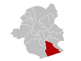
map-
arms=Watermaalbosvoordewapen.gif
flag_link=Symbols of Brussels#Municipalities
arms_link=Symbols of Brussels#Municipalities
region=BE-REG-BRU
community=BE-FR
BE-NL
province=
arrondissement=Brussels
nis=21017
pyramid-date=
0-19=
20-64=
65=
foreigners=
foreigners-date=
mayor=
majority=
postal-codes=1170
telephone-area=02
web= [http://www.watermaal-bosvoorde.be/ www.watermaal-bosvoorde.be]
lat_deg=50
lat_min=48
lon_deg=04
lon_min=25Watermaal-Bosvoorde (Dutch) or Watermael-Boitsfort (French) is one of the nineteen municipalities located in the
Brussels-Capital Region inBelgium .On
1 January 2006 the municipality had a total population of 24,056. Its total area is 12.93 km² which gives it apopulation density of 1,860 inhabitants per km². It is the lowest population density of the 19 communities in the Brussels-Capital Region.Watermael-Boitsfort is in the south of the capital and borders the communes of
Uccle (Ukkel),Auderghem (Oudergem) andIxelles (Elsene) as well as the province ofFlemish Brabant . TheSonian Forest ("Zoniënwoud" or "Forêt de Soignes") covers almost 60% of the municipality.The municipality is twinned with Chantilly in
France and Annan inScotland .Notable inhabitiants
*
Antoine Depage , surgeon (1862 -1925 )
*Michel Roger Lafosse , claimant to the Scottish throne, b. 1958ee also
*
Barbu de Watermael External links
*fr icon nl icon [http://www.watermael-boitsfort.be Watermael-Boitsfort official Website]


Wikimedia Foundation. 2010.