- N17 road (Ireland)
-
N17 road
Route information Length: 128 km (80 mi) Location Primary
destinations:(bypassed towns in italics)
- County Sligo
- Collooney
- Ballinacarrow*
- Tubbercurry
- Curry
- Bellaghy*
- County Mayo
- Charlestown
- Ireland West Airport Knock
- Knock
- Claremorris
- Crosses the River Robe
- Ballindine
- County Galway
Road network The N17 road is a national primary road in Ireland, and is part of the Atlantic Corridor route.[1] It begins in County Galway and ends in County Sligo. The road serves as the symbolic focal point in the nostalgic song "N17" by Galway based Celtic-rock band the Saw Doctors.
The Southern Section N17 is currently the republic of Ireland's busiest single-carriageway inter-urban [2] road with over 25,000 vehicles using the road at Claregalway daily of which over 20,000 travel on the Claregalway-Galway section south of Claregalway.
Contents
Route
The 124 km (77 mi) route commences at Castlegar in Galway city and ends at the Toberbride roundabout at Collooney in Co. Sligo. It runs through or past several major towns and places in the area including Claregalway, Tuam, Miltown, Ballindine, Claremorris, Knock, Kilkelly, Charlestown, Curry, Tubbercurry and Ballinacarrow. The entire route is regular highway with no sections of dual carriageway as of yet.
Section through Co. Galway
The N17 begins at Castlegar in Galway city, where it makes its way northeast to Claregalway, passing through Claregalway village . This section of the N17 is the busiest with over 27,000 vehicles daily. The route continues north which consists of upgraded single carriageway with hard shoulders (1970s). The route sways east whilst entering the north County Galway town of Tuam, the route marginally bypasses Tuam town centre by a relief road constructed in the early 1980s, this road has several traffic light junctions and suffers from traffic congestion. After passing Tuam the route swings northwest towards Miltown, where a new realigned section of road is encountered (built late 1990s) avoiding a notorious stretch of road which saw many fatalities at one particular bend at a graveyard. This new section is the most recent improvement in Co. Galway. The route then passes through the village of Miltown passing over the River Clare, the main street in the village is very narrow and can become congested. After leaving Miltown the route continues north towards the Ballindine, this section of the N17 is of poor standard and is reduced to a narrow winding road to the County Mayo border.
Section through Co. Mayo
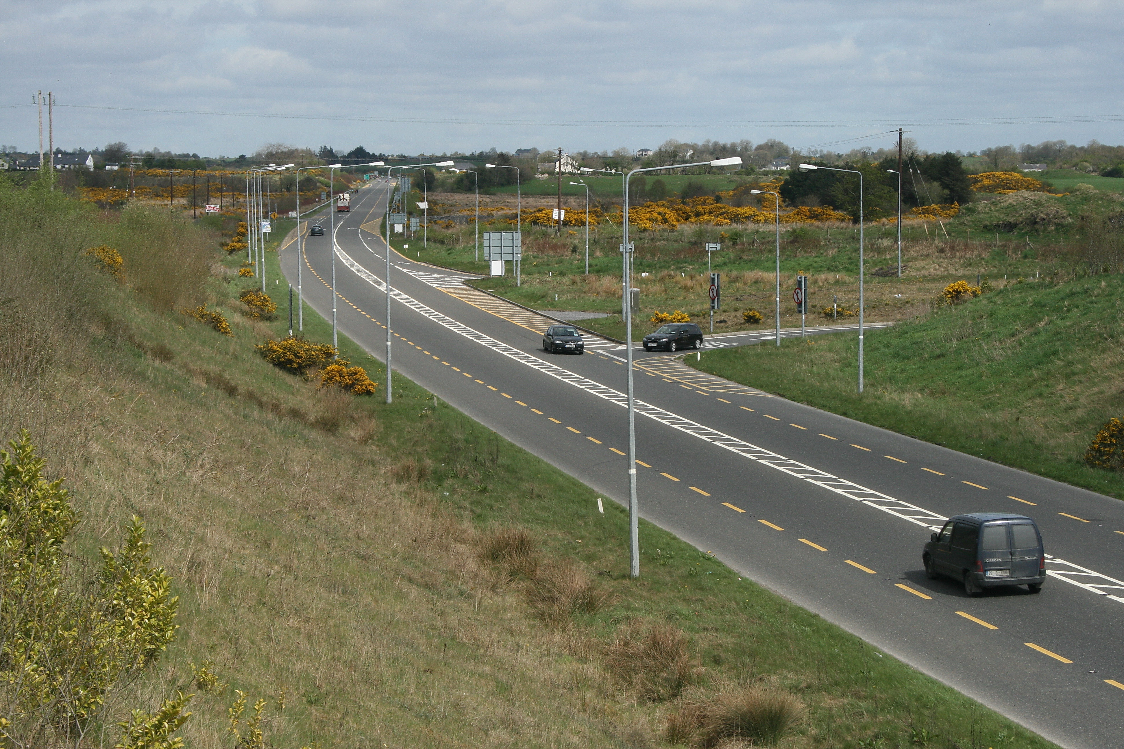
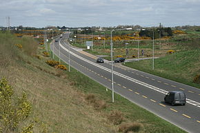 N17 Claremorris by-pass
The N17 passes through Ballindine just after it crosses the Galway/Mayo border. The main street though Ballindine is very wide reducing congestion in the village. Leaving Ballindine the route heads north towards Claremorris. This 5 km section of road was completely realigned in 1983, bypassing a dangerous stretch of road at Garryduff. This is busy section with almost 10,000 vehicles daily. At Lissduff the 16 km Claremorris/Knock bypass commences, the largest project on the N17 to date. It bypasses Claremorris to the east, greatly reducing heavy through traffic in the town. The 16 km bypass was constructed in 2 phases, the 6 km Claremorris phase (phase 1) which opened July 2001 and the 10 km Knock phase (phase 2) which opened to traffic December 2002. The Knock bypass passes the village to the west heading in a northeast direction bypassing Kilkelly (bypassed 1980s), the route continues towards Charlestown passing Knock Airport. This section of road is of good quality and has a hard shoulder to just south of Charlestown. The route passes through Charlestown and over the Sligo border into the village of Bellaghy.
Section through Co. Sligo
The N17 in Co. Sligo varies greatly in standard. After passing through Bellaghy the road heads in a northeasterly direction bypassing Curry, this 6 km section was built in 1993 and is of excellent standard. After bypassing Curry and as far as Tubbercurry the standard of the road is reduced to a very low quality winding road with a high fatality rate. The N17 passes Tubbercurry to the west in the form of a basic relief road, heavy goods vehicles use this road around the town, although many cars continue on through the town's main street as it is often faster than the relief road. The route continues in a north easterly direction towards Ballinacarrow, another section of poor standard. Two kilometres past Ballinacarrow the road improves and a slow lane section is encountered. This 8 km section to the N4 Collooney bypass was constructed in 1993 with the bypassing of Collooney. The N17 ends where it meets the N4 Sligo-Dublin road at the Toberbride roundabout.
M17 motorway and other planned upgrades

A number of upgrade projects are planned for the N17, which forms part of the Atlantic Corridor under Transport 21, along with the N18 and N20.
The biggest project is a plan by the National Roads Authority to upgrade 25.5 km of this route to motorway standard, between Tuam and east of Galway. Under the Irish road numbering scheme, this section will be designated the M17 motorway. It will run from a new junction with the existing M6 motorway near Athenry, which also forms the starting point for the proposed new M18 motorway to Gort.
It has been confirmed that the new motorway will not be tolled.[3]
At the northern terminus, the scheme will link in with a bypass of Tuam, which will provide an additional 4.2 km (2.6 mi) of dual carriageway. [4] This will be Type 2 Dual Carriageway, or "2+2 road" as it has been dubbed by the NRA. This type of scheme has some at grade roundabout junctions and a wire barrier between the carriageways.
The following schemes are all at design stage :
Galway to Tuam (Motorway - At Tender)
The Galway to Tuam upgrade scheme consists of 25.5 km of motorway commencing at the future interchange of the M18 and the M6 to the west of Athenry. Continuing north, the route interchanges with the N63 at Annagh Hill, then continues towards Tuam passing tying back in with the existing N17 immediately west of Tuam. This scheme has now moved into the tender stage.[5]
Mainline Length (km): 25.5
Tuam Bypass (At Tender)
The scheme consists of 4.2 km of 2+2 dual carriageway and 3.6 km of side roads. It provides a bypass of Tuam to the west and links into the existing N17 with at grade roundabouts at its northern and southern junctions. The scheme is being built at the same time as the M17 Athenry-Tuam scheme and has also moved into the tender stage.
Mainline Length (km): 4.2
Charlestown Bypass
The scheme consists of approximately 25.7 km of 2+2 dual carriageway from the northern end of Knock Bypass to the southern end of the Tobercurry Bypass, and 15 km of single carriageway slip roads, side roads and link roads. The scheme bypasses both the towns of Kilkelly and Charlestown/ Bellahy and the village of Curry, following a route to the east of the existing N17. Mainline Length (km): 25.7
Tobercurry Bypass
The N17 Collooney/Charlestown Road Realignment Scheme consists of 25 km of 2+2 dual carriageway. The scheme extends from northern end of the proposed Charlestown bypass. Northwards it will bypass Curry and Tubbercurry. Mainline Length (km): 10.2
Tobercurry to Collooney
This scheme consists of 14 km of 2+2 dual carriageway extending from the northern end of the Tobercurry bypass to the N4/N17 roundabout at Collooney. Mainline Length (km): 14
See also
- Roads in Ireland
- Motorways in Ireland
- National secondary road
- Regional road
References
External links
- Roads Act 1993 (Classification of National Roads) Order 2006 – Department of Transport
- N17 Realignment – Collooney to Charlestown – Sligo County Council
- N17 Charlestown bypass – Mayo County Council
- N17 Proposed Tuam Bypass – Galway County Council
- M17 Galway to Tuam Motorway
Roads in Ireland Motorways National primary roads National secondary roads Regional roads (R101–R399) R101 · R102 · R103 · R104 · R105 · R106 · R107 · R108 · R109 · R110 · R111 · R112 · R113 · R114 · R115 · R116 · R117 · R118 · R119 · R120 · R121 · R122 · R123 · R124 · R125 · R126 · R127 · R128 · R129 · R130 · R131 · R132 · R133 · R134 · R135 · R136 · R148 · R149 · R150 · R151 · R152 · R153 · R154 · R155 · R156 · R157 · R158 · R159 · R160 · R161 · R162 · R163 · R164 · R165 · R166 · R167 · R168 · R169 · R170 · R171 · R172 · R173 · R174 · R175 · R176 · R177 · R178 · R179 · R180 · R181 · R182 · R183 · R184 · R185 · R186 · R187 · R188 · R189 · R190 · R191 · R192 · R193 · R194 · R195 · R196 · R197 · R198 · R199 · R200 · R201 · R202 · R203 · R204 · R205 · R206 · R207 · R208 · R209 · R210 · R211 · R212 · R213 · R214 · R229 · R230 · R231 · R232 · R233 · R234 · R235 · R236 · R237 · R238 · R239 · R240 · R241 · R242 · R243 · R244 · R245 · R246 · R247 · R248 · R249 · R250 · R251 · R252 · R253 · R254 · R255 · R256 · R257 · R258 · R259 · R260 · R261 · R262 · R263 · R264 · R265 · R266 · R267 · R268 · R277 · R278 · R279 · R280 · R281 · R282 · R283 · R284 · R285 · R286 · R287 · R288 · R289 · R290 · R291 · R292 · R293 · R294 · R295 · R296 · R297 · R298 · R299 · R310 · R311 · R312 · R313 · R314 · R315 · R316 · R317 · R318 · R319 · R320 · R321 · R322 · R323 · R324 · R325 · R326 · R327 · R328 · R329 · R330 · R331 · R332 · R333 · R334 · R335 · R336 · R337 · R338 · R339 · R340 · R341 · R342 · R343 · R344 · R345 · R346 · R347 · R348 · R349 · R350 · R351 · R352 · R353 · R355 · R356 · R357 · R358 · R359 · R360 · R361 · R362 · R363 · R364 · R365 · R366 · R367 · R368 · R369 · R370 · R371 · R372 · R373 · R374 · R375 · R376 · R377 · R378 · R379 · R389 · R390 · R391 · R392 · R393 · R394 · R395 · R396 · R397 · R398 · R399Regional roads (R400–R699) R400 · R401 · R402 · R403 · R404 · R405 · R406 · R407 · R408 · R409 · R410 · R411 · R412 · R413 · R414 · R415 · R416 · R417 · R418 · R419 · R420 · R421 · R422 · R423 · R424 · R425 · R426 · R427 · R428 · R429 · R430 · R431 · R432 · R433 · R434 · R435 · R436 · R437 · R438 · R439 · R440 · R441 · R442 · R443 · R444 · R445 · R446 · R448 · R449 · R458 · R459 · R460 · R461 · R462 · R463 · R464 · R465 · R466 · R467 · R468 · R469 · R470 · R471 · R472 · R473 · R474 · R475 · R476 · R477 · R478 · R479 · R480 · R481 · R482 · R483 · R484 · R485 · R486 · R487 · R488 · R489 · R490 · R491 · R492 · R493 · R494 · R495 · R496 · R497 · R498 · R499 · R500 · R501 · R502 · R503 · R504 · R505 · R506 · R507 · R509 · R510 · R511 · R512 · R513 · R514 · R515 · R516 · R517 · R518 · R519 · R520 · R521 · R522 · R523 · R524 · R525 · R526 · R527 · R548 · R549 · R550 · R551 · R552 · R553 · R554 · R555 · R556 · R557 · R558 · R559 · R560 · R561 · R563 · R564 · R565 · R566 · R567 · R568 · R569 · R570 · R571 · R572 · R573 · R574 · R575 · R576 · R577 · R578 · R579 · R580 · R581 · R582 · R583 · R584 · R585 · R586 · R587 · R588 · R589 · R590 · R591 · R592 · R593 · R594 · R595 · R596 · R597 · R598 · R599 · R600 · R601 · R602 · R603 · R604 · R605 · R606 · R607 · R608 · R609 · R610 · R611 · R612 · R613 · R614 · R615 · R616 · R617 · R618 · R619 · R620 · R621 · R622 · R623 · R624 · R626 · R627 · R628 · R629 · R630 · R631 · R632 · R633 · R634 · R635 · R637 · R638 · R639 · R659 · R660 · R661 · R662 · R663 · R664 · R665 · R666 · R667 · R668 · R669 · R670 · R671 · R672 · R673 · R674 · R675 · R676 · R677 · R678 · R679 · R680 · R681 · R682 · R683 · R684 · R685 · R686 · R687 · R688 · R689 · R690 · R691 · R692 · R693 · R694 · R695 · R696 · R697 · R698 · R699Regional roads (R700–R940) R700 · R701 · R702 · R703 · R704 · R705 · R706 · R707 · R708 · R709 · R710 · R724 · R725 · R726 · R727 · R729 · R730 · R731 · R733 · R734 · R735 · R736 · R737 · R738 · R739 · R740 · R741 · R742 · R743 · R744 · R745 · R746 · R747 · R748 · R749 · R750 · R751 · R752 · R753 · R754 · R755 · R756 · R757 · R758 · R759 · R760 · R761 · R762 · R763 · R764 · R765 · R766 · R767 · R768 · R769 · R770 · R772 · R773 · R774 · R801 · R802 · R803 · R804 · R805 · R806 · R807 · R808 · R809 · R810 · R811 · R812 · R813 · R814 · R815 · R816 · R817 · R818 · R819 · R820 · R821 · R822 · R824 · R825 · R826 · R827 · R828 · R829 · R830 · R831 · R833 · R834 · R835 · R836 · R837 · R838 · R839 · R840 · R841 · R842 · R843 · R846 · R847 · R848 · R849 · R851 · R852 · R853 · R854 · R855 · R857 · R858 · R859 · R860 · R863 · R864 · R865 · R866 · R867 · R868 · R870 · R871 · R873 · R874 · R875 · R876 · R877 · R880 · R883 · R884 · R885 · R886 · R887 · R888 · R889 · R890 · R891 · R895 · R896 · R898 · R899 · R900 · R901 · R902 · R903 · R904 · R906 · R907 · R908 · R909 · R910 · R911 · R913 · R914 · R915 · R916 · R917 · R918 · R919 · R920 · R921 · R922 · R923 · R924 · R925 · R926 · R927 · R928 · R929 · R930 · R931 · R932 · R933 · R934 · R935 · R936 · R937 · R940See also: National Development Plan · National Roads Authority · Local roads · Trunk roads Categories:- National primary roads in the Republic of Ireland
- Roads in County Galway
- Roads in County Mayo
- Roads in County Sligo
- County Sligo

Wikimedia Foundation. 2010.