- Lunenburg, Vermont
Infobox Settlement
official_name = Pagename
other_name =
native_name =
nickname =
settlement_type = Town
motto =
imagesize =
image_caption =
flag_size =
image_
seal_size =
image_shield =
shield_size =
image_blank_emblem =
blank_emblem_size =
mapsize = 250px
map_caption = Located in Essex County, Vermont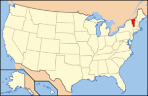
mapsize1 = 195px
map_caption1 = Location of Vermont with the U.S.A.
subdivision_type = Country
subdivision_name =United States
subdivision_type1 = State
subdivision_name1 =Vermont
subdivision_type2 = County
subdivision_name2 = Essex
subdivision_type3 =
subdivision_name3 =
subdivision_type4 =
subdivision_name4 =
government_footnotes =
government_type =
leader_title =
leader_name =
leader_title1 =
leader_name1 =
leader_title2 =
leader_name2 =
leader_title3 =
leader_name3 =
leader_title4 =
leader_name4 =
established_title =
established_date =
area_magnitude =
unit_pref = Imperial
area_footnotes =
area_total_km2 = 117.5
area_land_km2 = 116.7
area_water_km2 = 0.7
area_total_sq_mi = 45.4
area_land_sq_mi = 45.1
area_water_sq_mi = 0.3
area_water_percent =
population_as_of = 2000
population_footnotes =
population_note =
population_total = 1328
population_density_km2 = 11.4
population_density_sq_mi = 29.5
population_blank1_title = Households
population_blank1 = 516
population_blank2_title = Families
population_blank2 = 366
timezone = EST
utc_offset = -5
timezone_DST = EDT
utc_offset_DST = -4
latd = 44 |latm = 28 |lats = 4 |latNS = N
longd = 71 |longm = 41 |longs = 14 |longEW = W
elevation_footnotes =
elevation_m = 395
elevation_ft = 1296
postal_code_type =ZIP code
postal_code = 05906
area_code = 802
blank_name = FIPS code
blank_info = 50-41425GR|2
blank1_name = GNIS feature ID
blank1_info = 1462139GR|3
website =
footnotes =Lunenburg is a town in Essex County,
Vermont ,United States . The population was 1,328 at the 2000 census. The name stems from one of the titles of George 2nd of England, Duke of Brunswick-Lunenburg.fact|date=December 2007Lunenburg is part of the Berlin, NH–VT Micropolitan Statistical Area.
Geography
According to the
United States Census Bureau , the town has a total area of 45.4square mile s (117.5km² ), of which, 45.1 square miles (116.8 km²) of it is land and 0.3 square miles (0.7 km²) of it (0.62%) is water.Demographics
As of the
census GR|2 of 2000, there were 1,328 people, 516 households, and 366 families residing in the town. Thepopulation density was 29.5 people per square mile (11.4/km²). There were 747 housing units at an average density of 16.6/sq mi (6.4/km²). The racial makeup of the town was 97.82% White, 0.08% African American, 0.68% Native American, 0.08% Asian, and 1.36% from two or more races. Hispanic or Latino of any race were 0.38% of the population.There were 516 households out of which 33.5% had children under the age of 18 living with them, 57.0% were married couples living together, 8.5% had a female householder with no husband present, and 28.9% were non-families. 21.7% of all households were made up of individuals and 9.7% had someone living alone who was 65 years of age or older. The average household size was 2.55 and the average family size was 2.97.
In the town the population was spread out with 26.4% under the age of 18, 7.1% from 18 to 24, 29.1% from 25 to 44, 23.1% from 45 to 64, and 14.4% who were 65 years of age or older. The median age was 37 years. For every 100 females there were 103.1 males. For every 100 females age 18 and over, there were 98.8 males.
The median income for a household in the town was $28,802, and the median income for a family was $33,000. Males had a median income of $26,793 versus $18,594 for females. The
per capita income for the town was $12,804. About 8.7% of families and 12.6% of the population were below thepoverty line , including 15.0% of those under age 18 and 9.9% of those age 65 or over.Canadian City Geographic Location (8-way)
Northwest = Victory
North = Granby
Northeast = Guildhall
West = Victory
Centre = Pagename
East = Lancaster, NH
Southwest = Concord
South = Dalton, NH
Southeast =References
External links
*

Wikimedia Foundation. 2010.