- Quemahoning Township, Pennsylvania
Infobox Settlement
official_name = Pagename
settlement_type = Township
nickname =
motto =
imagesize =
image_caption =
image_
mapsize = 250x200px
map_caption = Map of Somerset County, Pennsylvania Highlighting Quemahoning Township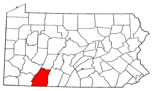
mapsize1 = 250x200px
map_caption1 = Map of Somerset County, Pennsylvania
subdivision_type = Country
subdivision_name =United States
subdivision_type1 = State
subdivision_name1 =Pennsylvania
subdivision_type2 = County
subdivision_name2 = Somerset
government_footnotes =
government_type =
leader_title =
leader_name =
leader_title1 =
leader_name1 =
leader_title2 =
leader_name2 =
established_title = Settled
established_date =
established_title1 = Incorporated
established_date1 =
unit_pref = Imperial
area_footnotes =
area_magnitude =
area_total_km2 =
area_land_km2 =
area_water_km2 =
area_total_sq_mi = 36.2
area_land_sq_mi = 35.6
area_water_sq_mi = 0.6
population_as_of = 2000
population_footnotes =
population_total = 2180
population_density_km2 =
population_density_sq_mi = 61.3
timezone = Eastern (EST)
utc_offset = -5
timezone_DST = EDT
utc_offset_DST = -4
postal_code_type =
postal_code =
area_code =
website =
footnotes =Quemahoning Township is a township in Somerset County,
Pennsylvania ,United States . The population was 2,180 at the 2000 census. It is part of the Johnstown,Pennsylvania Metropolitan Statistical Area .In 1775, Quemahoning Township was organized, by the Bedford County Court, out of part of Brothersvalley and Turkeyfoot townships. At that time, it included the northern portion of present-day Somerset County and part of what is now Cambria County. Its size was later reduced through the formation of new townships. When Somerset County was established in 1795 Quemahoning was one of the six original townships.
Geography
According to the
United States Census Bureau , the township has a total area of 36.2square mile s (93.7km² ), of which, 35.6 square miles (92.1 km²) of it is land and 0.6 square miles (1.6 km²) of it (1.74%) is water.It is bordered on the west by Jenner Township, on the north by Conemaugh Township and Paint Township, on the east by Shade Township, and on the south by Stonycreek Township and Somerset Township. Quemahoning Township's eastern border is formed by the
Stonycreek River and the north-western border byQuemahoning Creek , from which the township got its name. "Quemahoning" is an Indian word meaning "water issuing from a lick." (A lick is a place where salt is found on the surface of the earth and wild animals resort to licking it up; also a salt spring or brook.)Demographics
As of the
census GR|2 of 2000, there were 2,180 people, 827 households, and 627 families residing in the township. Thepopulation density was 61.3 people per square mile (23.7/km²). There were 897 housing units at an average density of 25.2/sq mi (9.7/km²). The racial makeup of the township was 99.54% White, 0.05% African American, 0.09% Native American, 0.05% Asian, 0.05% from other races, and 0.23% from two or more races. Hispanic or Latino of any race were 0.37% of the population.There were 827 households out of which 31.8% had children under the age of 18 living with them, 63.4% were married couples living together, 8.1% had a female householder with no husband present, and 24.1% were non-families. 21.5% of all households were made up of individuals and 10.2% had someone living alone who was 65 years of age or older. The average household size was 2.64 and the average family size was 3.06.
In the township the population was spread out with 25.5% under the age of 18, 7.9% from 18 to 24, 27.3% from 25 to 44, 26.0% from 45 to 64, and 13.3% who were 65 years of age or older. The median age was 38 years. For every 100 females there were 99.6 males. For every 100 females age 18 and over, there were 96.8 males.
The median income for a household in the township was $32,134, and the median income for a family was $37,500. Males had a median income of $27,000 versus $20,096 for females. The
per capita income for the township was $14,002. About 9.1% of families and 12.5% of the population were below thepoverty line , including 16.3% of those under age 18 and 10.1% of those age 65 or over.References
External links
*http://www.rootsweb.com/~pacquema/history.htm

Wikimedia Foundation. 2010.