- Jenner Township, Pennsylvania
Infobox Settlement
official_name = Pagename
settlement_type = Township
nickname =
motto =
imagesize =
image_caption =
image_
mapsize = 250x200px
map_caption = Map of Somerset County, Pennsylvania Highlighting Jenner Township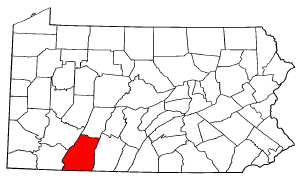
mapsize1 = 250x200px
map_caption1 = Map of Somerset County, Pennsylvania
subdivision_type = Country
subdivision_name =United States
subdivision_type1 = State
subdivision_name1 =Pennsylvania
subdivision_type2 = County
subdivision_name2 = Somerset
government_footnotes =
government_type =
leader_title =
leader_name =
leader_title1 =
leader_name1 =
leader_title2 =
leader_name2 =
established_title = Settled
established_date =
established_title1 = Incorporated
established_date1 =
unit_pref = Imperial
area_footnotes =
area_magnitude =
area_total_km2 =
area_land_km2 =
area_water_km2 =
area_total_sq_mi = 65.1
area_land_sq_mi = 64.6
area_water_sq_mi = 0.5
population_as_of = 2000
population_footnotes =
population_total = 4054
population_density_km2 =
population_density_sq_mi = 62.8
timezone = Eastern (EST)
utc_offset = -5
timezone_DST = EDT
utc_offset_DST = -4
postal_code_type =
postal_code =
area_code =
website =
footnotes =Jenner Township is a township in Somerset County,
Pennsylvania ,United States . The population was 4,054 at the 2000 census. It is part of the Johnstown,Pennsylvania Metropolitan Statistical Area .Jenner Township includes the unincorporated communities of Jenners, Jenner Crossroads, Ralphton, Pilltown, Ferrellton, Acosta, and Gray. Jenner Township completely surrounds the nearby boroughs of Boswell and Jennerstown, each of which has its own government and is not part of the Township.
Geography
It is located approximately at 40.175°N by 79.06°W. According to the
United States Census Bureau , the township has a total area of 65.1square mile s (168.6km² ), of which, 64.6 square miles (167.3 km²) of it is land and 0.5 square miles (1.3 km²) of it (0.77%) is water.Demographics
As of the
census GR|2 of 2000, there were 4,054 people, 1,598 households, and 1,192 families residing in the township. Thepopulation density was 62.8 people per square mile (24.2/km²). There were 1,773 housing units at an average density of 27.4/sq mi (10.6/km²). The racial makeup of the township was 99.33% White, 0.05% Native American, 0.10% Asian, 0.12% from other races, and 0.39% from two or more races. Hispanic or Latino of any race were 0.25% of the population.There were 1,598 households out of which 28.8% had children under the age of 18 living with them, 59.6% were married couples living together, 9.9% had a female householder with no husband present, and 25.4% were non-families. 22.3% of all households were made up of individuals and 11.4% had someone living alone who was 65 years of age or older. The average household size was 2.54 and the average family size was 2.96.
In the township the population was spread out with 22.1% under the age of 18, 8.0% from 18 to 24, 27.0% from 25 to 44, 26.7% from 45 to 64, and 16.2% who were 65 years of age or older. The median age was 41 years. For every 100 females there were 98.0 males. For every 100 females age 18 and over, there were 97.6 males.
The median income for a household in the township was $32,141, and the median income for a family was $39,341. Males had a median income of $26,163 versus $22,688 for females. The
per capita income for the township was $15,066. About 8.8% of families and 10.2% of the population were below thepoverty line , including 14.6% of those under age 18 and 11.7% of those age 65 or over.History
Initial hunters and settlers in the territory that includes present-day Jenner Township were
Mingo , also known as the Seneca, one of the Six Nations of theIroquois . [Cassady, John C. 1932. "The Somerset County Outline." Scottdale, Pa.: Mennonite Publishing House. pp. 75-76.] The land was ceded by the Iroquois Six Nations officially by theTreaty of Fort Stanwix of 1768 to Penn family as proprietors of Pennsylvania province. [Cassady, pp. 80-81.] Early European traders crossed Jenner Township as early as 1750, whenChristopher Gist documented his brief time there in his travel diary. [Cassady, p. 82] Gist is said to have named Quemahoning Creek [Cassady, p. 82] , which drains much of Jenner Township. The Northern Trail, an established Indian trail, crossed the territory from east to west, intersecting Quemahoning Creek at Kickenapaulin's Town, a rather substantial Indian settlement, the site of which now lies under the waters of theQuemahoning Reservoir , just outside the township. [Cassady, p. 113.] In August 1758, the Northern Trial was improved, initially for the British military use, and renamed the Forbes Trial, [Cassady, pp. 106-109] , later known as the Pennsylvania Road, theLincoln Highway , and nowU.S. Route 30 . [Cassady, pp. 189-191.]With the building of the Forbes Road to
Fort Ligonier and, later, onward to Fort Pitt, present-day Pittsburgh, European settlement began in earnest. Jenner Township was formed out of the western part of Quemahoning Township in 1811. [Cassady, p. 211] The township was named in honor of Dr.Edward Jenner , discoverer of the smallpox vaccine. Early Jenner Township settlers were primarily German and English speakers engaged in agriculture. Pennsylvania Dutch was still spoken in rural parts of the township until the 1960s.Jenner Crossroads, the township's first substantial European settlement, grew near a grist mill and tavern stop established about 1800 along the Pennsylvania Road. [Cassady, 1932. pp. 58, 213.] Samuel Steel built a sawmill at Jenner Crossroads in 1817; John Shopwood opened a hotel in 1825, and Samuel Elder opened the first store in 1836 [ Cassady, pp. 50, 216.] Other early industry in the township included a sawmill on Quemahoning Creek built about 1813 by Moses Fream and a small woolen mill, built in 1817 by William Dalley, enlarged by Owen and William Morgan later into a small settlement known as Morgantown. [Cassady, pp. 50, 59.]
Jenners, Ralphton, Acosta and Gray were each built shortly after 1900 as company towns by Consolidation Coal, a Rockefeller interest, for its newly opened deep coal mines. Immigrants from Poland, Italy, Russia, Ruthenia, Wales, and Ireland filled the coal towns. The Somerset Coal Strike of 1922-1923 centered in these towns, and nearby Boswell, Jerome and Windber. The strike, which ultimately failed in its goal to unionize miners, drew significant nationwide attention for the hardships suffered by local miners. [ For additional detail, see Blankenhorn, Heber. 1924. "The Strike for Union: A Study of the Non-Union Question in Coal and the Problems of a Democratic Movement." New York: H.W. Wilson; Brophy, John. 1964. "A Miner's Life." Madison: University of Wisconsin Press. Bussel, Robert. 1999. " From Harvard to the Ranks of Labor: Powers Hapgood and the American Working Class." University Park: Pennsylvania State University Press.] By the 1960s, the deep mines had closed. The town of Randolph was also a very small coal mining community in Jenner Township, any trace of which is now virtually gone, having been destroyed by highway construction in 1970.
Surface mining and some deep mining of coal continues in the immediate area. Farming, timber harvest and tourism are also mainstays of the local economy. Jenner Township also serves as a bedroom community for the nearby Somerset and Johnstown areas.Notable Persons in Jenner Township History
*
Sergeant Joseph Darby , who in 2004 exposed theAbu Ghraib torture and prisoner abuse in Iraq, lived in the community of Jenners. Darby received the 2005 Profiles in Courage Award from the John F. Kennedy Library Foundation. [http://www.jfklibrary.org/Education+and+Public+Programs/Profile+in+Courage+Award/Award+Recipients/Joseph+Darby/]
*Christopher Gist , an early English pioneer and surveyor, and the first European documented to have visited the territory that is now Jenner Township, in 1750.
*Powers Hapgood , a Harvard-educated miner, labor leader and organizer for the United Mine Workers Union of America, helped lead the Somerset County Coal Strike of 1922-23, a bitter sixteen-month effort which draw significant national press and political attention.
* James Wells, one of the first European settlers in Jenner Township, known for his harrowing experience from Indian attack while tending his fields in autumn 1776 -- "Wells' Escape" -- near the present site of Jennerstown. [Cassady, p. 215, 232.]References
External links
* [http://www.northstar.k12.pa.us North Star School District.]
* [http://www.lib.iup.edu/spec_coll/articles/mag_fight.html Indiana University of Pennsylvania Special Collections and Archives "That Magnificent Fight for Unionism".] :Narrative on Somerset County Coal Strike, including its violence, and its hardship for women in particular.

Wikimedia Foundation. 2010.