- Haverford Township, Pennsylvania
Geobox Township
name = Haverford Township
native_name =
other_name =
other_name1 =
category = Township
image_size =
image_caption =
flag_size =
symbol =
symbol_size =
nickname =
motto =
country = United States
state = Pennsylvania
region = Delaware
region_type = County
district =
area_imperial = 10.0
area_land_imperial = 10.0
area_water_imperial = 0.0
area_water_percentage = auto
area_percentage_round = 2
area_round = 1
location =
lat_d = 39
lat_m = 59
lat_s = 00
lat_NS = N
long_d = 75
long_m = 17
long_s = 59
long_EW = W
elevation_imperial = 289
elevation_round = 1
population_as_of = 2000
population = 48498
population_density_imperial = 4844.6
population_density_round = 1
established_type =
established =
mayor =
timezone = EST
utc_offset = -5
timezone_DST = EDT
utc_offset_DST = -4
postal_code =
postal_code_type =
area_code = 610
area_code_type =
code2_type =
code2 =
free_type =
free =
free1_type =
free1 =
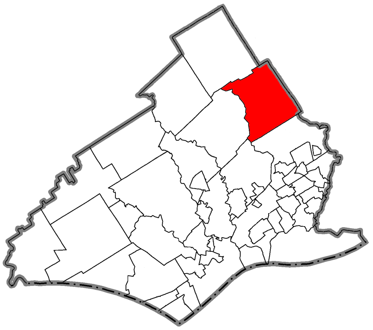
map_caption = Location of Haverford Township in Delaware County
map1 = Pennsylvania Locator Map.png
map1_locator = Pennsylvania
map2 = Map of USA PA.svg
map2_caption = Location of Pennsylvania in the United States
website = http://www.haverfordtownship.comHaverford Township (named after the town of
Haverfordwest in Wales, UK) is a township in Delaware County, nearPhiladelphia , in southeasternPennsylvania ,United States .Haverford Township contains portions of the communities of Haverford, Bryn Mawr, Ardmore, Drexel Hill, and Wynnewood. The unincorporated "town" of Havertown lies wholly within Haverford Township. The population was originally reported as 48,498 at the 2000 census. The corrected count as reported by the Count Question Resolution program was 49,608.
History
Haverford Township was founded by Welsh Quakers in 1681 from land purchased by
William Penn . The first three families arrived in Haverford Township in 1682.Nitre Hall Powder Mills was in operation before 1810 and provided gunpowder for theWar of 1812 .Swell Bubble Gum , the township's last major industry, was closed in 2004. The township is currently in the middle of selecting a plan with the developers Goldenberg-Pohlig to develop theHaverford State Hospital land.Geography
According to the
United States Census Bureau , the township has a total area of 10.0square mile s (25.9km² ), all of it land. The township is part of thePennsylvania Main Line and of theWelsh Tract .Adjacent Municipalities
*Lower Merion Township, Montgomery County - northeast
*City of Philadelphia - east
*Upper Darby Township, Delaware County - south
*Springfield Township, Delaware County - southwest
*Marple Township, Delaware County - west
*Radnor Township, Delaware County - northwestDemographics
As of the initial
census GR|2 report of 2000, there were 48,498 people, 18,061 households, and 13,021 families residing in the township. Thepopulation density was 4,844.6 people per square mile (1,870.6/km²). There were 18,378 housing units at an average density of 1,835.8/sq mi (708.9/km²). The racial makeup of the township was 93.99% White, 2.12% African American, 0.10% Native American, 2.76% Asian, 0.01% Pacific Islander, 0.20% from other races, and 0.81% from two or more races. Hispanic or Latino of any race were 0.89% of the population.There were 18,061 households out of which 33.3% had children under the age of 18 living with them, 60.9% were married couples living together, 8.6% had a female householder with no husband present, and 27.9% were non-families. 23.3% of all households were made up of individuals and 12.4% had someone living alone who was 65 years of age or older. The average household size was 2.65 and the average family size was 3.17.
In the township the population was spread out with 24.9% under the age of 18, 6.3% from 18 to 24, 28.6% from 25 to 44, 22.7% from 45 to 64, and 17.5% who were 65 years of age or older. The median age was 39 years. For every 100 females there were 90.6 males. For every 100 females age 18 and over, there were 86.4 males.
The median income for a household in the township was $65,714, and the median income for a family was $76,813. Males had a median income of $52,471 versus $38,852 for females. The
per capita income for the township was $29,749. About 2.0% of families and 3.7% of the population were below thepoverty line , including 2.1% of those under age 18 and 4.2% of those age 65 or over.Education
Public school students living in Haverford Township attend schools in the
School District of Haverford Township .Haverford College is partially located within Haverford Township and partially within Lower Merion Township.Notable residents
*
Jeff Yass
*Billy King
*Glen Macnow
*Jack Thayer
*Jason Johnson Asst. Coach Philadelphia 76ers
*Jennifer Toof "Toasteee" from Flavor of Love
*John LeClair ,NHL , current player,Pittsburgh Penguins
* Harold "Spike" Yoh, Former Chairman and CEO ofDay_%26_Zimmermann , namesake of Yoh Football Center atDuke University
*Atwater Kent Points of interest
*
Haverford College
*Haverford College Arboretum
*The Haverford School
*Grange Estate
*Nitre Hall
*Federal School
*Lawrence Cabin
*Merion Golf Club
* Beechwood Amusement Park
* Old Haverford Friends MeetingReferences
External links
* [http://www.haverfordtownship.com/ Haverford Township]
* [http://www.haverfordlibrary.org/ Haverford Township Free Library website]
* [http://www.haverfordblog.com/ Haverford Township Blog - Haverford's online community bulletin board website]
* [http://www.haverforddemocrats.com/ Haverford Township's Democratic Party website]
* [http://www.digitalcorp.com/haverford Map of Haverford Township]
Wikimedia Foundation. 2010.