- Marseilles, Ohio
-
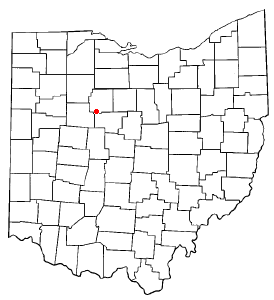
Marseilles, Ohio — Village — Downtown Marseilles Location of Marseilles, Ohio
Coordinates: 40°42′4″N 83°23′34″W / 40.70111°N 83.39278°WCoordinates: 40°42′4″N 83°23′34″W / 40.70111°N 83.39278°W Country United States State Ohio County Wyandot Area – Total 0.1 sq mi (0.2 km2) – Land 0.1 sq mi (0.2 km2) – Water 0.0 sq mi (0.0 km2) Elevation[1] 876 ft (267 m) Population (2000) – Total 124 – Density 1,294.9/sq mi (500.0/km2) Time zone Eastern (EST) (UTC-5) – Summer (DST) EDT (UTC-4) FIPS code 39-47992[2] GNIS feature ID 1061474[1] Marseilles is a village in Wyandot County, Ohio, United States. The population was 124 at the 2000 census.
Geography
Marseilles is located at 40°42′4″N 83°23′34″W / 40.70111°N 83.39278°W (40.701207, -83.392672)[3].
According to the United States Census Bureau, the village has a total area of 0.1 square miles (0.26 km2), all of it land.
State Route 67 runs through Marseilles, where it is the main street.
Demographics
As of the census[2] of 2000, there were 124 people, 48 households, and 33 families residing in the village. The population density was 1,294.9 people per square mile (478.8/km²). There were 54 housing units at an average density of 563.9 per square mile (208.5/km²). The racial makeup of the village was 99.19% White and 0.81% African American.
There were 48 households out of which 35.4% had children under the age of 18 living with them, 58.3% were married couples living together, 8.3% had a female householder with no husband present, and 29.2% were non-families. 22.9% of all households were made up of individuals and 10.4% had someone living alone who was 65 years of age or older. The average household size was 2.58 and the average family size was 3.06.
In the village the population was spread out with 25.8% under the age of 18, 4.0% from 18 to 24, 36.3% from 25 to 44, 23.4% from 45 to 64, and 10.5% who were 65 years of age or older. The median age was 35 years. For every 100 females there were 93.8 males. For every 100 females age 18 and over, there were 100.0 males.
The median income for a household in the village was $45,000, and the median income for a family was $46,875. Males had a median income of $27,917 versus $20,625 for females. The per capita income for the village was $14,852. There were 6.5% of families and 5.9% of the population living below the poverty line, including 4.9% of under eighteens and 25.0% of those over 64.
References
- ^ a b "US Board on Geographic Names". United States Geological Survey. 2007-10-25. http://geonames.usgs.gov. Retrieved 2008-01-31.
- ^ a b "American FactFinder". United States Census Bureau. http://factfinder.census.gov. Retrieved 2008-01-31.
- ^ "US Gazetteer files: 2010, 2000, and 1990". United States Census Bureau. 2011-02-12. http://www.census.gov/geo/www/gazetteer/gazette.html. Retrieved 2011-04-23.
Municipalities and communities of Wyandot County, Ohio City 
Villages Townships Unincorporated
communitiesCategories:- Villages in Ohio
- Populated places in Wyandot County, Ohio


Wikimedia Foundation. 2010.