- North Baltimore, Ohio
-
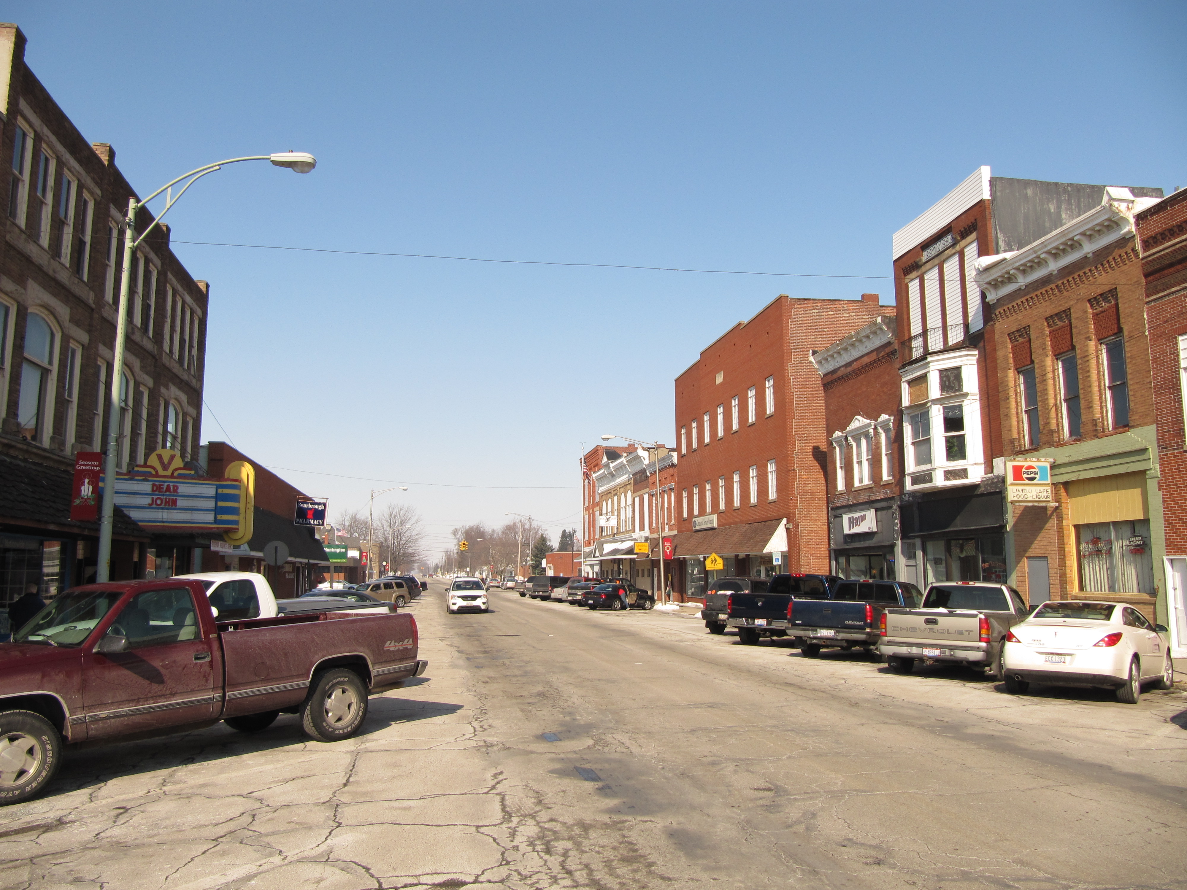
North Baltimore, Ohio — Village — North Main Street in North Baltimore, Ohio. Location of North Baltimore, Ohio
Coordinates: 41°10′55″N 83°40′28″W / 41.18194°N 83.67444°WCoordinates: 41°10′55″N 83°40′28″W / 41.18194°N 83.67444°W Country United States State Ohio County Wood Area - Total 2.3 sq mi (5.8 km2) - Land 2.2 sq mi (5.8 km2) - Water 0.0 sq mi (0.1 km2) Elevation[1] 732 ft (223 m) Population (2000) - Total 3,361 - Density 1,512.2/sq mi (583.9/km2) Time zone Eastern (EST) (UTC-5) - Summer (DST) EDT (UTC-4) ZIP code 45872 Area code(s) 419 FIPS code 39-56154[2] GNIS feature ID 1056452[1] Website www.northbaltimore.net North Baltimore is a village in Wood County, Ohio, United States. The population was 3,361 at the 2000 census.
North Baltimore is south of Toledo.
Contents
Geography
North Baltimore is located at 41°10′55″N 83°40′28″W / 41.18194°N 83.67444°W (41.181978, -83.674409).[3]
According to the United States Census Bureau, the village has a total area of 2.2 square miles (5.7 km2), of which, 2.2 square miles (5.7 km2) of it is land and 0.04 square miles (0.10 km2) of it (1.33%) is water.
The village is west of Interstate 75 on State Highway 18 (West State Street/South Main Street).
North Baltimore is about 12 miles south of Bowling Green, 8 miles north of Findlay, and halfway between Lima and Toledo.
Demographics
As of the census[2] of 2000, there were 3,361 people, 1,272 households, and 886 families residing in the village. The population density was 1,512.2 people per square mile (584.5/km²). There were 1,360 housing units at an average density of 611.9 per square mile (236.5/km²). The racial makeup of the village was 96.82% White, 0.36% Native American, 0.39% Asian, 1.13% from other races, and 1.31% from two or more races. Hispanic or Latino of any race were 3.33% of the population.
There were 1,272 households out of which 36.0% had children under the age of 18 living with them, 50.9% were married couples living together, 14.2% had a female householder with no husband present, and 30.3% were non-families. 25.3% of all households were made up of individuals and 12.7% had someone living alone who was 65 years of age or older. The average household size was 2.57 and the average family size was 3.07.
In the village the population was spread out with 28.2% under the age of 18, 8.8% from 18 to 24, 28.1% from 25 to 44, 19.7% from 45 to 64, and 15.2% who were 65 years of age or older. The median age was 34 years. For every 100 females there were 91.0 males. For every 100 females age 18 and over, there were 86.0 males.
The median income for a household in the village was $38,507, and the median income for a family was $45,962. Males had a median income of $33,144 versus $23,022 for females. The per capita income for the village was $16,894. About 6.9% of families and 8.8% of the population were below the poverty line, including 10.5% of those under age 18 and 11.8% of those age 65 or over.
Notable natives
- Russell Coffey, once the oldest living American veteran of World War I
References
- ^ a b "US Board on Geographic Names". United States Geological Survey. 2007-10-25. http://geonames.usgs.gov. Retrieved 2008-01-31.
- ^ a b "American FactFinder". United States Census Bureau. http://factfinder.census.gov. Retrieved 2008-01-31.
- ^ "US Gazetteer files: 2010, 2000, and 1990". United States Census Bureau. 2011-02-12. http://www.census.gov/geo/www/gazetteer/gazette.html. Retrieved 2011-04-23.
External links
- Village of North Baltimore
- North Baltimore Area Chamber of Commerce
- North Baltimore information
- Community website
Municipalities and communities of Wood County, Ohio Cities Bowling Green | Fostoria‡ | Northwood | Perrysburg | Rossford

Villages Bairdstown | Bloomdale | Bradner | Custar | Cygnet | Grand Rapids | Haskins | Hoytville | Jerry City | Luckey | Millbury | Milton Center | North Baltimore | Pemberville | Portage | Rising Sun | Tontogany | Walbridge | Wayne | West Millgrove | Weston
Townships Bloom | Center | Freedom | Grand Rapids | Henry | Jackson | Lake | Liberty | Middleton | Milton | Montgomery | Perry | Perrysburg | Plain | Portage | Troy | Washington | Webster | Weston
Unincorporated
communitiesDunbridge | Lemoyne | Moline | New Rochester | Rudolph | Stony Ridge | Sugar Ridge
Footnotes ‡This populated place also has portions in an adjacent county or counties
Categories:- Villages in Ohio
- Populated places in Wood County, Ohio
- Toledo metropolitan area


Wikimedia Foundation. 2010.