- East Liverpool, Ohio
-
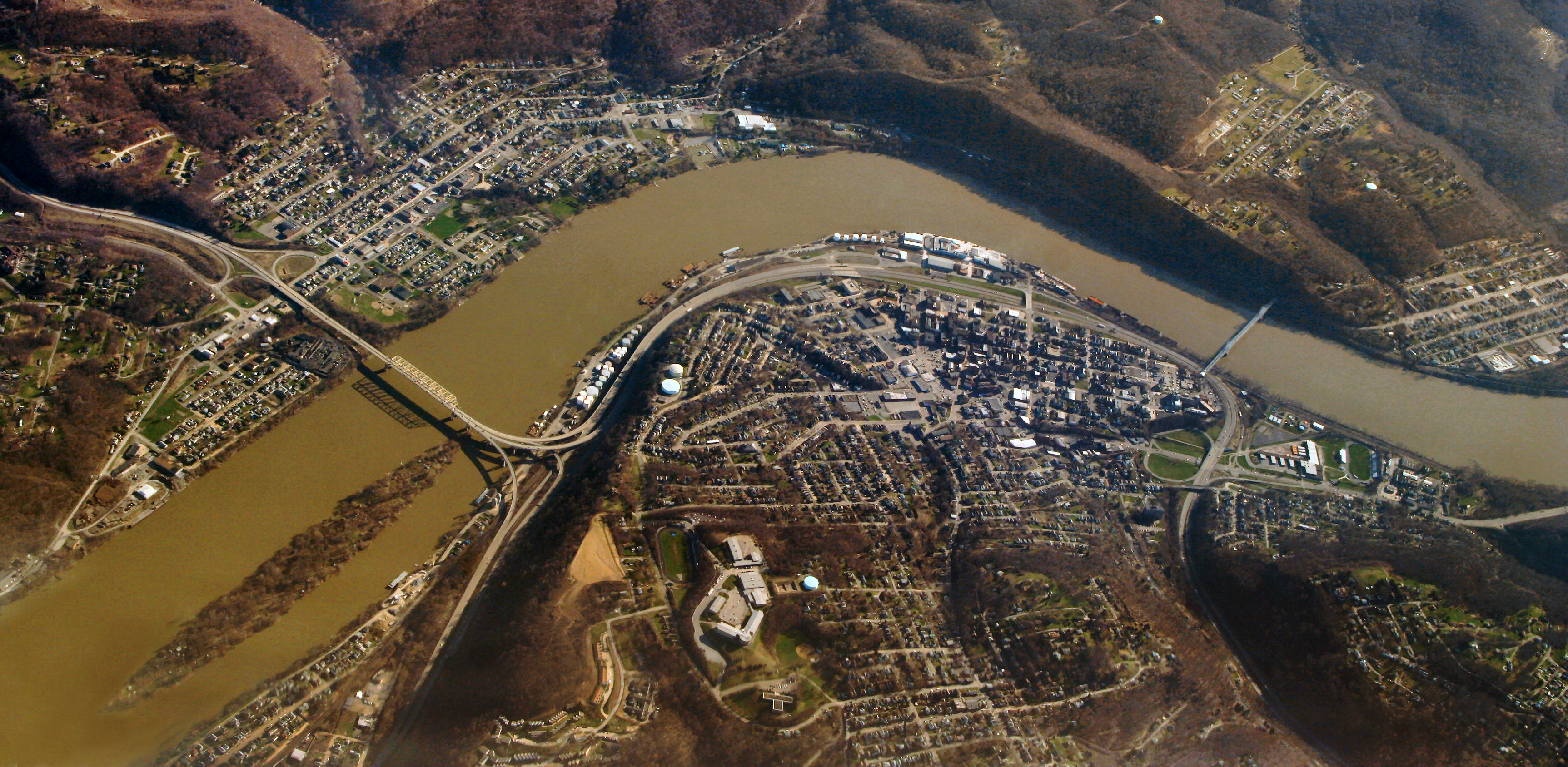
East Liverpool, Ohio — City — East Liverpool from the air, looking south.
Nickname(s): The Pottery Capital of the World Location of East Liverpool, Ohio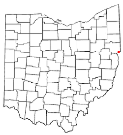
Coordinates: 40°37′43″N 80°34′9″W / 40.62861°N 80.56917°WCoordinates: 40°37′43″N 80°34′9″W / 40.62861°N 80.56917°W Country United States State Ohio County Columbiana Government – Mayor James P. Swoger Area – City 4.5 sq mi (11.7 km2) – Land 4.3 sq mi (11.3 km2) – Water 0.2 sq mi (0.5 km2) Elevation[1] 768 ft (234 m) Population (2000) – City 13,089 – Density 3,010.3/sq mi (1,162.3/km2) – Urban 33,560 Time zone Eastern (EST) (UTC-5) – Summer (DST) EDT (UTC-4) ZIP code 43920 Area code(s) 330, 234 FIPS code 39-23730[2] GNIS feature ID 1061038[1] Website http://www.eastliverpool.com/ East Liverpool is a city in Columbiana County, Ohio, United States. The population was 13,089 at the time of the 2000 census. It is located along the Ohio River and borders the states of Pennsylvania and West Virginia. East Liverpool is a principal city of the East Liverpool–Salem Micropolitan Statistical Area, which includes all of Columbiana County.
Long known as the "Pottery Capital of the World," East Liverpool and the immediate area are still home to three major potteries. The city is perhaps best known as the hometown of former University of Notre Dame football coach Lou Holtz, and as the city to which the body of bank robber Pretty Boy Floyd was taken for embalming. The Beginning Point of the U.S. Public Land Survey is just east of the city center, on the Ohio-Pennsylvania border.
Contents
History
East Liverpool was originally named St. Clair by Thomas Fawcett, one of the earliest land owners, in 1800 after Arthur St. Clair, who at that time was Governor of the Northwest Territory. It was called Fawcettstown for a time by the residents. It was incorporated as East Liverpool in 1834 when a Liverpool in western Ohio (now defunct) protested the use of its name by this newer town.
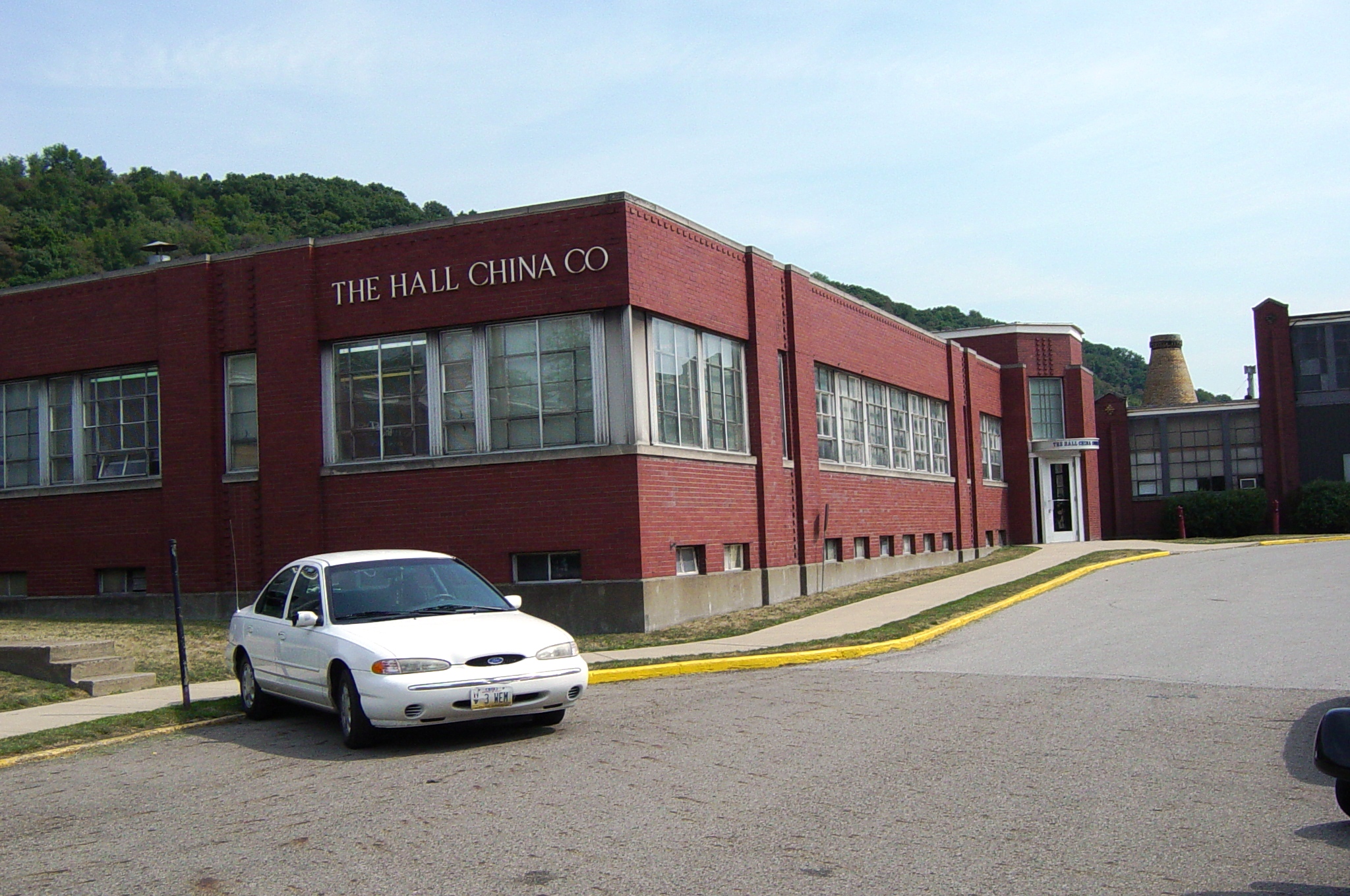
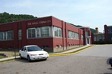 The Hall China Company.
James Bennett, an English potter, established the pottery industry in East Liverpool, and it became the community's leading employer. East Liverpool became known as "The Crockery City." East Liverpool once produced more than half of the United States's annual ceramics output. Throughout East Liverpool's ceramics history there were more than 300 potteries. Of these, three remain: The Hall China Company, the Homer Laughlin China Company (located across the Ohio River in Newell, West Virginia) and Pioneer Pottery.
Among the most famous of East Liverpool's ceramics was the porcelain known as Lotus Ware. Produced by Knowles, Taylor & Knowles in the 1890s, this Moorish- and Persian-influenced artware swept the competition at the 1893 World's Fair in Chicago. It is generally considered to be the finest porcelain ever produced in the US. The Museum of Ceramics in downtown East Liverpool has the country's largest public display of Lotus Ware.
Since the mid-1960s or so, East Liverpool's pottery industry has steadily declined. This has been because pottery workers in less-developed countries—among them China, South Korea and Taiwan--are paid a small fraction of the wage of American workers.
In the mid-1990s, the city renovated its downtown district, with Great Depression-era lightposts, a new center of town called Devon's Diamond, and the reconstruction of the old High School's clocktower, which is now home of the East Liverpool High School Alumni Association.
Geography
 Spliced panoramic photo of East Liverpool, Ohio, from the east, taken August 11, 2000.
East Liverpool is located at 40°37′43″N 80°34′9″W / 40.62861°N 80.56917°W (40.628510, -80.569063)[3].
According to the United States Census Bureau, the city has a total area of 4.5 square miles (12 km2), of which 4.3 square miles (11 km2) is land and 0.2 square miles (0.52 km2) (3.97%) is water.
Demographics
Historical populations Census Pop. %± 1870 2,105 — 1880 5,568 164.5% 1890 10,956 96.8% 1900 16,485 50.5% 1910 20,387 23.7% 1920 21,411 5.0% 1930 23,329 9.0% 1940 23,555 1.0% 1950 24,217 2.8% 1960 22,306 −7.9% 1970 26,243 17.6% 1980 16,517 −37.1% 1990 13,654 −17.3% 2000 13,089 −4.1% Est. 2008 11,996 −8.4% As of the census[2] of 2000, there were 13,089 people, 5,261 households, and 3,424 families residing in the city. The population density was 3,010.3 people per square mile (1,161.8/km²). There were 5,743 housing units at an average density of 1,320.8 per square mile (509.7/km²). The racial makeup of the city was 92.85% White, 4.81% African American, 0.24% Native American, 0.08% Asian, 0.05% Pacific Islander, 0.21% from other races, and 1.76% from two or more races. Hispanic or Latino of any race were 0.72% of the population.
There were 5,261 households out of which 32.9% had children under the age of 18 living with them, 43.5% were married couples living together, 16.6% had a female householder with no husband present, and 34.9% were non-families. 30.3% of all households were made up of individuals and 13.5% had someone living alone who was 65 years of age or older. The average household size was 2.44 and the average family size was 3.01.
In the city the population was spread out with 27.1% under the age of 18, 8.8% from 18 to 24, 27.3% from 25 to 44, 20.8% from 45 to 64, and 16.0% who were 65 years of age or older. The median age was 36 years. For every 100 females there were 86.5 males. For every 100 females age 18 and over, there were 81.8 males.
The median income for a household in the city was $23,138, and the median income for a family was $27,500. Males had a median income of $27,346 versus $18,990 for females. The per capita income for the city was $12,656. About 21.5% of families and 25.2% of the population were below the poverty line, including 35.2% of those under age 18 and 13.0% of those age 65 or over.
Notable natives and residents
- Dan Adkins - comic book artist for Marvel and other companies grew up in East Liverpool
- Bernie Allen - professional baseball player: second baseman for the Minnesota Twins, the Washington Senators, the New York Yankees, and the Montreal Expos
- Charles King Boyd - posthumously decorated with the Dutch Military Order of William (the Dutch equivalent of the Medal of Honor) for his actions in Operation Market Garden
- John Caparulo - stand-up comedian and host of CMT's Mobile Home Disaster
- Jane Louise Curry - writer for children
- Robert Jack Eardley, M.D. - former Chief of Psychiatry for the Federal Bureau of Prisons
- Ben Feldman (1912–1993) - one of the most prolific salespeople in world history
- Lou Holtz - author, television commentator, motivational speaker, and former NCAA football head coach
- George P. Ikirt - physician and U.S. Representative from Ohio
- Aric Long - decathlete at the 1992 Summer Olympics in Barcelona
- Bob McFadden- American voice actor.
- O. O. McIntyre - feature writer for East Liverpool Morning Tribune before going on to reach 7,000,000 readers daily with his syndicated column
- Hy Myers - major league baseball player, led the National League in RBIs and slugging percentage in 1919 while playing for the Brooklyn Dodgers
- Ruth Crawford Seeger - famous composer and first woman to receive the Guggenheim Fellowship.
- Will Lamartine Thompson - noted American composer, best known for his hymns
- Norm Van Lier - star basketball point guard, played at Saint Francis University and in the NBA for the Cincinnati Royals, Chicago Bulls, and Milwaukee Bucks in the 1970s
- Jabez Vodrey - prominent early potter
See also
- List of cities and towns along the Ohio River
- Jennings Randolph Bridge
- Ohio River Trail
References
- ^ a b "US Board on Geographic Names". United States Geological Survey. 2007-10-25. http://geonames.usgs.gov. Retrieved 2008-01-31.
- ^ a b "American FactFinder". United States Census Bureau. http://factfinder.census.gov. Retrieved 2008-01-31.
- ^ "US Gazetteer files: 2010, 2000, and 1990". United States Census Bureau. 2011-02-12. http://www.census.gov/geo/www/gazetteer/gazette.html. Retrieved 2011-04-23.
Adler, Jerry. “It’s not easy being green.” Newsweek 28 Feb. 1992. EBSCOhost. Web. 17 Apr. 2010.
Jones, Arthur. “Toxic-waste incinerator in the backyard: White House and church steer clear in Ohio.” National Catholic Reporter 18 Feb. 1994: 5+. Academic OneFile. Web. 17 Apr. 2010.
Rembert, Tracey C. “Terri Swearingen: the long war with WTI.” E Nov.-Dec. 1997: 10+. Academic OneFile. Web. 17 Apr. 2010.
Swearingen, Terri. “’We’re losing our democracy.’.”Earth Island Journal Summer 1997: 38+. Academic OneFile.Web. 17 Apr. 2010.
External links
- Official City of East Liverpool website
- Official East Liverpool Facebook fan page
- East Liverpool Area Chamber of Commerce
- East Liverpool City Schools
Municipalities and communities of Columbiana County, Ohio Cities Columbiana‡ | East Liverpool | East Palestine | Salem‡

Villages Hanoverton | Leetonia | Lisbon | Minerva‡ | New Waterford | Rogers | Salineville | Summitville | Washingtonville‡ | Wellsville
Townships CDPs Unincorporated
communitiesClarkson | Damascus‡ | East Rochester | Elkton | Fredericktown | Homeworth | Kensington | Negley | North Georgetown | West Point | Winona
Footnotes ‡This populated place also has portions in an adjacent county or counties
Categories:- East Liverpool, Ohio
- Cities in Ohio
- Populated places in Columbiana County, Ohio
- Micropolitan areas of Ohio


Wikimedia Foundation. 2010.