- Rock Creek, Ohio
Infobox Settlement
official_name = Rock Creek, Ohio
settlement_type = Village
nickname =
motto =
imagesize =
image_caption =
image_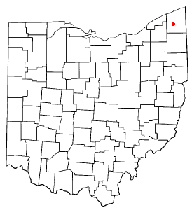
mapsize = 250x200px
map_caption = Location of Rock Creek, Ohio
mapsize1 =
map_caption1 =subdivision_type = Country
subdivision_name =United States
subdivision_type1 = State
subdivision_name1 =Ohio
subdivision_type2 = County
subdivision_name2 = Ashtabulagovernment_footnotes =
government_type =
leader_title =
leader_name =
leader_title1 =
leader_name1 =
established_title =
established_date =unit_pref = Imperial
area_footnotes =area_magnitude =
area_total_km2 = 2.3
area_land_km2 = 2.3
area_water_km2 = 0.0
area_total_sq_mi = 0.9
area_land_sq_mi = 0.9
area_water_sq_mi = 0.0population_as_of = 2000
population_footnotes =
population_total = 584
population_density_km2 = 249.5
population_density_sq_mi = 646.2timezone = Eastern (EST)
utc_offset = -5
timezone_DST = EDT
utc_offset_DST = -4
elevation_footnotes = GR|3
elevation_m = 245
elevation_ft = 804
latd = 41 |latm = 39 |lats = 39 |latNS = N
longd = 80 |longm = 51 |longs = 13 |longEW = Wpostal_code_type =
ZIP code
postal_code = 44084
area_code = 440
blank_name = FIPS code
blank_info = 39-67846GR|2
blank1_name = GNIS feature ID
blank1_info = 1061619GR|3
website =
footnotes =Rock Creek is a village in Ashtabula County,
Ohio ,United States . The population was 584 at the 2000 census.The principal village festival is the Ox Roast. Its local elementary school,
Rock Creek Elementary , had 285 students beginning the 2004-2005 school year, and the school's mascot is the Roadrunner.Geography
Rock Creek is located at coor dms|41|39|39|N|80|51|13|W|city (41.660786, -80.853646)GR|1, at the confluence of Rock Creek and the Grand River.
According to the
United States Census Bureau , the village has a total area of 0.9square mile s (2.3km² ), all of it land.Demographics
As of the
census GR|2 of 2000, there were 584 people, 195 households, and 146 families residing in the village. Thepopulation density was 646.2 people per square mile (250.5/km²). There were 201 housing units at an average density of 222.4/sq mi (86.2/km²). The racial makeup of the village was 97.26% White, 1.71% African American, 0.17% Native American, and 0.86% from two or more races. Hispanic or Latino of any race were 0.17% of the population. 32.2% were of German, 14.5% Irish, 8.8% Italian, 7.7% American and 6.9% English ancestry according toCensus 2000 .There were 195 households out of which 40.0% had children under the age of 18 living with them, 59.5% were married couples living together, 10.8% had a female householder with no husband present, and 25.1% were non-families. 20.0% of all households were made up of individuals and 10.8% had someone living alone who was 65 years of age or older. The average household size was 2.99 and the average family size was 3.43.
In the village the population was spread out with 32.5% under the age of 18, 8.0% from 18 to 24, 33.0% from 25 to 44, 17.5% from 45 to 64, and 8.9% who were 65 years of age or older. The median age was 32 years. For every 100 females there were 90.2 males. For every 100 females age 18 and over, there were 90.3 males.
The median income for a household in the village was $35,536, and the median income for a family was $37,917. Males had a median income of $28,125 versus $23,409 for females. The
per capita income for the village was $13,276. About 7.9% of families and 9.6% of the population were below thepoverty line , including 13.3% of those under age 18 and none of those age 65 or over.References
External links
Wikimedia Foundation. 2010.