- Main Eastern Highway
-
State Highway 8 (Kerala)

8Main Eastern Highway Route information Maintained by Kerala Public Works Department Length: 153.6 km (95.4 mi) Major junctions From: Punalur Konni, Ranni, Manimala, Ponkunnam, Pala, Thodupuzha To: Muvattupuzha Location Districts: Kollam, Pathanamthitta, Kottayam, Idukki, Ernakulam Primary
destinations:Pathanamthitta, Pala Highway system Indian Road Network
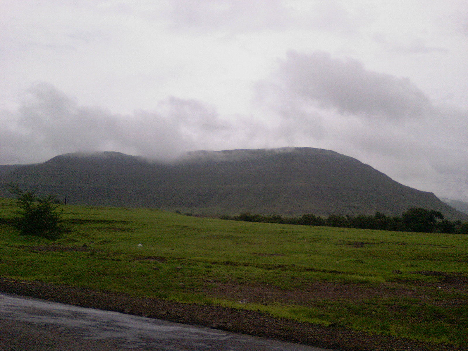
National • Expressways • State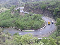 Ghat section of The Main Eastern Highway
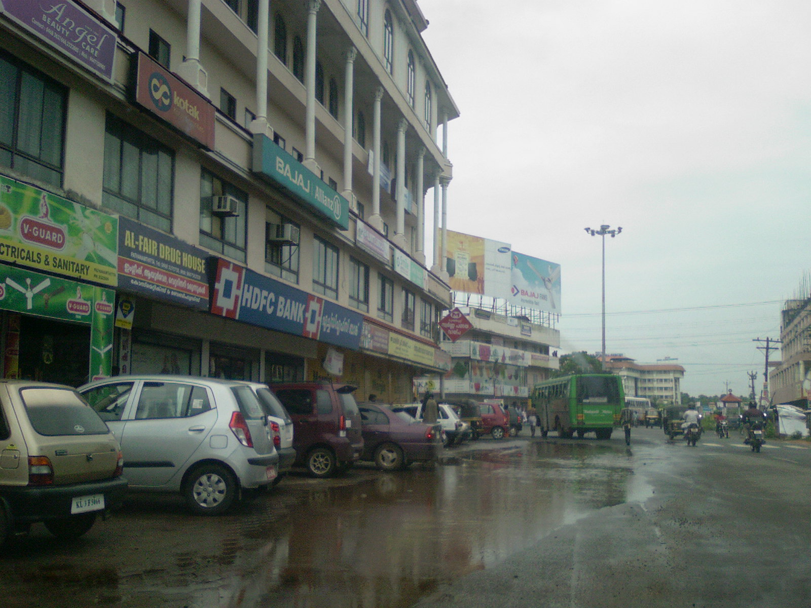
 Pathanamthitta City is on The Main Eastern Highway
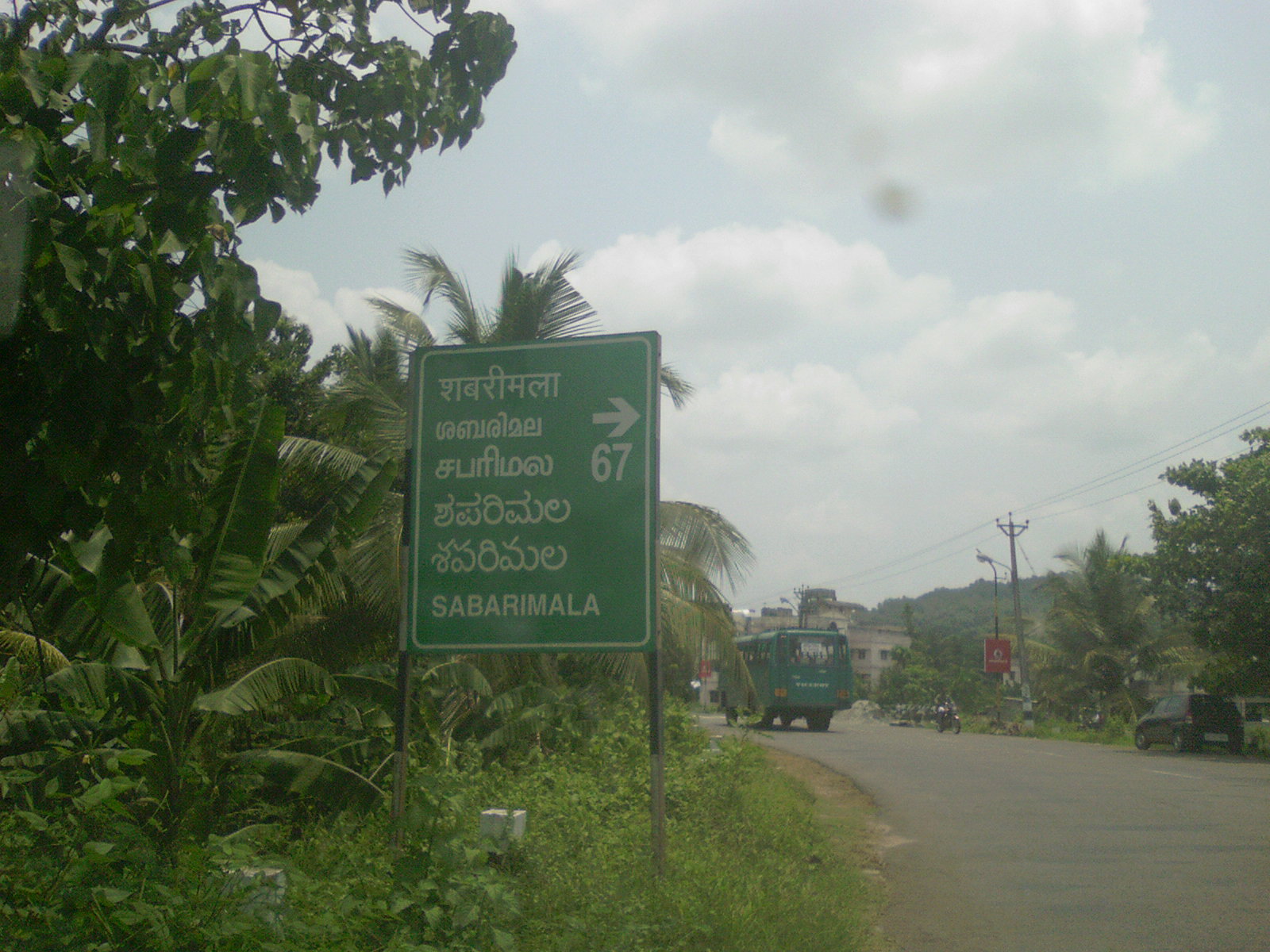
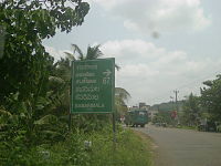 A sign-board that indicates the direction to Sabarimala. The multilingual board is written in English, Hindi, Malayalam, Tamil, Telugu and Kannad
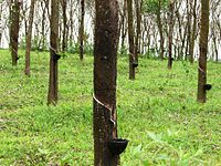 Large rubber plantations are generally seen along the Main Eastern Highway
 A journey through The Main Eastern Highway is a refreshing experience
The Main Eastern Highway is the life line of the high range townships of the Travancore region of Kerala state, India. It is also known as Punalur-Pathanamthitta-Thodupuzha-Muvattupuzha Highway. Main Eastern Highway is categorized as State Highway - 08 ( SH-08 ) of Kerala. It is the second longest State Highway of Kerala covering a distance of 153.6 km. The districts it passes through are Kollam, Pathanamthitta, Kottayam, Idukki and Ernakulam.
It interconnects the townships of Punalur, Pathanapuram, Konni, Pathanamthitta, Ranni, Manimala, Ponkunnam, Pala, Thodupuzha and Muvattupuzha.
Contents
The Route map
Punalur (starts from Km 44/900 of NH 208) - Pallimukku(TB) junction (joins SH 05) - Koodal junction - Konni junction - Kumbazha Jn Pathanamthitta (meets T.K.Road / SH - 07) Ranni market - Makkapuzha - Ponthanpuzha - Manimala bridge - Cheruvally - Ponkunnam junction (Kottayam - Kumily road (NH 220) crosses and overlaps for 0.4 km) - Elamgulam - Pala town - Thodupuzha - Vazhakulam - Nirmala College junction - Muvattupuzha (joins MC Road -SH 01)
The Significance
The economy of the High-Ranges of South and Central Kerala largely depends on the Main Eastern Highway. The main trunk road to Sabarimala, Kerala's Largest Pilgrim Centre starts from Main Eastern Highway near Pathanamthitta. Though it is the shortest route to Thrissur and Northern Kerala townships from Punalur, (the hill town of Kollam District) and in turn from the Tamil Nadu townships Tenkasi and Tirunelveli, it is not developed to its capacity. It acts as a parallel road to the Main Central Road. (M.C.Road/SH-01). It is also the Shortest route to the Kerala State Capital Thiruvananthapuram from Kumali and other major townships of Idukki district viz Kattappana, Thodupuzha etc.
Districts connected by Main Eastern Highway
- Kollam
- Pathanamthitta
- Kottayam
- Idukki
- Ernakulam
Townships on the Main Eastern Highway
- Punalur
- Pathanapuram
- Konni
- Kumbazha
- Mylapra
- Ranni
- Ponkunnam
- Pala
- Thodupuzha
- Muvattupuzha
See also
- M. C. Road
- Roads in Kerala
- List of State Highways in Kerala
 Kerala State Highways Network
State Highways 1• 2 •3 • 5 • 6 • 7 • 8 • 9 • 10 • 11 • 12 • 14 • 15 • 16 • 17 • 18 • 19 • 21 • 22 • 23 • 25 • 26 • 27 • 28 • 29 • 30 • 31 • 32 • 33 • 34 • 36 • 37 • 38 • 39 • 40 • 41 • 42 • 43 • 44 • 45 • 46 • 47 • 48 • 49 • 50 • 51 • 52 • 53 • 54 • 55 • 56 • 57 • 58 • 59 • 60 • 61 • 62 • 63 • 64 • 65 • 66 • 67 • 68 • 69 • 70 • 71 • 72 • 73 • 74 • 75 • 76 • 77Notable Department of Public Works (Kerala) • Roads and Bridges Development Corporation • Roads in Kerala • Kerala State Transport ProjectCategories:- State Highways in Kerala
- Kingdom of Travancore
- India road stubs
- Kerala stubs


Wikimedia Foundation. 2010.