- Indian Expressways
-
This article is about Indian Expressways. For Indian National Highways, see National Highway (India).
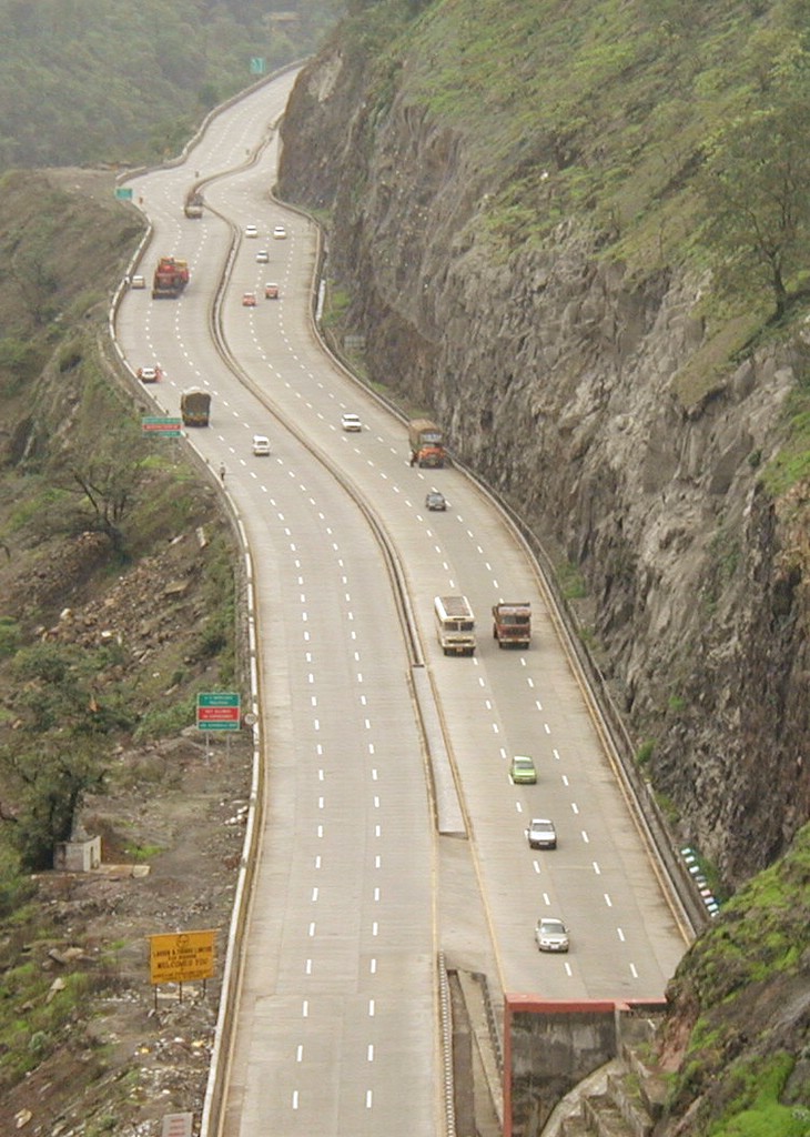
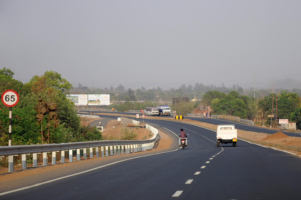
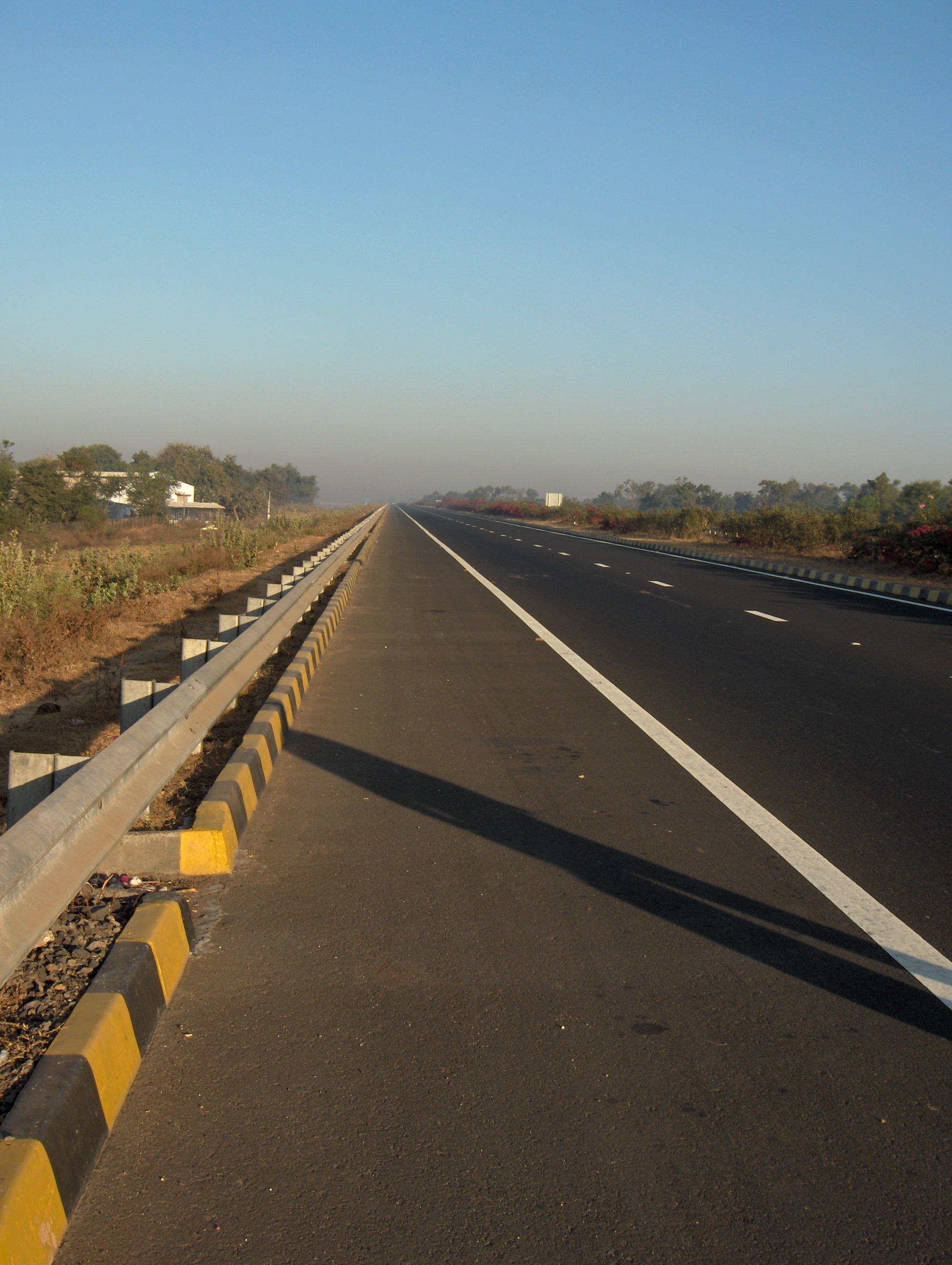
 The Mumbai-Pune Expressway as seen from Khandala
An expressway is a controlled-access highway; it is a highway that controls entrances to it and exits from it by incorporating the design of the slip roads for entry and exit into the design of the highway itself.[1] Access-control should not be confused with collection of toll. An expressway may be free to use and may not collect toll at all. Expressways are the highest class of roads in the Indian Road Network. These are six or eight lane highways with controlled-access. India has approximately 600km expressways.
National Highway system of India consists of approximately 10,000 km (6,200 mi) of four-laned highways that collect toll from users but do not have control of access and cannot be called expressways. Currently, a massive project is underway to expand the highway network and the Government of India plans to add an additional 18,637 km (11,580 mi) of expressways to the network by the year 2022.[2] These roads will be access-controlled roads and will feature between four and six lanes with 3,530 km (2,190 mi) km to come up in the next three years (starting when?). The Ministry of Road Transport and Highways is already in the process of preparing a draft for creation of a National Expressways Authority of India (NEAI) on the lines of NHAI.[3]
Contents
Expressways
Existing
This list includes roads without access-control. Such a road cannot be called "expressway" though the name of the road may include the word "expressway" and may be a misnomer. Such a road should be excluded from this list. Eastern and Western Express Highways in Mumbai are two examples of such roads. Ambala-Chandigarh NH is another such example as it does not have access control for entry and exit at predetermined points. As stated above, access-control is different from collection of toll.
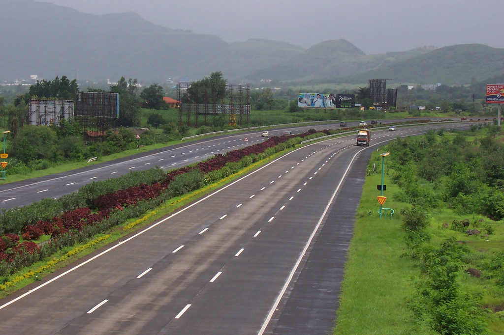
Expressway Name Distance State 1 Ahmedabad Vadodara Expressway 95 km (59 mi) Gujarat 2 Mumbai-Pune Expressway 93 km (58 mi) Maharashtra 3 Jaipur-Kishangarh Expressway 90 km (56 mi) Rajastan 4 Allahabad Bypass 86 km (53 mi) Uttar Pradesh 5 Durgapur Expressway 65 km (40 mi) West Bengal 6 Chennai Bypass 32 km (20 mi) Tamil Nadu 7 Delhi-Gurgaon Expressway 28 km (17 mi) Delhi/Haryana 8 Noida-Greater Noida Expressway 24.53 km (15.24 mi) Delhi/Uttar Pradesh 9 Delhi Noida Direct Flyway 9.2 km (5.7 mi) Delhi/Uttar Pradesh 10 Hyderabad Elevated Expressways 11.6 km (7.2 mi) Andhra Pradesh 11 Hosur Road Elevated Expressway 9.985 km (6.204 mi) Karnataka 12 Kona Expressway 8 km (4.97 mi) West Bengal 13 Ambala Chandigarh Expressway 35 km (22 mi) Haryana 14 Eastern Express Highway, Mumbai 23.55 km (14.63 mi) Maharashtra 15 Western Express Highway, Mumbai 25.33 km (15.74 mi) Maharashtra Total 636.19 km (395.31 mi) - Mumbai Pune Expressway The Mumbai-Pune Expressway is India's first six-lane, concrete, high-speed, tolled, access-controlled, 93 km (58 mi) long expressway. It connects Mumbai, the commercial capital of India, to the neighbouring educational and information technology-oriented city of Pune. With its smoothly paved concrete construction, this highway is unlike most other roads in India. This expressway offers a scenic drive between Mumbai and Pune and reduced the travel time between these two commercially important cities from 4-5 hours on the old NH4 to 2-3 hours.
- Highway features
- 6-lane concrete highway with 7m-wide divider. An extra lane provided on each side as a hard shoulder.
- Separate tunnels for traffic in each direction.
- Complete fencing to avoid humans and animals crossing the expressway.
- No two-wheelers, three-wheelers or tractor vehicles allowed.
- Provision of petrol pumps, motels, workshops, toilets, emergency phones, first aid, breakdown vans, etc.
- Proposed planting of 80,000 trees along the Expressway.
- Highway features
- Eastern Express Highway, Mumbai is a 23.55 km (14.63 mi) city highway. It is one of the busiest and most important roads in the Mumbai Metropolitan Area and is a part of the NH3. It is generally six-lane wide (three lanes in each direction) with more than a dozen flyovers/grade separators. It is a north-south artery of Mumbai connecting the city proper to the eastern suburbs and to the metropolitan area of Thane.
- Western Express Highway, Mumbai is a north-south arterial city road in Mumbai, stretching from the suburb of Bandra to Dahisar. The 25.33 km (15.74 mi) city highway begins near the Mahim Creek and extends to the Mira-Dahisar toll booth in the northern limit of the city. Beyond the city limits, it continues as the Mumbai-Delhi NH8. The road passes by domestic airport, Chhatrapati Shivaji International Airport.
- Ahmedabad Vadodara Expressway is also known as National Expressway 1 (India). It was originally planned during the 1970s, but was delayed for decades due to land-usage and political issues. These issues were resolved in the 1990s, and the expressway opened in 2004. The expressway cuts the journey between the two cities to less than 1 hour. This expressway was India's first four-lane expressway project, and includes minor bridges and canal crossings, interchanges at Nadiad and Anand, cross-drainage works, rest areas, and related structures, for a length of 95 km (59 mi).[4][5]
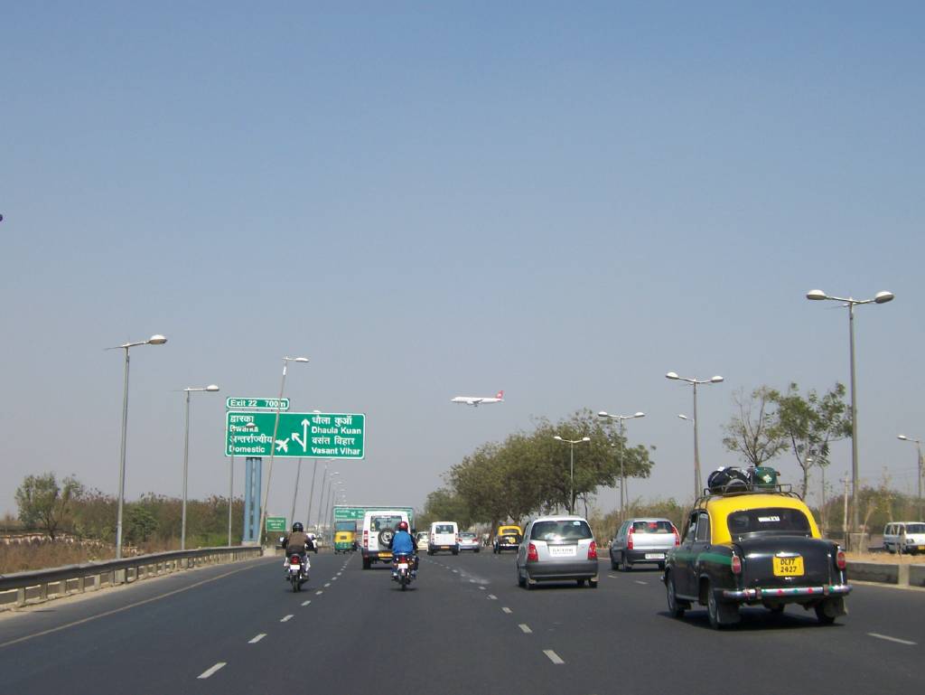
- Delhi Gurgaon Expressway - This eight-lane expressway opened in January 2008 and is part of Golden Quadrilateral highway project. It is 28 km (17 mi) long and was expected to reduce travel time between Gurgaon and Delhi from upwards of 60 minutes to approximately 20 minutes. However, long queues of vehicles at toll plaza have reduced the efficacy of the expressway. Some special features of this expressway are SOS telephones every 1.5 km, CCTV surviliance and a 32-lane toll plaza at the Delhi-Haryana border. The expressway starts near the domestic terminal of the airport at Palam, has an exit for the international airport and ends beyond Gurgaon where it joins the six-lane NH8 after the toll plaza.
- Noida Greater Noida Expressway connects Noida, a residential and industrial suburb of Delhi to Greater Noida, a still newer suburb. The total length of the expressway is 24.53 km (15.24 mi). It is under expansion to Taj Economic Zone, International Airport and Aviation Hub proposed to be constructed along the Taj Expressway. The objectives of the proposed expressway are as follows:
- Highway features
- To provide a fast moving corridor to minimize the travel time
- To connect the main town ships / commercial centers on the Eastern site of river Yamuna
- To ensure development of adjoining area
- To relieve pressure on NH2 that is already congested and runs through the heart of cities like Faridabad, Ballabhgarh and Palwal.
- Highway features
- Delhi Noida Direct Flyway is an eight-lane, 9.2 km (5.7 mi) km[6] access controlled tolled expressway which connects Delhi with Noida. It was built under a Build-Own-Operate-Transfer (BOOT) model. The project included the construction of a flyover at Ashram Chowk. The other major part of the project was the construction of a 552.5 m (1,813 ft) bridge over the Yamuna river. This bridge, which was estimated to cost
 408 crore (US$82.7 million).
- Ambala Chandigarh Expressway The four-laning of the 35km[7] long, high-traffic density corridor of Ambala-Chandigarh section (km 5.735 to km 39.960 km on NH22 and 0 km to 0.871 km on NH21) on BOT basis, is completed in 30 months at a cost of 298 crore (US$60.43 million)[8]
- Jaipur Kishangarh Expressway is 90 km (56 mi) long and part of six-lane NH8.
- Durgapur Expressway is 65 km (40 mi) long,[9] linking Dankuni with Memari on Grand Trunk Road, now allows fast communication between Kolkata and Durgapur.
- Belghoria Expressway through Nivedita Bridge is completed Dum Dum Airport will be 20-25 minutes from Dankuni.[10]
- Panipat Elevated Expressway six-lane 10 km (6.2 mi) expressway is expected to decongest the busy Delhi-Amritsar route.[11] The Panipat Expressway is an uplift of National Highway 1.
- Kona Expressway is 8 km (5.0 mi) long and serves as cut-offs and provides easier access to Kolkata from NH-2.[9]
- Hyderabad Elevated Expressways - The 11.6 km (7.2 mi)[12] long elevated expressway connects Mehdipatnam in the city to Aramgarh Junction on the National Highway-7 leading to the Hyderabad International Airport at Shamshabad[13]
- Hosur Road Elevated Expressway - is a 9.985 km (6.204 mi) kilometers (6 mi) long elevated, tolled, access controlled expressway in the city of Bengaluru, Karnataka, India. The project is a part of the BETL (Bangalore Elevated Tollways Ltd), project as part of the National Highways Development Project and the Elevated Highways Project. It was initiated in early 2006, and was inaugurated on 22nd January 2010.[14]
- Chennai Bypass Expressway is a fully access-controlled expressway that interconnects four radial Indian National Highways around Chennai, India covering a distance of 32 km (20 mi). Constructed as part of the National Highway Development Project to decongest the city of transiting vehicles, the expressway interconnects NH45, NH4, NH205 and NH5. This expressway now forms a part of the circular transportation corridor.
Under construction
Expressway Name Distance State 1 Western Freeway Mumbai 25.33 km (15.74 mi) Maharashtra 2 Eastern Freeway Mumbai 22 km (14 mi) Maharashtra 3 Mumbai Nashik Expressway 150 km (93 mi) Maharashtra 4 Kundli ManesarPalwal Expressway(KMP) 135.6 km (84.3 mi) Haryana 5 Delhi Eastern Peripheral Expressway 135 km (84 mi) Uttar Pradesh/Haryana 6 Pathankot Ajmer Expressway 600 km (370 mi) Punjab/Rajasthan 7 Ganga Expressway 1,000 km (620 mi) Uttar Pradesh 8 Yamuna Expressway 165.53 km (102.86 mi) Delhi/Uttar Pradesh 9 Bamroli Althan Expressway 12 km (7.5 mi) Gujarat 10 Upper Ganga Canal Expressway 150 km (93 mi) Uttar Pradesh 11 Chennai Port Maduravoyal Expressway 19 km (12 mi) Tamil Nadu 12 Hungund Hospet Expressway 99 km (62 mi) Karnataka 13 Hyderabad ORR 158 km (98 mi) Andhra Pradesh 14 Suratkal-B.C Road Expressway 36 km (22 mi) Karnataka Total length of Expressways 2,607.46 km (1,620.20 mi) - Western Freeway Mumbai is an ambitious project to connect the suburbs of Mumbai with downtown Mumbai. The project envisions the setting up of multiple flyovers over the Arabian Sea. The first phase of the project, known as the Bandra-Worli Sea Link, is complete, and links Bandra in the north with Worli to the south with a cable stayed bridge spanning the Mahim Bay. This development shall relieve the congestion on the Mahim Causeway, which up until now has been the only road connection between the suburbs and the main city of Mumbai on the western sea front. Toll will be Rs.50(one way),Rs.75(two way) for cars and Rs.100 for heavy vehicles.
- Eastern Freeway Mumbai project (EFP) to provide a direct link to the Eastern Express Highway and south Mumbai.[15] The Eastern Freeway will be a 22 km (14 mi) high-speed corridor from Prince of Wales Museum up to Eastern Express Highway at Wadala through 12 km (7.5 mi) of relatively less-congested roads of the Mumbai Port Trust (MbPT) area.[16] Of this, 9 km (5.6 mi) will be elevated. The expressway will drastically reduce travel time between Colaba in South Mumbai and the eastern suburbs like Ghatkopar and Mulund. Work on this freeway started in January 2008 and is scheduled to complete in five years.[17]
- Mumbai Nashik Expressway will be 150 km (93 mi)[18] long and one of the most important gateways - Mumbai to Northern, Central and Eastern part of India[19]As of 18-July-2011 the project was completed 64km [20][21]
- Kundli Manesar Palwal Expressway(KMP) Delhi Western Peripheral Expressway, also known as the Kundli-Manesar-Palwal (KMP) expressway, will act as a bypass for vehicles transiting Delhi and relieve Delhi of congestion of heavy night traffic. It takes off from NH1 at Kundli (Haryana), crosses NH1, NH10, NH8 and SH57 and meets NH-2 beyond Palwal. Cloverleaf flyovers are being proposed at places where the expressway crosses national highways. The construction of the six-lane 135.6 km (84.3 mi) long road is progressing at a snail's pace. The construction started in 2007 and was expected to be completed by June 2009 but is not likely to be over before 2012.
- Delhi Eastern Peripheral Expressway It will have two six-lane sections: 49 km (30 mi) long Kundli-Ghaziabad section and 56 km (35 mi) long Ghaziabad—NOIDA-Palwal section. It will take off from NH1 at 36.1 km stone at Kundli (Haryana), cross Yamuna river near Mawikalan and Hindon river near Sharfabad (both in Baghpat district, U.P.), NH-58 near Duhai, NH-24 near Dasna, NH-91 near Beel Akbarpur, again cross Yamuna near Fajjupur Khadar and meet NH-2 beyond Palwal at km 64.33 stone. The construction has not started. No contractor has been finalized.
- Pathankot Ajmer Expressway - Expressway will begin from Pathankot in Punjab and pass through Haryana and end at the Holy city of Ajmer in Rajasthan. The total length of this expressway is 600 km (372.82 mi)[22]
- Ganga Expressway - This project was announced in 2007 by Uttar Pradesh Chief Minister Mayawati. At 1,000 km (620 mi), it will be India's longest expressway. It will link Noida, on Uttar Pradesh's western border with Delhi to Ballia, on Uttar Pradesh's eastern border with Bihar. The expressway will run along the left bank of the Ganga river, in contrast to the Grand Trunk Road which is on the right bank. The expected cost is 40,000 crore (US$8.11 billion). This expressway should reduce the travel time between Delhi and Varanasi to 8 hours. The project is expected to be completed in 2011.[23] Private firms have shown their interest in the Ganga Expressway as twenty companies have placed their bids for this project.[24]
- Yamuna Expressway(Taj Expressway) - Greater Noida-Agra - Extended connectivity with Delhi through Noida-Greater Noida Expressway (linked through interchange) and Delhi-Noida Direct.[25][26]
- Suratkal-B.C Road Expressway-The expressway is almost completed and it is built to control Traffic on Nh-17 and Nh-48 on Mangalore city.
- Upper Ganga Canal Expressway The eight-lane 150 km (93 mi)[27] long Upper Ganga Canal expressway, popularly known as Hindon Expressway, will stretch from Noida to Hardwar through Muzaffarnagar and Roorkee.[28]
- Chennai Port - Maduravoyal Expressway The Chennai Port - Maduravoyal Expressway is a proposed 19 kilometers (12 mi) elevated expressway in the city of Chennai, India. The corridor begins at Chennai Port Gate no. 10 and travels along the bank of the Cooum River till it reaches Koyambedu and along the median of NH4 thereon till it reaches Maduravoyal.
- Hungund Hospet Expressway is a 99 km (62 mi) long access-controlled toll expressway connecting Hungund and Hospet, Karnataka.[29] It will be built on existing NH 13, with cost of 1,700 crore (US$344.76 million).[30][31]
NH22 from Chandigarh to Shimla has been widened to four lanes at some stretches. Some portions of it (such as through Kalka town on Haryana-Himachal Pradesh border) have just two lanes with no place for widening. NH22 is a mountain road and even after widening, it cannot have access-control and would not become an expressway.
Planned
- Mumbai Vadodara Expressway is an expressway scheduled to be constructed between the cities of Vadodara (Gujarat) and Mumbai (Maharashtra). Its cost of the project is expected to be 6,672 crore (US$1.35 billion).
- Chennai Outer Ring Road is a second Chennai ring to complement the existing facility.
NHAI has proposed the following two Expressways in the NHDP VI.
The Uttar Pradesh government is planning five more expressways in the state. The five proposed expressways will have a combined length of around 750 km (470 mi).
The Five Expressways would be
- Greater Noida-Saharanpur-Dehradun expressway (in partnership with the Uttarakhand state government)
- Farrukhabad-Kotdwar expressway.
- Delhi-Meerut expressway.
- Chennai HSCTC
- Chennai Elevated Expressways
Gallery
-

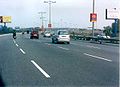
The Delhi-Gurgaon Expressway
-
The Delhi-Noida section of the Delhi-Noida-Greater Noida expressway
-

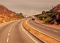
A stretch of the Ahmedabad-Vadodara expressway
-
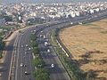
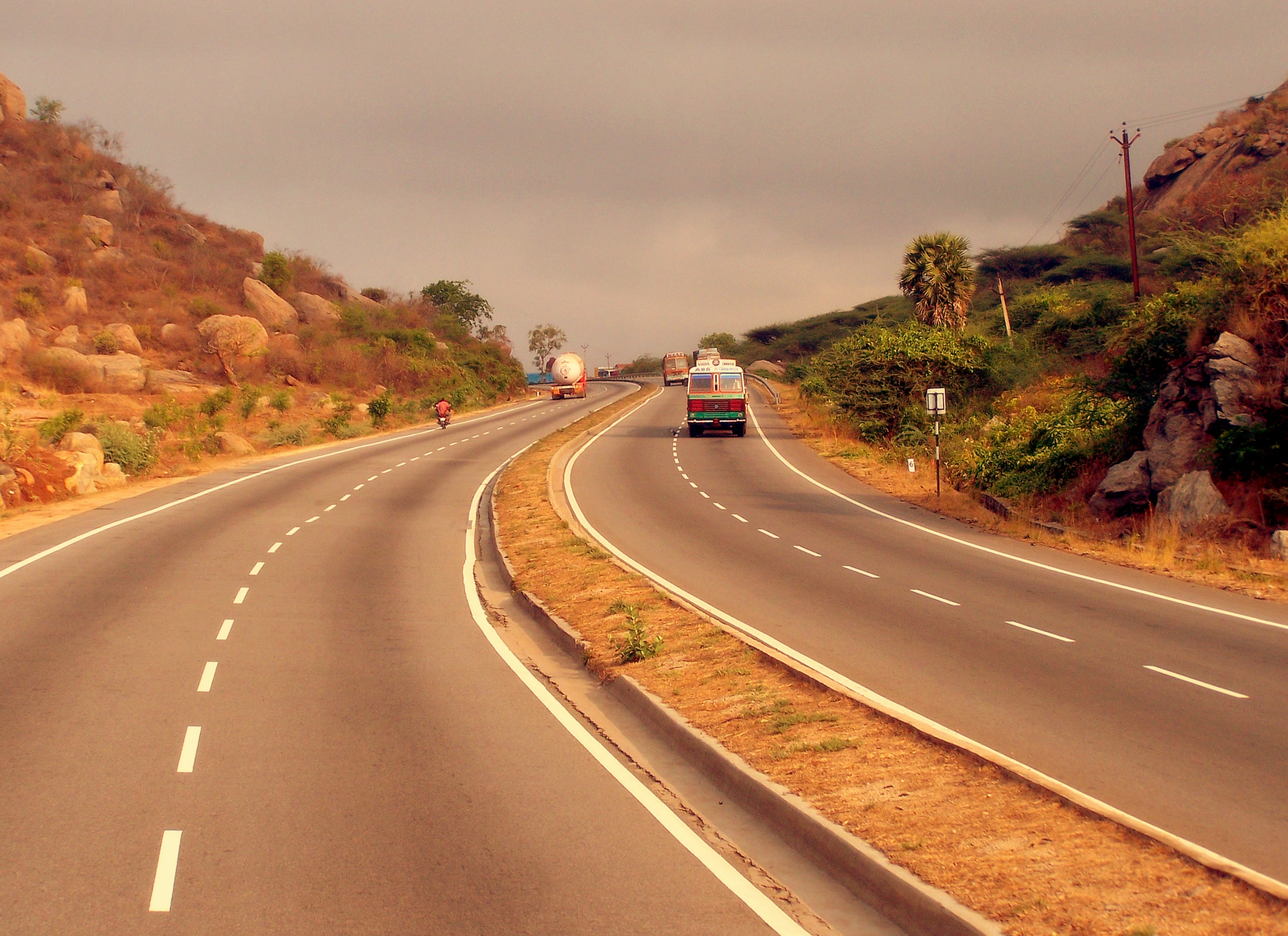
A section of the Golden Quadrilateral between Bengaluru and Chennai
-
A view of Delhi-Gurgaon stretch of National Highway - 8 (NH-8). The 8-lane expressway connects Delhi to Gurgaon and IGIA
References and notes
- ^ http://en.wikipedia.org/wiki/Controlled-access_highway
- ^ Ashutosh Kumar. "Expressway cost pegged at Rs20 crore/km". Daily News and Analysis. DNA. http://www.dnaindia.com/money/report_expressway-cost-pegged-at-rs20-crore-km_1381235.
- ^ Dipak Kumar Dash (2009-11-23). "By 2022, govt to lay 18,637km of expressways". Times of India. http://timesofindia.indiatimes.com/articleshow/5259102.cms.
- ^ "Ahmedabad-Vadodara Expressway Project". Cclindia.com. http://www.cclindia.com/expertise/ahmedabadexpressway.htm. Retrieved 2010-09-16.
- ^ Ahmedabad-Baroda expressway
- ^ "Welcome to DND Flyway". Dndflyway.com. 2009-07-22. http://www.dndflyway.com/. Retrieved 2010-07-16.
- ^ "Roads-GMR Ambala-Chandigarh Expressways Private Limited". Gmrgroup.in. http://www.gmrgroup.in/Roads/GMR_Ambala_Chandigarh_Expressways_Private_Limited.html. Retrieved 2010-07-16.
- ^ "In fast lane, NHAI inks pact to widen Chandigarh section". Financialexpress.com. 2005-11-19. http://www.financialexpress.com/news/in-fast-lane-nhai-inks-pact-to-widen-chandigarh-section/159485/. Retrieved 2010-07-16.
- ^ a b "Business Portal of India : Investment Opportunities and Incentives : State Level Investment : West Bengal : Infrastructure". Business.gov.in. http://business.gov.in/investment_incentives/infrastructure_wb.php. Retrieved 2010-07-16.
- ^ "The Telegraph - Calcutta : Metro". Telegraphindia.com. 2006-02-13. http://www.telegraphindia.com/1060213/asp/calcutta/story_5837519.asp. Retrieved 2010-07-16.
- ^ "Panipat elevated highway inaugurated". Projectsmonitor.com. http://www.projectsmonitor.com/detailnews.asp?newsid=16598. Retrieved 2010-07-16.
- ^ 4:30 AM (2009-10-20). "Longest Elevated Expressway inaugurated in Hyderabad | India Trends". Indiatrends.info. http://www.indiatrends.info/2009/10/elevated-expressway-inaugurated-in.html. Retrieved 2010-07-16.
- ^ "Hyderabad gets India's longest flyover". Ndtv.com. http://www.ndtv.com/news/india/hyderabad_gets_indias_longest_flyover.php. Retrieved 2010-07-16.
- ^ "Expressway elevates commuting". Deccanherald.com. http://www.deccanherald.com/content/48391/expressway-elevates-commuting.html. Retrieved 2010-07-16.
- ^ "Mumbai eastern freeway project gets underway". Thaindian.com. http://www.thaindian.com/newsportal/business/mumbai-eastern-freeway-project-gets-underway_10072847.html. Retrieved 2010-07-16.
- ^ "Eastern Freeway is the way to go, says MMRDA". dnaindia.com. 2009-07-10. http://www.dnaindia.com/mumbai/report_eastern-freeway-is-the-way-to-go-says-mmrda_1272687. Retrieved 2010-07-16.
- ^ "MMRDA - Projects - Mumbai Urban Infrastructure Project". 202.54.119.40. http://202.54.119.40/projects_muip.htm. Retrieved 2010-07-16.
- ^ "Mum-Nashik Expressway gets boost from MSRDC | Nashik ::::: A Complete Guide and Update on Nashik". Nashikcity.in. 2009-01-29. http://www.nashikcity.in/2009/mum-nashik-expressway-gets-boost-from-msrdc/. Retrieved 2010-07-16.
- ^ "Projects - Mumbai Nasik Expressway Limited (MNEL)". Gammoninfra.com. http://www.gammoninfra.com/mnel.html. Retrieved 2010-07-16.
- ^ http://www.moneycontrol.com/news/business/mumbai-nashik-proj-is-key-toll-revenue-maker-gammon-infra_566378.html
- ^ http://www.nashikcity.in/2010/the-mumbai-nasik-expressway-is-expected-to-be-commissioned-before-march-2011/
- ^ "http://worldsikhnews.com Pathankot Jalandhar Ajmer Expressway project info". Worldsikhnews.com. 2007-12-08. http://worldsikhnews.com/17%20February%202010/Three%20years%20later%20Akali%20govt%20sits%20on%20pile%20of%20tall%20claims%20little%20progress.htm. Retrieved 2010-09-16.
- ^ Hidustan Times article - dated September 05' 2007
- ^ "20 cos bid for longest expressway in India". Livemint.com. 2007-12-06. http://www.livemint.com/2007/12/06225739/20-cos-bid-for-longest-express.html. Retrieved 2010-09-16.
- ^ [1][dead link]
- ^ "Yamuna Expressway Industrial Development Authority [Govt. of U.P. Undertaking]". Yamunaexpresswayauthority.com. http://www.yamunaexpresswayauthority.com/. Retrieved 2010-07-16.
- ^ "7 bids for Upper Ganga Canal Expressway". Financialexpress.com. 2010-03-11. http://www.financialexpress.com/news/7-bids-for-upper-ganga-canal-expressway/589281/. Retrieved 2010-07-16.
- ^ "No state consent, NHAI goes ahead with four-laning of highway section". Indian Tollways. 2009-12-03. http://www.indiantollways.com/2009/12/03/no-state-consent-nhai-goes-ahead-with-four-laning-of-highway-section/. Retrieved 2010-07-16.
- ^ DRS Krishnan (2008-03-05). "GMR Infra achieves financial closure for Karnataka project - CNBC-TV18". Moneycontrol.com. http://www.moneycontrol.com/news/business/gmr-infra-achieves-financial-closure-for-karnataka-project_484702.html. Retrieved 2010-09-16.
- ^ "Highways - Hungund-Hospet Project". Gmrgroup.in. http://www.gmrgroup.in/Highways/Hungund_Hospet_Project.html. Retrieved 2010-09-16.
- ^ "GMR Infrastructure ties up funding for Hospet highway - Money - DNA". Dnaindia.com. 2010-06-25. http://www.dnaindia.com/money/report_gmr-infrastructure-ties-up-funding-for-hospet-highway_1400872. Retrieved 2010-09-16.
Indian Highways Network National Expressways NE 1 • NE 2


State Expressways Mumbai-Pune • Delhi-Gurgaon • DND Flyway • Bengaluru-Mysore • Chennai HSCTC • Hyderabad Elevated ExpresswaysNational Highways 1 • 1A • 1B • 1C • 1D • 2 • 2A • 3 • 4 • 4A • 4B • 5 • 5A • 6 • 7 • 7A • 8 • 8A • 8B • 8C • 8D • 8E • 9 • 10 • 11 • 11A • 11B • 12 • 12A • 13 • 14 • 15 • 16 • 17 • 17A • 17B • 18 • 19 • 20 • 21 • 21A • 22 • 23 • 24 • 24A • 24B • 25 • 25A • 26 • 26A • 27 • 28 • 28A • 28B • 28C • 29 • 30 • 30A • 31 • 31A • 31B • 31C • 31D • 32 • 33 • 34 • 35 • 36 • 37 • 37A • 38 • 39 • 40 • 41 • 42 • 43 • 44 • 44A • 45 • 45A • 45B • 45C • 46 • 47 • 47A • 47B • 47C • 48 • 49 • 50 • 51 • 52 • 52A • 52B • 53 • 54 • 54A • 55 • 56 • 57 • 57A • 58 • 59 • 59A • 60 • 60A • 61 • 62 • 63 • 64 • 65 • 66 • 67 • 68 • 69 • 70 • 71 • 71A • 71B • 72 • 72A • 73 • 73A • 74 • 75 • 76 • 77 • 78 • 79 • 79A • 80 • 81 • 82 • 83 • 84 • 85 • 86 • 86A • 87 • 88 • 89 • 90 • 91 • 91A • 92 • 93 • 94 • 95 • 96 • 97 • 98 • 99 • 100 • 101 • 102 • 103 • 104 • 105 • 106 • 107 • 108 • 109 • 110 • 111 • 112 • 113 • 114 • 116 • 117 • 119 • 121 • 123 • 125 • 126 • 127 • 128 • 129 • 150 • 151 • 152 • 153 • 154 • 155 • 200 • 201 • 202 • 203 • 203A • 204 • 205 • 206 • 207 • 208 • 209 • 210 • 211 • 212 • 213 • 214 • 214A • 215 • 216 • 217 • 218 • 219 • 220 • 221 • 222 • 223 • 224 • 226 • 227 • 228 • 229 • 234 • 235State Highways Andhra Pradesh • Arunachal Pradesh • Assam • Bihar • Chhattisgarh • Goa • Gujarat • Haryana • Himachal Pradesh • Jammu and Kashmir • Jharkhand • Karnataka • Kerala • Madhya Pradesh • Maharashtra • Manipur • Meghalaya • Mizoram • Nagaland • Orissa • Punjab • Rajasthan • Sikkim • Tamil Nadu • Tripura • Uttarakhand • Uttar Pradesh • West BengalNotable Transport in India Road National Highways Authority of India · National Highways Development Project · Ministry of Road Transport and Highways · List of National Highways in India · Indian Expressways

Rail Indian Railways · High-speed rail in India · Ministry of Railways · Dedicated Freight Corridor Corporation of India · List of railway stations in India
Air Water Shipping Corporation of India · Ports in India · Ministry of Shipping · Inland Waterways Authority of India
Miscellaneous Indian licence plates · Driving licence in India · Road signs in India
Categories:- Roads in India
- Indian National Expressways
- Mumbai Pune Expressway The Mumbai-Pune Expressway is India's first six-lane, concrete, high-speed, tolled, access-controlled, 93 km (58 mi) long expressway. It connects Mumbai, the commercial capital of India, to the neighbouring educational and information technology-oriented city of Pune. With its smoothly paved concrete construction, this highway is unlike most other roads in India. This expressway offers a scenic drive between Mumbai and Pune and reduced the travel time between these two commercially important cities from 4-5 hours on the old NH4 to 2-3 hours.


Wikimedia Foundation. 2010.