- Seaside Heights, New Jersey
Infobox Settlement
official_name = Borough of Seaside Heights
nickname =
motto = Your home for family fun since 1913!
imagesize = 200px
image_caption = Seaside Heights boardwalk looking toward Funtown Pier
image_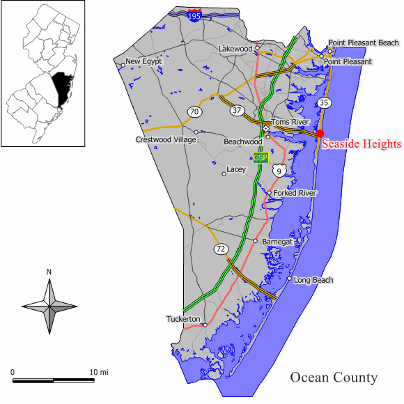
mapsize = 250x200px
map_caption = Location of Seaside Heights in Ocean County. Inset: Location of Ocean County in the State of New Jersey.
mapsize1 = 250x200px
map_caption1 = Census Bureau map of Seaside Heights, New Jersey
subdivision_type = Country
subdivision_name =United States
subdivision_type1 = State
subdivision_name1 =New Jersey
subdivision_type2 = County
subdivision_name2 = Ocean
government_type = Borough
settlement_type = Borough
leader_title =Mayor
leader_name = P. Kenneth Hershey (2011)
leader_title2 = Administrator
leader_name2 = John Camera [ [http://www.seaside-heightsnj.org/govphone.html Phone Directory] , accessedMay 10 ,2007 .]
established_title = Incorporated
established_date =February 26 ,1913
area_magnitude =
area_total_km2 = 2.0
area_total_sq_mi = 0.8
area_land_km2 = 1.6
area_land_sq_mi = 0.6
area_water_km2 = 0.4
area_water_sq_mi = 0.2
area_water_percent =
area_urban_km2 =
area_urban_sq_mi =
area_metro_km2 =
area_metro_sq_mi =
population_as_of = 2006
population_footnotes =
population_total = 3242
population_density_km2 = 1,797.6
population_density_sq_mi = 4,646.8
population_metro =
population_density_metro_km2 =
population_density_metro_sq_mi =
population_urban =
timezone = Eastern (EST)
utc_offset = -5
timezone_DST = EDT
utc_offset_DST = -4
latd = 40 |latm = 55 |lats = 25 |latNS = N
longd = 73 |longm = 59 |longs = 56 |longEW = W
elevation_m = 2
elevation_ft = 7
elevation_footnotes = [Gnis|885390|Seaside Heights,Geographic Names Information System , accessedMay 10 ,2007 .]
postal_code_type = ZIP code
postal_code = 08752
area_code = 732
website = http://www.seaside-heightsnj.org/
blank_name = FIPS code
blank_info = 34-66450GR|2 [ [http://mcdc2.missouri.edu/webrepts/commoncodes/ccc_nj.html A Cure for the Common Codes: New Jersey] , Missouri Census Data Center. AccessedJuly 14 ,2008 .]
blank1_name = GNIS feature ID
blank1_info = 0880450GR|3
footnotes = Seaside Heights is a Borough in Ocean County,New Jersey ,United States . As of theUnited States 2000 Census , the borough population was 3,155. Seaside Heights is situated on theBarnegat Peninsula , a long, narrow barrier peninsula that separatesBarnegat Bay from theAtlantic Ocean .Seaside Heights was incorporated as a borough by an Act of the
New Jersey Legislature onFebruary 26 ,1913 , from portions of both Berkeley Township and Dover Township (now Toms River Township), based on the results of a referendum held onMarch 25 ,1913 ."The Story of New Jersey's Civil Boundaries: 1606-1968", John P. Snyder, Bureau of Geology and Topography; Trenton, New Jersey; 1969. p. 205.]Seaside Heights is a resort community, with a beach, an amusement-oriented boardwalk, and numerous clubs and bars, making it a popular destination. Seaside Heights calls itself, "Your Home For Family Fun Since 1913!" [ [http://www.seaside-heightsnj.org/beachinfo.html Seaside Heights Beach Information] , accessed
April 5 ,2007 ] Peak months are July and August, but the season actually runs March-October. Summer population explodes upwards to thirty thousand persons. [ [http://www.seaside-heightsnj.org/main_about.html ABOUT SEASIDE HEIGHTS] , accessedMay 10 ,2007 . "A community of 3,100 year-round residents, Seaside Heights expands to more than 30,000 in the summer."] Route 37 in Toms River is routinely gridlocked on Friday afternoons in the summer months as vacationers pack the barrier islands.The Seaside Heights Boardwalk has been featured worldwide, most notably by
MTV in 1998 and 2002.Geography
Seaside Heights is located at coor dms|39|56|35|N|74|4|27|W|city (39.943068, -74.074193)GR|1.
According to the
United States Census Bureau , the borough has a total area of 0.8square mile s (2.0km² ), of which, 0.6 square miles (1.6 km²) of it is land and 0.2 square miles (0.4 km²) of it (19.74%) is water.Climate
Seaside Heights can be best describe as a humid subtropical climate
Demographics
USCensusPop
1930=399
1940=549
1950=862
1960=954
1970=1248
1980=1802
1990=2366
2000=3155
estimate=3242
estyear=2006
estref= [http://factfinder.census.gov/servlet/SAFFPopulation?_event=Search&geo_id=16000US3425200&_geoContext=01000US%7C04000US34%7C16000US3425200&_street=&_county=seaside+heights&_cityTown=seaside+heights&_state=04000US34&_zip=&_lang=en&_sse=on&ActiveGeoDiv=geoSelect&_useEV=&pctxt=fph&pgsl=160&_submenuId=population_0&ds_name=null&_ci_nbr=null&qr_name=null®=null%3Anull&_keyword=&_industry= Census data for Seaside Heights borough] ,United States Census Bureau . AccessedAugust 6 ,2007 .]
footnote=Population 1930 - 1990 [http://factfinder.census.gov/servlet/SAFFPopulation?_event=Search&geo_id=16000US3441370&_geoContext=01000US%7C04000US34%7C16000US3441370&_street=&_county=margate+city&_cityTown=margate+city&_state=04000US34&_zip=&_lang=en&_sse=on&ActiveGeoDiv=geoSelect&_useEV=&pctxt=fph&pgsl=160&_submenuId=population_0&ds_name=null&_ci_nbr=null&qr_name=null®=null%3Anull&_keyword=&_industry= New Jersey Resident Population by Municipality: 1930 - 1990] , Workforce New Jersey Public Information Network. AccessedMarch 1 ,2007 .] As of thecensus GR|2 of 2000, there were 3,155 people, 1,408 households, and 691 families residing in the borough. Thepopulation density was 5,162.2 people per square mile (1,997.0/km²). There were 2,840 housing units at an average density of 4,646.8/sq mi (1,797.6/km²). The racial makeup of the borough was 89.95% White, 4.03% African American, 0.63% Native American, 0.86% Asian, 1.17% from other races, and 3.36% from two or more races. Hispanic or Latino of any race were 9.70% of the population.There were 1,408 households out of which 25.6% had children under the age of 18 living with them, 26.8% were married couples living together, 16.3% had a female householder with no husband present, and 50.9% were non-families. 40.1% of all households were made up of individuals and 9.0% had someone living alone who was 65 years of age or older. The average household size was 2.17 and the average family size was 2.93.
In the borough the population was spread out with 23.3% under the age of 18, 10.9% from 18 to 24, 35.4% from 25 to 44, 19.3% from 45 to 64, and 11.0% who were 65 years of age or older. The median age was 33 years. For every 100 females there were 106.5 males. For every 100 females age 18 and over, there were 102.8 males.
The median income for a household in the borough was $25,963, and the median income for a family was $27,197. Males had a median income of $30,354 versus $21,899 for females. The
per capita income for the borough was $18,665. About 21.9% of families and 24.1% of the population were below thepoverty line , including 37.9% of those under age 18 and 12.3% of those age 65 or over.Government
Local government
Seaside Heights is governed under the Borough form of New Jersey municipal government. The government consists of a Mayor and a Borough Council comprising six council members, with all positions elected at large. A Mayor is elected directly by the voters to a four-year term of office. The Borough Council consists of six members elected to serve three-year terms on a staggered basis, with two seats coming up for election each year."2005 New Jersey Legislative District Data Book",
Rutgers University Edward J. Bloustein School of Planning and Public Policy , April 2005, p. 53.]The
Mayor of Seaside Heights is P. Kenneth Hershey (R, term endsDecember 31 ,2011 ). Borough Council members are William Akers (R, 2009), Joyce Camera (R, 2009), Joann Duszczak (R, 2008), Arline Ottoson (R, 2010), Agnes Polhemus (R, 2008) and Richard Tompkins (R, 2010). As of January 2006, Seaside Heights had an historic, first-time four-woman majority on its governing body. [ [http://www.seaside-heightsnj.org/main_government.html Seaside Heights Borough Government] , Seaside Heights Borough. AccessedApril 22 ,2008 .] [ [http://www.oceancountyclerk.com/elelectedofficials2008.pdf#page=10 2008 Elected Officials of Ocean County] ,Ocean County, New Jersey . p. 10. AccessedApril 22 ,2008 .]Mayor Hershey has been in politics in Seaside Heights uninterrupted for over 35 years. He has been Mayor since 1992. His predecessor George Tompkins (father of current councilman Rich Tompkins) served 16 years from 1985-1991, and Mayor J. Stanley Tunney served for 25 years from 1939-1964.
Councilwoman Agnes Polhemus served from 1972-1993, and returned in 2006.
Seaside Heights Borough Attorney George R. Gilmore, Esq. is grandson of the late Seaside Heights Mayor J. Stanley Tunney and is the Ocean County Republican Chairman.
Federal, state and county representation
Seaside Heights is in the Third Congressional District and is part of New Jersey's 10th Legislative District. [ [http://www.lwvnj.org/pubs/CG06.pdf 2006 New Jersey Citizen's Guide to Government] , New Jersey
League of Women Voters , p. 64. AccessedAugust 30 ,2006 .]Education
The
Seaside Heights School District is a publicschool district for students in Kindergarten through sixth grade. Hugh J. Boyd, Jr. Elementary School served 245 students as of the 2005-06 school year. [ [http://nces.ed.gov/ccd/schoolsearch/school_list.asp?Search=1&DistrictID=3414790 Data for the Seaside Heights Public School] ,National Center for Education Statistics . AccessedApril 22 ,2008 .] The school was built in 1967, and is dedicated to Hugh J. Boyd Jr., its late, longtime Superintendent of Schools and legend of Seaside Heights Beach Patrol. Its addition built in 2005 is dedicated in the name of a late, longtime Board of Education Member Harry M. Smith III. The Board of Education is made up of five members, each elected to three-year terms. The Principal of Hugh J. Boyd Elementary School is Mrs. Jane Strada.The
Toms River Regional Schools provides administrative, maintenance, food and other services to The Seaside Heights Board of Education, and has done so since 2003. Superintendent of Schools is Michael J. Ritacco, who is also the Superintendent of the Toms River Regional School District. The Seaside Heights / Toms River relationship is a first in the State of New Jersey.Public school students in grades 7 through 12 attend the schools of the
Central Regional School District , which also serves students from the municipalities of Berkeley Township, Island Heights, Ocean Gate and Seaside Park. [ [http://education.state.nj.us/rc/rc07/narrative/29/0770/29-0770-000.html Central Regional School District 2007 School Report Card Narrative] ,New Jersey Department of Education . AccessedApril 22 ,2008 . "The Central Regional School District is located in the Bayville section of Berkeley Township and draws from the constituent districts of Berkeley Township, Island Heights, Ocean Gate, Seaside Heights, and Seaside Park."] The total student population in the district is approximately 2,400, instructed by 200 staff members. The schools in the district are [http://www.centralreg.k12.nj.us/middleschool/MiddleSchool.htm Central Regional Middle School] for grades 7 and 8 (833 students), andCentral Regional High School for grades 9 - 12 (1,494 students).Transportation
Route 35 and Route 37 both pass through Seaside Heights, intersecting at the approach to the
Thomas A. Mathis and J. Stanley Tunney Bridges .New Jersey Transit provides seasonal bus service in Seaside Heights on the 137 route to thePort Authority Bus Terminal inMidtown Manhattan and to Newark on the 67 line. [ [http://www.njtransit.com/sf_tp_rc_ocean.shtml Ocean County Bus/Rail Connection] ,New Jersey Transit . AccessedAugust 6 ,2007 .]Points of interest
Casino Pier and [http://www.funtownpier.com/ Funtown Pier] areamusement park s, each situated on apier extending approximately 300 feet (100 m) into theAtlantic Ocean . [http://www.casinopiernj.com/breakwaterbeach/ Breakwater Beach] , formerly known as Water Works, is awater park situated across the street fromCasino Pier . The boardwalk itself offers many family-friendly attractions from arcades, to beaches, to the wide variety of foods and desserts, all within walking distance. Seaside Heights hosted the AVP volleyball tournament for 2 years during the Summers of 2006 and 2007.Popular culture
Portions of the 2006 movie "
Artie Lange's Beer League " were filmed in Seaside Heights. [ [http://www.imdb.com/title/tt0453453/locations Filming locations for Beer League] ,Internet Movie Database . AccessedAugust 6 ,2007 .]MTV 's "True Life: I Have A Summer Share" was filmed in Seaside Heights.Fact|date=May 2008References
External links
* [http://www.seasideheights.org/ Seaside Heights Memorabilia Website]
* [http://www.seaside-heightsnj.org/ Seaside Heights website]
* [http://www.ssheights.k12.nj.us/ Seaside Heights Public School]
*NJReportCard|29|4710|050|Hugh J. Boyd, Jr. Elementary School
* [http://nces.ed.gov/ccd/schoolsearch/school_list.asp?Search=1&DistrictID=3414790 Data for the Seaside Heights Public School] ,National Center for Education Statistics
* [http://www.centralreg.k12.nj.us/ Central Regional School District]
* [http://www.shfd44.com Seaside Heights Volunteer Fire Department Station 44]
* [http://www.popartpete.com local pictures and photos, updated weekly]
Wikimedia Foundation. 2010.