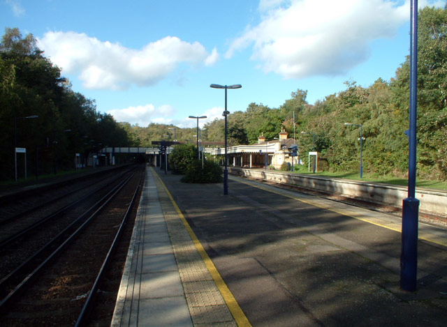
Elmstead Woods railway station
- Elmstead Woods railway station
Infobox London station
name = Elmstead Woods
zone = 4
manager = Southeastern
locale = Elmstead
borough = Bromley
start = 1 July 1904
platforms = 4
railexits0405 = 0.891
railexits0506 = 0.890
railexits0607 = 1.118
railcode = ESD
Elmstead Woods railway station is in Elmstead in the London Borough of Bromley in south east London. It is in Travelcard Zone 4, and the station and all trains are operated by Southeastern.
Services
The typical off-peak service is
*2tph (two trains per hour) to Orpington, 1 of which continues to Sevenoaks
*2tph to London Charing Cross, running fast from Hither Green to London Bridge.
External links
Wikimedia Foundation.
2010.
Look at other dictionaries:
Grove Park railway station — Infobox London station name = Grove Park zone = 4 |A view of Grove Park, taken on the 18th April 2008, on the right of the picture can be seen the shuttle service to Bromley North, formed of 466002. manager = Southeastern locale = Grove Park and… … Wikipedia
Hither Green railway station — Infobox London station name = Hither Green zone = 3 manager = Southeastern locale = Hither Green borough = Lewisham railcode = HGR platforms = 6 railexits0405 = 1.991 railexits0506 = 2.030 railexits0607 = 2.753 start = 1 June 1895Hither Green is… … Wikipedia
Elmstead — infobox UK place country = England map type = Greater London region= London population= official name= Elmstead latitude= 51.4155 longitude= 0.0501 os grid reference= TQ425705 london borough= Bromley post town= CHISLEHURST postcode area= BR… … Wikipedia
Chislehurst railway station — Chislehurst … Wikipedia
Lewisham station — Infobox London station name = Lewisham manager = Southeastern manager1 = Docklands Light Railway zone = 2 and 3 locale = Lewisham borough = Lewisham years = 30 July 1849 events = Opened years1 = 1 January 1857 events1 = Renamed (Lewisham… … Wikipedia
Mottingham — Coordinates: 51°26′01″N 0°02′11″E / 51.4337°N 0.0365°E / 51.4337; 0.0365 … Wikipedia
Chislehurst — Coordinates: 51°24′54″N 0°04′44″E / 51.4150°N 0.0789°E / 51.4150; 0.0789 … Wikipedia
Chinbrook — Coordinates: 51°25′54″N 0°01′53″E / 51.4316°N 0.0314°E / 51.4316; 0.0314 … Wikipedia
South Eastern Main Line — London–Dover Elektrotriebzüge von Southeastern im Bahnhof London Bridge Spurweite: 1435 mm (Normalspur) Stromsystem … Deutsch Wikipedia
Bickley — infobox UK place country = England map type = Greater London region= London population= official name= Bickley latitude= 51.4003 longitude= 0.0466 population = 13,904 (ward, 2001 census) [Bromley.org… … Wikipedia