- Puerto Rico Highway 22
Infobox road
marker_
state=
highway_name=
name_notes=
type=
route=PRI-2
alternate_name=PR-22, PRI-2Jose De Diego Expressway
maint=Puerto Rico Dept. of Transportation and Public Works (DTOP)
section=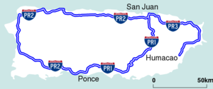
length_mi=51
length_round=
length_ref=
length_notes=
established=1999
decommissioned=
direction_a=east
terminus_a=
beltway_city=
junction=
direction_b=west
terminus_b=
counties=
rural_municipalities=
cities=Arecibo ,Bayamon ,Guaynabo , San Juan
system=Puerto Rico Highway System
spur_type=
spur_of=
previous_type=
previous_route=
next_type=
next_route=
browse=
commons=
customcommons=PR-22 ( also part of unsigned Interstate PR2 ) is a 51-mileFact|date=February 2008 (83-km) long
toll road in the north coast ofPuerto Rico that connects the cities of San Juan andArecibo . The road is also known as the "Jose de Diego Expressway" (Spanish: "Expreso De Diego"), and is part of unsigned Interstate PR-2. It is a 4-lane road for much of its length, but expands to up to 12 lanes in the San Juan metro area. The road is frequently congested, in particular during rush hour, thanks to heavy commuter traffic.The road is part of theU.S. Interstate Highway System . [U.S. Dept. of Transportation, Federal Highway Administration. [http://www.fhwa.dot.gov/reports/routefinder/index.cfm FHWA Route Log and Finder List.] Additional Designations. Retrieved on February 20, 2008.] PR-22 is maintained by a system of tolls managed by the Puerto Rico Department of Transportation and Public Works [http://www.dtop.gov.pr/] . All of its toll plazas have express lanes. There are eastbound tolls in Hatillo,Vega Alta andGuaynabo . Westbound tolls are found inToa Baja andManati . TheArecibo toll plaza collects tolls in both directions. All toll plazas have restroom facilities; the Vega Alta toll plaza also has an ATM.Route description
PR-22 runs parallel to PR-2. Unlike PR-22, PR-2 is not a
controlled-access road, and has numerous traffic signals throughout the full run of its course. The construction of highway PR-22 reduced congestion on PR-2. The eastern terminus is at PR-26 (a non-tolled freeway) in Santurce, and passes through the Minillas Tunnel before its terminus at PR-26. The freeway bypasses all of the cities PR-2 passes through (see below under "Course of the Expressway"). PR-22's western terminus is at PR-2 in Hatillo. From there, PR-2 continues toAguadilla andMayaguez , ending in Ponce.Future
PR-22 is planned to be extended to AguadillaFact|date=February 2008, but plans to turn PR-2 to a
freeway Fact|date=February 2008 are also considered to prevent damage to the dairy industryFact|date=February 2008, one of the major industries in the areaFact|date=February 2008.Exit list
Exit list
Course of the Expressway
The following is the list of municipalities/towns which PR-22 cuts through, in order from San Juan to Hatillo (westbound):
Cataño Guaynabo Bayamón Toa Baja Vega Alta Vega Baja Manatí Arecibo ee also
*
Puerto Rico Highway 2 Other Links
*
Puerto Rico Highway 1
*Puerto Rico Highway 10
*Puerto Rico Highway 52
*Interstate Highway System References
Links to the U. S. Eisenhower Interstate Highway System

Wikimedia Foundation. 2010.