- Mwenezi District
-
Mwenezi — District — Mwenezi River bisects the district in two on its way to join the Limpopo River in Mozambique south.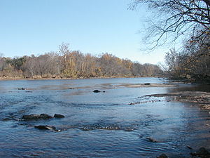

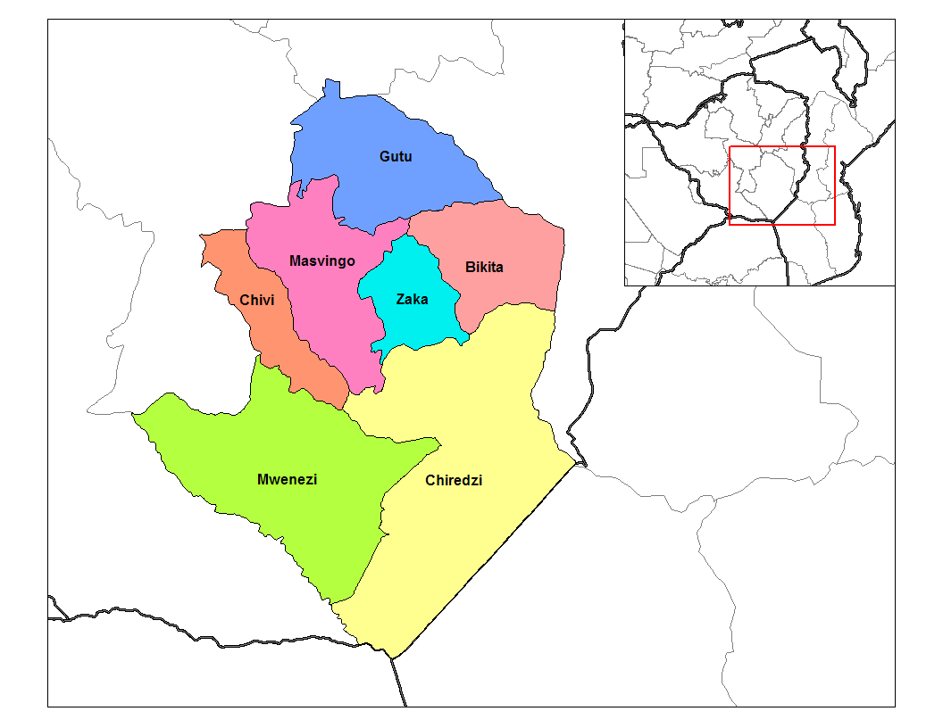
SealDistricts of Masvingo Province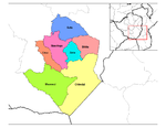 Masvingo Province constituency seats for the 2008 elections, showing the division of Mwenezi (District)
Country Zimbabwe Province Masvingo District Mwenezi Established late 19th Century Government – House of Assembly, MP Kudakwashe Bhasikiti, (East) – House of Assembly, MP Pilot Masukume (West) Population – Total 133,108 Estimate (UN) Time zone CET (UTC+1) – Summer (DST) CEST (UTC+1) Mwenezi is a small district situated in southern Zimbabwe. Mwenzi is bisected by the Mwenezi River and the A4 highway, the main road that connects the town of Beitbridge, on the border with South Africa, to Masvingo.
Contents
Background
Mwenezi District derives it name from the mighty Mwenezi River which provides irrigation water to the sugarcane plantations in and around Rutenga Business Center.[1] Although the police station is located along the highway, the main administrative offices are located at Neshuro Business Center. In 2002, the population of the drought prone district was estimated at 126,000, up by 25,000 from 1992, the year of the drought.[2] The weather is hot and dry throughout the year, except during the summer when the rains come.
Mwenezi district lies in natural regions four and five. The district is prone to droughts and experiences Low Mean Annual rainfall patterns. The majority of households in Mwenezi District depend on agricultural production. This includes livestock rearing. The low rainfall pattern has created a desire to shift more towards livestock farming especially cattle and goats, although the majority of households indicate that they have not been able to restock after the severe drought of 1992.
Education
Like in other rural parts of the country, all the schools in the district are government run although some have historical links with missionary Christian Churches. There is one boarding school, namely Lundi Secondary School (Free Methodist Church). The fact that all the secondary schools (other than Lundi Secondary School) were established after independence is testimony to the marginalisation of the distirct and the 'catch up' it has to do. Though Zimbabwe has one of the highest literacy rates in the world, in some Mwenezi communities such as Maranda, a former designated Native Reserve before independence in 1980, the rate could be as low as 50%.[citation needed]
Secondary and primary schools
Some of the notable schools in the districts include Lundi Secondary School situated along the Masvingo- Beitbridge Road, Mabhare Secondary School north of the Mwenezi River but close to Manyuchi Dam, Dengenya Primary School between Mwenezi and Mushawe River, Maranda High and Mwenezi Govt. School, Guiding Star Secondary School. However, not all villages in the district are serviced with secondary schools. Some students, especially those villages along the Mwenezi River below the main wall of the Manyuchi Dam, they still have to walk long distances to school, on average fifteen to twenty kilometers. This state of affairs discourages students from going to school, instead they all opt to cross the border and go to South Africa.
Economy
The main employer in the district is sugar cane plantations in Rutenga. The cattle rachers, before the invasions of commercial farms in 2000, used to employ a considerable number of people. Just like in most rural districts in the country, many people are employed in the civil service.
The people in the district had always trekked to the mines of South Africa. However, the number of those people has increased in recent due to the economic recession that the country has been going through. Very few young man and women remain the village across the districts, preferring to take their chances in South Africa working from one menial contract job to another. The fact that the Beitbridge and the border with South Africa makes their trek easier.
In the past, the district generated some revenue from tourism, with large numbers of tourists visiting the private game parks in the district and the nearby Manyuchi Dam.
Business centers
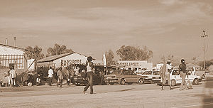
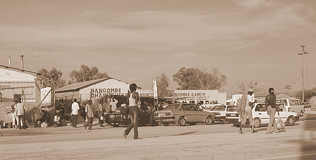
The district has many service centres and business centres of varying sizes and economic vibrancy. Among these, Neshuro, Sarahuru, Sengejira, Maranda and Chaoma are of noteworthy. The witdrawal of government funded grain collection/distribution facilities as part of neoliberla reforms in the 1990s and the recent economic woes of the country (1998–2008) led to the decline of these business centers. However, some like Neshuro have continued to grow, with water and poor roads the major bottlenecks to investment.
Government and politics
Like other districts in Masvingo Province, ZANU-PF dominates in the politics of the district. Ever since independence, the constituency has been represented by a ZANU-PF party member in the parliament of Zimbabwe. Isaiah Shumba was the member of parliament for Mwenezi (District), who won both the 2000 and 2005 elections on a ZANU-PF ticket.
General elections 2008
The district now sends two members to Zimbabwe's new House of Assembly. Each of the wards in the district has an elected official who works at the rural district council. The district has been a stronghold of ZANU-PF since independence in 1980. That trend didn't change in the elections of 2008.[3][4]
The district was divided into to parts, namely Mwenezi West and Mwenezi East, for the general elections of 2008. Candidates from both the MDC and ZANU-PF competed for the two constituency seats. The winners will represent the district in the House of Assembly in the parliament of Zimbabwe. Mwenezi (District), together with Chivi (District), will elect a member to the new Zimbabwe Senate.[5]
Political violence
Ever since 2000, there has been sporadic reports of violence in the district, mostly perpetrated by ZANU-PF supporters and war veterans on their perceived enemies. Isiah Shumba,the former MP for Mwenezi constituency, was arrested with twelve other ZANU-PF supporters for political violence and intimidation in the run up to the harmonized elections of 2008. He took a violent avenue after he had lost in the ZANU-Pf primary elections, a fact he didn't like.[6] He had run for the Mwenezi East seat and had lost to Kudakwashe Bhasikiti (2793 votes) and Cletos Muchara with 214 votes. Isiah Shumba was a distant third, with 48 votes.[7][8]
Mwenezi East
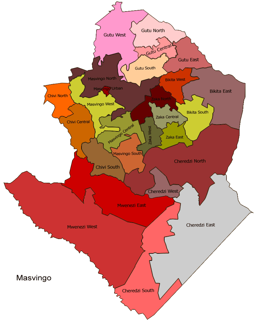
There are a total of eight wards in this part of the district: 2, 3, 4, 5, 6, 7, 13, and 18. This part of the district includes the large chunk of land that is north of the Mwenezi River. Bhasikiti Kudakwashe (Zanu-PF), Murambwi Ananias (MDC Tsvangirai), and Chidyamakono Tavengwa (Independent) ran for the Mewnezi East House of Assembly seat. Bhasikiti won with 9696 to 2477 of Murambwi.
Mwenezi West

There are nine wards in the district, namely 10, 11, 12, 14, 15, 16, and 17. Mwenezi West comprises the area that is south of the Mwenezi River, including Manyuchi Dam. Masukume Pilot (Zanu-PF) and Tedious Douglas (MDC Tsvangirai) battled it out for the Mwenezi west constituency.[9] Pilot won the contest with a landslide of 12636 to Tedeous's 1577.
Health care
Public health care is delivered at four levels which are meant to function as a referral chain: Entry level : Rural Health Centers, Rural Hospitals and Urban Clinics (services do not require an attending Physician); First Referral Level : District Hospitals; Second Referral Level : Provincial and General Hospitals, and Third Referral Level : Central and Special Hospitals.
Most of the health care facilities in the district are owned and run by the government's Ministry of Health & Child Welfare although local communities are involved in the management of some clinis. The main referral hospital is Mwenezi District Hosptial (at Neshuro). Previously Neshuro clinic, it was upgraded by the Chinese to a Rural Hospital in the late 1980s. The Catholic run Matibi Mission hospital to the north west (bordesr with Mberengwa District) also acts as another referral hospital. There are several poly-clinics scattered across the district that offer primary health care to people from the villages in the district. In recent years as the economy of Zimbabwe has declined, there has been a shortage of drugs and equipment at all the hospitals although staffing levels by end of 2010 had improved. Communities also rely heavily on traditional medicines.
The major diseases that affect the people in the district include TB and Malaria. Owing to the low rates of literacy, especially in Mwenezi West, TB remains a threat to the district as affected usually don't finish the treatment regime course.
HIV/AIDS
The remoteness of the district from over areas has spared it from the scourge of HIV/AIDS. However, cases of the malady have been reported to be on the increase in recent years as the highly mobile youth that venture to South Africa in search of jobs gets exposed to the virus.
Infrastructure development
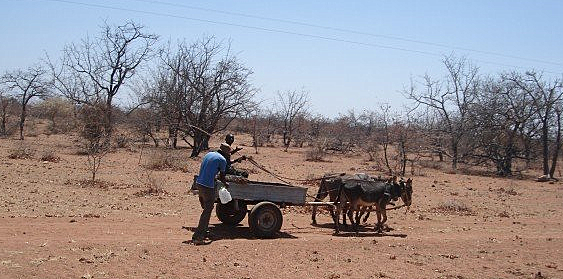
 The sight of a donkey cart along the gravel roads that service the district. Most people use donkey carts for transport
Road network
The district is serviced by a network of roads, mostly gravel roads. Apart from the shoulder-less A1 highway, all other roads in the district are of macadamized gravel roads. During the rain season, despite the best efforts of DDF, they get washed away. Most of the places are accessible only by four-wheel-drive enabled vehicles. Some of the vital bridges, destroyed during Cyclone Eline, have yet to be repaired.[10] Phone lines connect most of the business centers with the outside world. On the whole, the basic mode of transport is by donkey cart.
General
The area south of the Mwenezi River beyond the Maranda communal lands is dominated by some of the largest ranches found in the country. Nuanesti Ranch, reputed to be the largest freestanding ranch in the whole province if now the whole country, is found in the district along the A1 highway between Masvingo and Beitbridge.[11][12][13] These ranches provide some of the basic infrastructure, from schools, clinics to roads and dip-tanks.
Since the farm invasions of early 2000, peasant farmers from the communal lands of both Matibi, north of the Mwenezi River, and those from Maranda communal lands south of the river, invaded some of the arid ranches found in the district, changing the map of land use in the district.
Personalities
Paul Matavire the popular singer who sang under Paul Matavire and the Jairos Jiri Band, many great songs before his untimely death. Matavire was a social worker who was left blind by glaucoma as a child.
See also
References
- ^ Mwenezi (District) Map
- ^ Administrative Units of Zimbabwe
- ^ Independent Election Results site [1] (accessed 04/01/2008)
- ^ Sokwanele site
- ^ Constituency Boundaries [2](accessed 02/12/2008)
- ^ A ban on political rallies [3](accessed 02/18/2008)
- ^ Nonimation Court sitting extended [4](accessed 02/18/2008)
- ^ Mwenezi MP arrested [5](accessed 02/19/2008)
- ^ List of 2008 candidates [6](accessed 02/18/2008)
- ^ AAA 2007 Road Report [7](accessed 02/28/2008)
- ^ Nuanetsi Ranch [8](accessed 02/28/2008)
- ^ Politicians Clash [9](accessed 02/28/2008)
- ^ Satellite picture [10](accessed 2008-02-28)
Business Centers Place & Names Masvingo Province Business Centres Towns & Cities Districts Noteworthy Places Subdivisions of Zimbabwe Provinces Districts Beitbridge · Bikita · Bindura · Binga · Bubi · Buhera · Bulawayo · Bulilimamangwe · Chegutu · Chikomba · Chimanimani · Chipinge · Chiredzi · Chirumhanzu · Chivi · Gokwe North · Gokwe South · Goromonzi · Guruve · Gutu · Gwanda · Gweru · Harare · Hurungwe · Hwange · Hwedza · Insiza · Kadoma · Kariba · Kwekwe · Lupane · Makonde · Makoni · Marondera · Masvingo · Matobo · Mazowe · Mberengwa · Mount Darwin · Mudzi · Mukumbura · Murehwa · Mutare · Mutasa · Mutoko · Muzarabani · Mwenezi · Nkayi · Nyanga · Rushinga · Seke · Shamva · Shurugwi · Tsholotsho · Umguza · Umzingwane · Uzumba-Maramba-Pfungwe · Wedza · Zaka · Zvimba · ZvishavaneWards Largest cities Categories:- Mwenezi (District)
- Districts of Masvingo Province

Wikimedia Foundation. 2010.