- Lake Chapala
-
Lake Chapala 
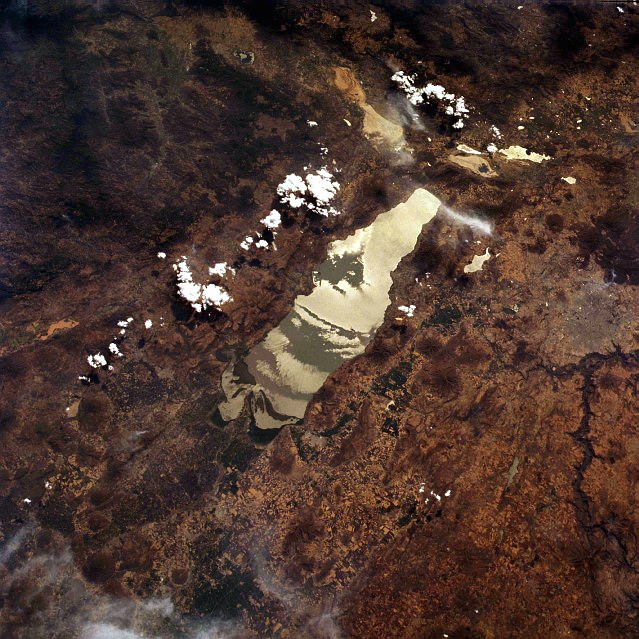
Location Jalisco / Michoacán, Mexico Coordinates 20°15′N 103°00′W / 20.25°N 103°WCoordinates: 20°15′N 103°00′W / 20.25°N 103°W Primary inflows Río Lerma, Río Zula, Río Huaracha, Río Duero Primary outflows Río Santiago Basin countries Mexico Max. length 80 km Max. width 18 km Surface area 1,100 km² Average depth 4.5 m Max. depth 10.5 m Water volume 8.1 km3 (1.9 cu mi) Surface elevation 1,524 m Islands 3  Lake Chapala from Space, 1994
Lake Chapala (Spanish: Lago de Chapala) is Mexico's largest freshwater lake.[1] It lies in the municipalities of Chapala, Jocotepec , Poncitlán, and Jamay, in Jalisco, and in Venustiano Carranza and Cojumatlán de Régules, in Michoacán.
Contents
Geography
Geographic Features
It is located at 20°20′N 103°00′W / 20.333°N 103°W, 45 km southeast of Guadalajara, Jalisco, and is situated on the border between the states of Jalisco and Michoacán, at 1,524 metres(5000 feet) above sea level. Its approximate dimensions are 80 km (50 mi) from east to west and averages 12.5 km(7.8 miles) from north to south, and covers an approximate area of 1,100 km2 (420 sq mi).[2]
It is a shallow lake, with a mean depth of 4.5 metres(14.9 feet) and a maximum of 10.5.(34 feet)
It is fed by the Río Lerma, Río Zula, Río Huaracha, and Río Duero rivers, and drained by the Rio Grande de Santiago. The water then flows northwest into the Pacific Ocean.
Islands
The lake also contains two small islands, Isla de los Alacranes (the largest of the two), Isla Mezcala and a third very small island next to Isla Mezcala called La Isla Menor.
Ecology
The city Guadalajara, Jalisco, has relied on Lake Chapala as a principal source of water since the 1950s.[3] Shortly after, a few consecutive years of poor rainfall dramatically decreased the water level of the Lake. The level rebounded until 1979, when Lake Chapala's water level rapidly began decreasing due to increases in urban water consumption.
Erosion due to deforestation along the Lake as well as the Lerma River has led to increased sedimentation of the Lake, also contributing to loss of lake depth. The shrinking depth has also raised the Lake's average temperature, resulting in increased evaporation.
Simultaneously, the waters of Lake Chapala are polluted by municipal, industrial and agricultural wastes, coming primarily from the Lerma River. The increased presence of nutrients from the pollution combined with the warmer water has been a boon to an invasive species of Water Hyacinth. The water hyacinth further exacerbates the problem of a shrinking lake depth through its own consumption of the water.
The increase in water pollution coupled with the increased presence of water hyacinth has had devastating effects on the ecology of the lake. Fish stock has decreased dramatically and some endemic species (e.g. a fish colloquially known as 'white fish') are on the verge of extinction. Contaminated fish stock has also posed a serious threat to the health and livelihoods of people who depend on the fish for food and their livelihoods.[4]
The drop in the Lake's water level has uncovered political issues that had been hidden for many years. Its fast decay has raised concern in the surrounding areas and in the scientific community. It was the Global Nature Fund's "Threatened Lake of the Year" in 2004.[5]
By 2007 and 2008, the level of Lake Chapala increased drastically, though the levels have yet to surpass the level in 1979, when the levels began a precipitous decline.[6] Although it is still subject to agricultural, domestic, and industrial sources of contamination, the actual levels of hazardous materials has not been officially assessed with regularity.
In 2010 water level has remained high and quality has improved due to water treatment plants along the Lerma river, water has been approved since 2008 for human use.[citation needed]
Habitat
The lake is also a critical habitat for several species of migratory birds, such as the American White Pelican, and home to thousands of indigenous plants and animals.The Audubonistas de Laguna de Chapala holds an annual Audubon Society sponsored Christmas Bird Count. In 2006, some 117 species were identified and, in 2007, the count was 125.[7]
Communities
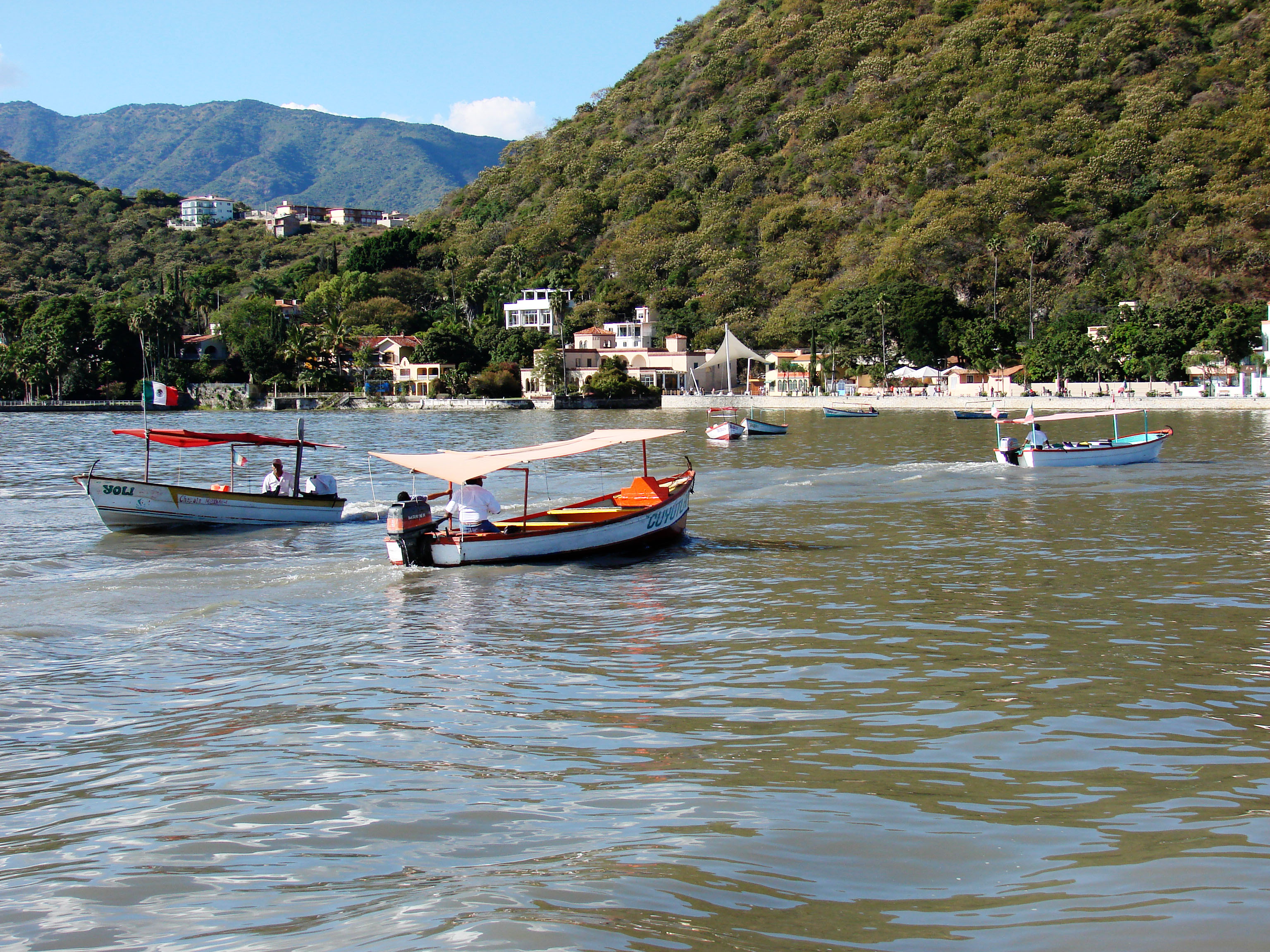
There are numerous towns and cities along the coast of Lake Chapala, including Chapala, Jalisco, San Juan Cosala, Jalisco , Mezcala de la Asunción, Jalisco, Tizapan El Alto and Ocotlán, Jalisco.
In recent years, because of the benign prevailing climate and attractive scenery, a substantial colony of retirees, including many from the United States and Canada, has established itself on the lake's shore, particularly in the town of Ajijic, Jalisco, located just west of the city of Chapala.
References
- "Lake Chapala, Mexico". NASA Earth Observatory. http://earthobservatory.nasa.gov/Newsroom/NewImages/images.php3?img_id=16652. Retrieved 2006-05-23.
- "Lake Chapala water level". CEA Jalisco. http://www.ceajalisco.gob.mx/chapala.html.
- ^ von Bertrab, Etienne (October 2003). "Guadalajara's water crisis and the fate of Lake Chapala: a reflection of poor water management in Mexico". Environment and Urbanization 15 (2): 127. http://eau.sagepub.com/content/15/2/127. Retrieved 16 April 2011.
- ^ von Bertrab, Etienne (October 2003). "Guadalajara's water crisis and the fate of Lake Chapala: a reflection of poor water management in Mexico". Environment and Urbanization 15 (2): 130. http://eau.sagepub.com/content/15/2/127. Retrieved 16 April 2011.
- ^ von Bertrab, Etienne (October 2003). "Guadalajara's water crisis and the fate of Lake Chapala: a reflection of poor water management in Mexico". Environment and Urbanization 15 (2): 130. http://eau.sagepub.com/content/15/2/131. Retrieved 16 April 2011.
- ^ von Bertrab, Etienne (October 2003). "Guadalajara's water crisis and the fate of Lake Chapala: a reflection of poor water management in Mexico". Environment and Urbanization 15 (2): 131–133. http://eau.sagepub.com/content/15/2/131. Retrieved 16 April 2011.
- ^ "Threatened Lake of the Year 2004: Lake Chapala in Mexico". http://www.globalnature.org/21223/CAMPAIGNS/Threatened-Lake-of-the-Year-2011/Threatened-Lake-2004/02_vorlage.asp. Retrieved 16 April 2011.
- ^ "Niveles Maximos y Minimos del Lago Chapala 1900-2010". http://www.ceajalisco.gob.mx/sia/niveles/niveles.html. Retrieved 16 April 2011.
- ^ AvesAjijic.com
External links
 Media related to Lake Chapala at Wikimedia Commons
- Threatened Lake of the Year 2004: Lake Chapala
Categories:- Lakes of Mexico
- Shrunken lakes
- Geography of Jalisco
- Geography of Michoacán
Wikimedia Foundation. 2010.