- Boothville-Venice, Louisiana
-
Boothville-Venice Census-designated place Country United States State Louisiana Parish Plaquemines Elevation -3 ft (-0.9 m) Coordinates 29°19′04″N 89°23′25″W / 29.31778°N 89.39028°W Area 5.1 sq mi (13.2 km2) - land 2.6 sq mi (7 km2) - water 2.5 sq mi (6 km2), 49.02% Population 2,220 (2000) Density 863.2 / sq mi (333.3 / km2) Timezone CST (UTC-6) - summer (DST) CDT (UTC-5) Area code 504 
 Location of Boothville-Venice in Louisiana
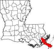
 Location of Louisiana in the United States
Boothville-Venice is a census-designated place (CDP) in Plaquemines Parish, Louisiana, United States, which includes the unincorporated communities of Boothville, Venice, and Orchid. The population was 2,220 at the 2000 census.
Boothville is the most populous and northernmost of these communities. all located along Louisiana Highway 23 on the West Bank of the Mississippi River. Boothville is home to the Boothville Heliport, important in helicopter transport for offshore oil rigs in the Gulf of Mexico. Venice, Louisiana is the town farthest south along Highway 23 within the protection levee. Neighboring Orchid (sometimes considered part of Venice) is outside of the protection levee; it has a boat marina and buildings raised on stilts. The Boothville-Venice area also includes the community of Tidewater, to the west of Orchid on a secondary road; port and petroleum facilities dominate Tidewater, which also has a weather station.
Contents
History
Hurricane Katrina
Boothville is very near to where Hurricane Katrina made landfall on August 29, 2005. According to the Baton Rouge Advocate, very little was left standing in either Boothville or Venice, the few buildings that survived had water up to the rooftops ([1]), and the area orange groves had also been submerged. The only building for almost 40 miles that weathered the storm with minimal damage was the Boothville-Venice High School. It was built after Hurricanes Betsy and Camille on concrete stilts 14 feet above ground to protect classrooms from storm surge, and it was designed with tall, narrow windows to lessen the risk of broken windows from flying debris. The school was reopened in 2006 as the Boothville-Venice Elementary School.
Geography
Boothville-Venice is located at 29°19′4″N 89°23′25″W / 29.31778°N 89.39028°W (29.317853, -89.390416)[1].
According to the United States Census Bureau, the CDP has a total area of 5.1 square miles (13 km2), of which 2.6 square miles (6.7 km2) is land and 2.5 square miles (6.5 km2) (49.01%) is water.
Demographics
As of the census[2] of 2000, there were 2,220 people, 746 households, and 584 families residing in the CDP. The population density was 863.2 people per square mile (333.5/km²). There were 933 housing units at an average density of 362.8 per square mile (140.2/km²). The racial makeup of the CDP was 61.94% White, 28.74% African American, 3.38% Native American, 4.01% Asian, 0.27% from other races, and 1.67% from two or more races. Hispanic or Latino of any race were 1.22% of the population.
There were 746 households out of which 41.6% had children under the age of 18 living with them, 58.3% were married couples living together, 14.2% had a female householder with no husband present, and 21.7% were non-families. 19.0% of all households were made up of individuals and 5.9% had someone living alone who was 65 years of age or older. The average household size was 2.96 and the average family size was 3.38.
In the CDP the population was spread out with 31.7% under the age of 18, 10.1% from 18 to 24, 28.6% from 25 to 44, 22.1% from 45 to 64, and 7.5% who were 65 years of age or older. The median age was 32 years. For every 100 females there were 104.2 males. For every 100 females age 18 and over, there were 100.9 males.
The median income for a household in the CDP was $33,813, and the median income for a family was $42,823. Males had a median income of $35,385 versus $18,571 for females. The per capita income for the CDP was $13,123. About 11.8% of families and 17.3% of the population were below the poverty line, including 17.4% of those under age 18 and 21.7% of those age 65 or over.
References
- ^ "US Gazetteer files: 2010, 2000, and 1990". United States Census Bureau. 2011-02-12. http://www.census.gov/geo/www/gazetteer/gazette.html. Retrieved 2011-04-23.
- ^ "American FactFinder". United States Census Bureau. http://factfinder.census.gov. Retrieved 2008-01-31.
Municipalities and communities of Plaquemines Parish, Louisiana CDPs Belle Chasse | Boothville-Venice | Buras-Triumph | Empire | Port Sulphur
Unincorporated
communitiesBohemia | Boothville | Buras | Davant | Grand Ecaille | Grand Isle | Homeplace | Ironton | Jesuit Bend | Nairn | Oakville | Olga | Orchid | Ostrica | Phoenix | Pilottown | Pointe à la Hache | Port Eads | Quarantine | Tidewater | Triumph | Venice | West Pointe à la Hache
Ghost towns Burrwood | La Balize
Categories:- Populated places in Plaquemines Parish, Louisiana
- Census-designated places in Louisiana
- Greater New Orleans
- Louisiana populated places on the Mississippi River


Wikimedia Foundation. 2010.