- West Lebanon, Indiana
Infobox Settlement
official_name = West Lebanon
settlement_type = Town
motto =
imagesize =
image_caption =
imagesize =
image_caption =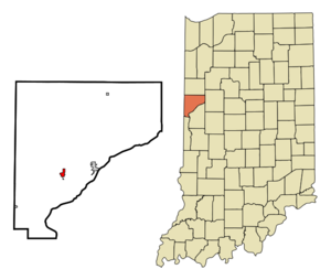
mapsize = 250x200px
map_caption =
mapsize1 =
map_caption1 =
image_dot_
dot_mapsize =
dot_map_caption =
dot_x =
dot_y =
pushpin_
pushpin_label_position =
pushpin_map_caption =
pushpin_mapsize =
subdivision_type = Country
subdivision_name =United States
subdivision_type1 = State
subdivision_name1 =Indiana
subdivision_type2 = County
subdivision_name2 = Warren
subdivision_type3 = Township
subdivision_name3 = Pike
government_type =
leader_title =
leader_name =
established_title = Founded
established_date =1830
established_title2 = Incorporated
established_date2 =1869
area_magnitude =
area_total_km2 = 1.6
area_land_km2 = 1.6
population_as_of =2006
population_footnotes =
population_note =
population_total = 791
population_density_km2 = 493.8
timezone = EST
utc_offset = -5
timezone_DST = EDT
utc_offset_DST = -4
latd = 40 |latm = 16 |lats = 14 |latNS = N
longd = 87 |longm = 23 |longs = 9 |longEW = W
area_water_km2 = 0.0
area_total_sq_mi = 0.6
area_land_sq_mi = 0.6
area_water_sq_mi = 0.0
elevation_footnotes = cite web|url=Gnis3|445780|title=USGS detail on West Lebanon|accessdate=2007-09-28]
elevation_m = 217
elevation_ft = 712
postal_code_type = ZIP code
postal_code = 47993
area_code = 765
website =
blank_name = FIPS code
blank_info = 18-82934GR|2
blank1_name = GNIS feature ID
blank1_info = 0445780GR|3
footnotes =West Lebanon is a town in Pike Township, Warren County,
Indiana ,United States . The population was 791 at the 2006 census.History
West Lebanon was laid out and platted in the fall of 1830 by Ebenezer Purviance, John G. Jemison and Andrew Fleming, and consisted of 64 lots. Originally named Lebanon, the founders may have changed the town's name in deference to the Boone County community of the same name, which established its post office on December 15, 1832, just eleven days before their own.
Not being close to any waterways, West Lebanon's early growth was relatively slow and for many years had no more than 20 families. However, with the completion of the
Wabash Railroad line one mile north of town in 1856, the community's fortunes improved and led to most of the town relocating closer to the station. The original settlement area became known as Old Town.West Lebanon was incorporated in 1869.
Geography
West Lebanon is located at coor dms|40|16|14|N|87|23|9|W|city (40.270447, -87.385964)GR|1. Rock Creek east of town flows south toward the Wabash and forms the township's eastern border; it's fed by the small Johnson Branch which crosses the north edge of town. The
Norfolk Southern Railway passes through West Lebanon. State Road 263 and State Road 28 intersect at the north edge of the town.According to the
United States Census Bureau , the town has a total area of 0.6square mile s (1.6km² ), all of it land.Demographics
As of the
census GR|2 of 2000, there were 793 people, 307 households, and 232 families residing in the town. Thepopulation density was 1,287.1 people per square mile (493.8/km²). There were 336 housing units at an average density of 545.4/sq mi (209.2/km²). The racial makeup of the town was 98.99% White, 0.13% Native American, 0.13% Asian, and 0.76% from two or more races. Hispanic or Latino of any race were 0.50% of the population.There were 307 households out of which 38.4% had children under the age of 18 living with them, 58.0% were married couples living together, 11.7% had a female householder with no husband present, and 24.4% were non-families. 20.2% of all households were made up of individuals and 10.1% had someone living alone who was 65 years of age or older. The average household size was 2.58 and the average family size was 2.94.
In the town the population was spread out with 28.0% under the age of 18, 8.1% from 18 to 24, 28.6% from 25 to 44, 23.3% from 45 to 64, and 12.0% who were 65 years of age or older. The median age was 36 years. For every 100 females there were 106.0 males. For every 100 females age 18 and over, there were 96.9 males.
The median income for a household in the town was $34,844, and the median income for a family was $40,139. Males had a median income of $31,250 versus $20,221 for females. The
per capita income for the town was $15,424. About 5.2% of families and 8.1% of the population were below thepoverty line , including 8.4% of those under age 18 and 7.0% of those age 65 or over.Arts and culture
Each year in early Autumn the town holds the West Lebanon Patriot Festival, a weekend event named for the Patriot mascot of nearby
Seeger High School . The festival features flea market vendors, a parade, cake walks, live music, fireman's water ball competition, Outhouse Races and other attractions. [cite news
first = Rebecca
last = Edwards
title = Patriot Fest Celebrates Hometown Heritage
publisher = The Review Republican
id =
page = 1
date = 2007-10-04 ] The festival was previously known as West Lebanon Fun Days.References
* Clifton, Thomas A. (editor) (1913), "Past and Present of Fountain and Warren Counties, Indiana", Indianapolis: B. F. Bowen & Co.
* Warren County Historical Society (2002), "A History of Warren County, Indiana (175th Anniversary Edition)"External links
Wikimedia Foundation. 2010.