- Cohutta, Georgia
-
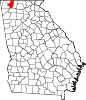
Cohutta, Georgia — Town — Location in Whitfield County and the state of Georgia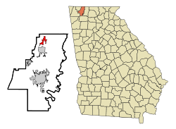
Coordinates: 34°57′33″N 84°57′10″W / 34.95917°N 84.95278°WCoordinates: 34°57′33″N 84°57′10″W / 34.95917°N 84.95278°W Country United States State Georgia County Whitfield Area - Total 2.5 sq mi (6.5 km2) - Land 2.5 sq mi (6.4 km2) - Water 0 sq mi (0.1 km2) Elevation 863 ft (263 m) Population (2000) - Total 582 - Density 232.8/sq mi (89.5/km2) Time zone Eastern (EST) (UTC-5) - Summer (DST) EDT (UTC-4) ZIP code 30710 Area code(s) 706 FIPS code 13-17496[1] GNIS feature ID 0331428[2] Cohutta is a town in Whitfield County, Georgia, United States. It is part of the Dalton, Georgia Metropolitan Statistical Area. The population was 582 at the 2000 census.
Contents
Geography
Cohutta is located at 34°57′33″N 84°57′10″W / 34.95917°N 84.95278°W (34.959202, -84.952908)[3].
According to the United States Census Bureau, the town has a total area of 2.5 square miles (6.5 km2), of which, 2.5 square miles (6.5 km2) of it is land and 0.04 square miles (0.10 km2) of it (1.59%) is water.
Demographics
As of the census[1] of 2000, there were 582 people, 222 households, and 170 families residing in the town. The population density was 233.8 people per square mile (90.2/km²). There were 235 housing units at an average density of 94.4 per square mile (36.4/km²). The racial makeup of the town was 95.02% White, 1.72% African American, 0.17% Native American, 0.17% Asian, 1.20% from other races, and 1.72% from two or more races. Hispanic or Latino of any race were 0.86% of the population.
There were 222 households out of which 37.8% had children under the age of 18 living with them, 65.3% were married couples living together, 7.7% had a female householder with no husband present, and 23.0% were non-families. 20.7% of all households were made up of individuals and 8.1% had someone living alone who was 65 years of age or older. The average household size was 2.62 and the average family size was 3.05.
In the town the population was spread out with 26.8% under the age of 18, 9.8% from 18 to 24, 33.2% from 25 to 44, 21.8% from 45 to 64, and 8.4% who were 65 years of age or older. The median age was 34 years. For every 100 females there were 102.8 males. For every 100 females age 18 and over, there were 100.9 males.
The median income for a household in the town was $41,563, and the median income for a family was $44,444. Males had a median income of $30,592 versus $22,232 for females. The per capita income for the town was $17,510. About 8.2% of families and 6.9% of the population were below the poverty line, including 8.1% of those under age 18 and 3.4% of those age 65 or over.
Culture
The architecture of the small city gives the impression that it once displayed a vibrant little downtown; this is perhaps due to the once-booming railroad system that still rumbles through Cohutta. Indeed, Cohutta reflects the trajectory of many smaller towns in the United States. The town emerged as a stop on the railroad from Cleveland, Tennessee to Dalton, Georgia, and served as the center for the surrounding farming areas. According to local lore, the town was originally known as "Shakerag," from the rag would-be passengers would wave to stop trains passing through.
In the 1920s, the town had a bank and a hotel, as well a high school, and was frequented especially in summer by inhabitants of Chattanooga seeking cooler temperatures. The high school burned down in 1952, and was not rebuilt.
As late as the late 1960s, Cohutta had a (small) supermarket, as well as three smaller "sundry" stores, a feed and seed, and the hair salon that is obligatory in practically all small towns in America. The improvement of roads, and the ease of access to larger cities (in this case, Dalton), drew shoppers away, so that by the 1990s, Cohutta had no businesses at all. Over the last decade, the surrounding area has become something of a bedroom community for Dalton, with housing developments taking over many of the farms in the area. Whether the "gentrification" of the area will lead to a revival of Cohutta itself is problematic.
Cohutta also prides itself on the Red Clay State Historic Park that serves as a national Native American meeting ground, Cherokee memorial with a museum, as well as an outdoor park and recreation center for visitors. This part of the state is extremely rich in Cherokee history as well as classic southern heritage that is complemented by the foliage of Georgia and Tennessee.
References
- ^ a b "American FactFinder". United States Census Bureau. http://factfinder.census.gov. Retrieved 2008-01-31.
- ^ "US Board on Geographic Names". United States Geological Survey. 2007-10-25. http://geonames.usgs.gov. Retrieved 2008-01-31.
- ^ "US Gazetteer files: 2010, 2000, and 1990". United States Census Bureau. 2011-02-12. http://www.census.gov/geo/www/gazetteer/gazette.html. Retrieved 2011-04-23.
External links
Municipalities and communities of Whitfield County, Georgia Cities Dalton | Tunnel Hill | Varnell
Town Cohutta
Categories:- Towns in Georgia (U.S. state)
- Populated places in Whitfield County, Georgia
- Dalton metropolitan area


Wikimedia Foundation. 2010.