- Cape Moreton
-
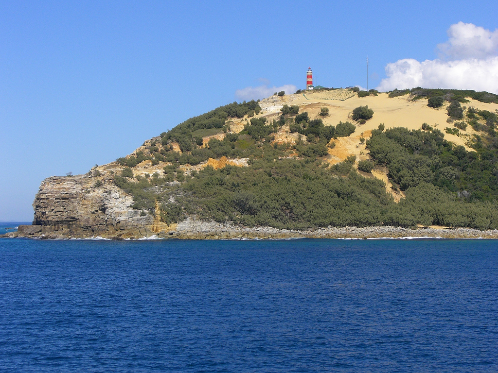
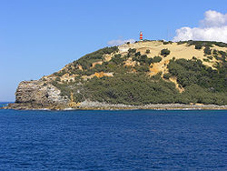 Cape Moreton from sea
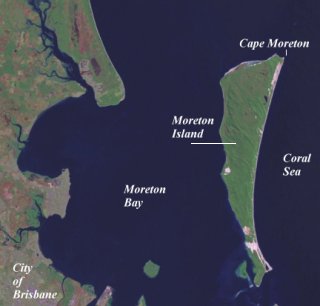
Cape Moreton is a rocky headland located at the north eastern tip of Moreton Island in South East Queensland, Australia. The surrounding area is part of the Moreton Island National Park. 5 km north-west of Cape Moreton is Flinders Reef.
The outcrop is mostly composed of sandstone, but also some conglomerate, siltstone and shale.[1] The whole of Moreton Island was formed by sand caught on and built up behind these rocks.
Contents
History
 Moreton Bay
On the 17 May 1770, James Cook sighted and named the point. By 1959 the island's second settlement begin at Cape Moreton. At one point a school was operating at Cape Moreton with a total of 15 children.[1] Until 1952 when it was abandoned, a telegraph line reached the point, via Amity on North Stradbroke Island.[1]
The hospital ship Centaur was sunk close to Cape Moreton in 1943 when a Japanese submarine torpedoed the ship, taking the lives of 268 people. The wreck was found on the 20 December 2009 in a steep walled gulley, 2,059 m below the ocean surface.
The MV Pacific Adventurer lost containers in high seas created by Cyclone Hamish and caused the 2009 southeast Queensland oil spill. The containers were located after a 10-day search, about 7 km off the coast of Cape Moreton.[2]
Lighthouse
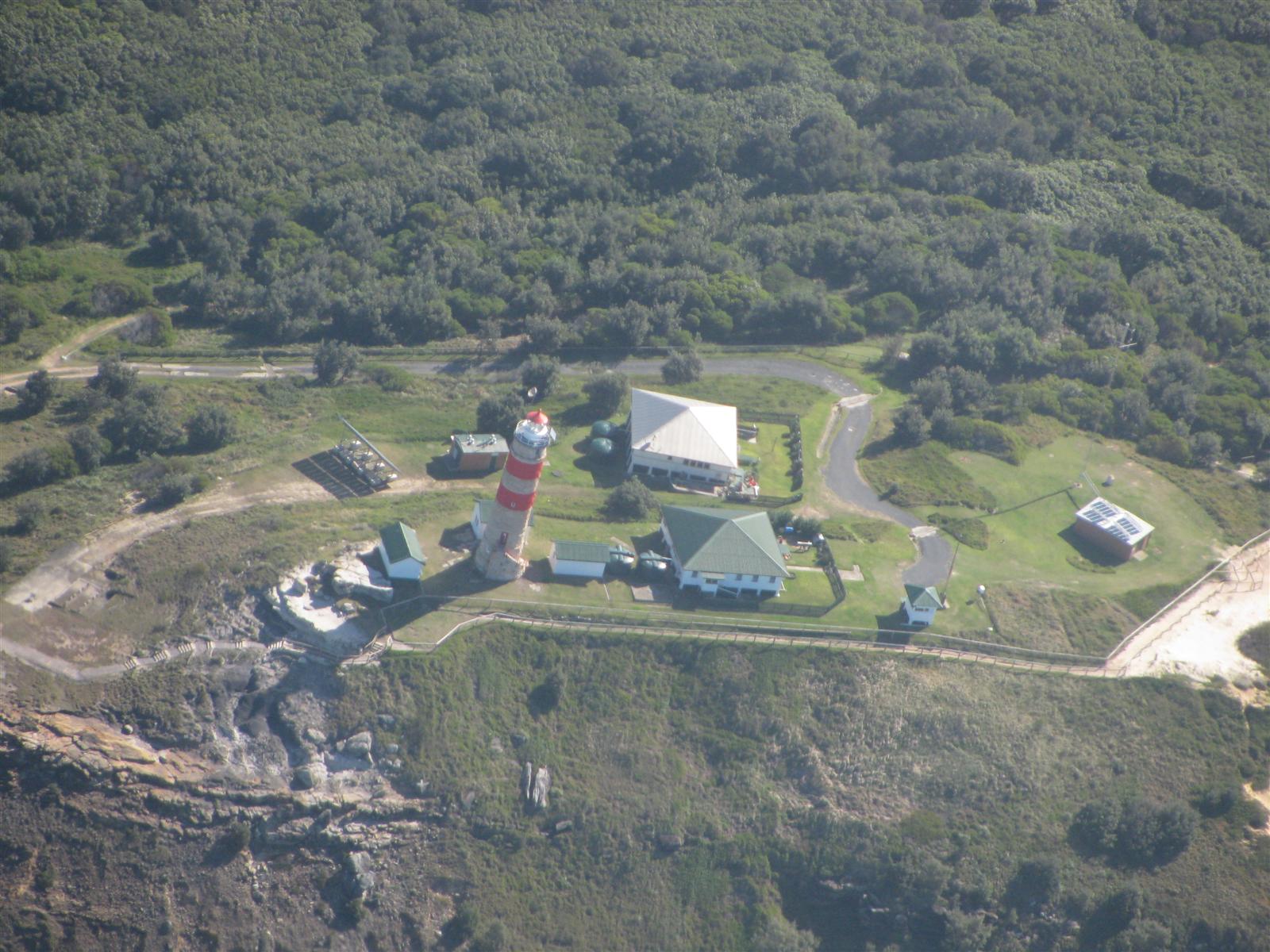
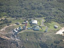 An aerial view of the lightstationMain article: Cape Moreton Light
Cape Moreton Light was the first lighthouse established in Queensland. The 23 metres (75 ft) tall structure was constructed of locally quarried sandstone, and was built in 1857.[3] 35 good conduct prisoners were used for labour.[1]
A pilot station was established at Bulwer on the northern end of the island in 1848.[1] At one time there was a total of seven lighthouses in operation on the island.[1]
Cape Moreton Lighthouse Complex, consisting of the lighthouse, three keepers' cottages and associated structures, was registered on the Register of the National Estate in 1981.
See also
References
- ^ a b c d e f Horton, Helen (1983). Islands of Moreton Bay. Spring Hill, Queensland: Boolarong Publications. pp. 103—114. ISBN 0908175671.
- ^ Andrew Wight (2008-03-28). "Navy locates missing containers". Brisbane Times. http://www.brisbanetimes.com.au/qld-news/navy-locates-missing-containers-20090328-9ej3.html. Retrieved 2008-03-28.
- ^ Nolan, Carolyn; Robert Longhurst (1996). Brisbane's Moreton Bay:Our heritage in focus. South Brisbane, Queensland: State Library of Queensland. p. 52. ISBN 0724271767.
External links
- "The Cape Moreton Lighthouse". Lighthouses of Queensland. Lighthouses of Australia Inc. http://www.lighthouse.net.au/lights/QLD/Moreton%20Island/Cape%20Moreton.htm.
- "Cape Moreton Lighthouse Complex (entry AHD17189)". Australian Heritage Database. Department of Sustainability, Environment, Water, Population and Communities. http://www.environment.gov.au/cgi-bin/ahdb/search.pl?mode=place_detail;place_id=17189.
Categories:- Headlands of Australia
- Register of the National Estate
Wikimedia Foundation. 2010.