- Moreton Bay Rail Link
-
Moreton Bay Rail Link 
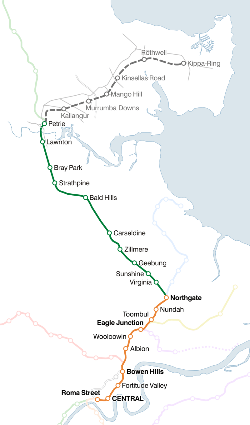
Website queenslandrail.com.au Technical Line length 0 km (0 mi) Track length 40.1 km (24.9 mi) Track gauge 1,067 mm (3 ft 6 in) Cape gauge Operating speed 0 km/h (0 mph) The Moreton Bay Rail Link (also known as the Kippa-Ring rail line, Redcliffe railway and Petrie to Kippa-Ring railway) is a $1.15 billion railway project, that will result in 12.6km of dual-track rail line between Petrie and Kippa-Ring on the Redcliffe peninsula. [1] The new line is to be part of the QR Citytrain suburban network, branching from the Caboolture line. The new line starts 200 metres north of Petrie railway station, extending from (27.5 km (17.1 mi) to 40.1 km (24.9 mi) north of Central railway station).
The line will have six new rail stations: Kallangur, Murrumba Downs, Mango Hill, Kinsellas Road, Rothwell and Kippa-Ring. Funding for the project will consist of: $742 million from the Commonwealth Government, $300 million from the Queensland Government (plus another $120 million for land) and $105 million from the Moreton Bay Regional Council.[1]
Contents
Early History
A rail line to Redcliffe was first proposed in 1895 when the Queensland Government's Minister for Railways, Mr Hon R Phillip, considered three proposals, one preferred route via North Pine (Petrie).[2] In more recent times, the Redcliffe railway was more seriously identified and anticipated in the 1970s, and the land was purchased in the 1980s under a Bjelke-Petersen National Party state government.[3] This land is still owned by the government and preserved as a transport corridor. The issue of the proposed railway line seemed to always come up again when a state election was due, leading to a skeptical belief by many that the line would never actually be constructed.
Petrie to Kippa-Ring Public Transport Corridor Study
In 1999, the Beattie Labor Party state government commissioned an investigative study into the transport corridor between Petrie to Kippa-Ring,[4] conducted by GHD Group. Key components under investigation included the mode of transport, the route and location of stations, future public transport usage, and the timing for construction.[5]
The study was conducted in two parts. The first part was completed in June 2000. It aimed to meet the state government's obligations to identify or forgo rights to a transport corridor running through the North Lakes residential development. This first stage was to identify the preferred mode of transport, the viability of public transport along the corridor, and the preferred alignment of the corridor.[3] Four modes of transport were investigated: heavy rail, buses or a busway, light rail, and monorail. Heavy rail was found to be the preferred mode of transport along the existing preserved corridor as it was the only option to give an acceptable level of economic efficiency – the study found that heavy rail had a benefit-cost ratio of 1.46, above the value of 1 when a project is considered economically viable – and provided the highest levels of patronage with its integration into the existing Citytrain network and no disadvantage with not having to change modes.[3]
The second part of the study was completed in October 2003. It looked at the route of the corridor between Petrie railway station and Kallangur railway station at Goodfellows Road. The original, preserved route was recommended.[3]
On 17 December 2001, the Minister for Transport, Stephen Bredhauer, announced public transport improvements between Petrie and Kippa-Ring, planned as part of a staged development of a new rail line in the area.[6] This is after the Petrie to Kippa-Ring Public Transport Corridor Study had released a draft report with recommendations. The minister also said that the government was also investigating private sector involvement in the construction of the project.[6] On 11 July 2003, the Minister said that the government had not made a commitment on the proposed line, and said that it may not go ahead as interest from the private sector in the project that they were looking for was negligible.[7] This was at the same time as similar passenger rail public-private partnerships such as the Airtrain to the Brisbane Airport and Airport Link to Sydney Airport were faltering and considered high risk at best by business and investors.[8][9]
In June 2004, Queensland Transport released an assessment of the Petrie to Kippa-Ring Public Transport Corridor Study's Impact Assessment Study. This assessment claimed that the Impact Assessment Study only looked at costs of the Petrie to Kippa-Ring corridor, and did not take into account commercial-in-confidence costs involved with operating the trains, integrating the services with the rest of the Citytrain network, higher maintenance costs, and the costs of increasing capacity between the Brisbane central business district and Petrie. Based on these higher costs, Queensland Transport deemed the construction of the railway by 2007 could not be justified. The report also said possible savings with a public-private partnership were small and would not provide value for money. Queensland Transport said that they would preserve the corridor until it is required.[10] Following from this, on 15 June 2004 the government announced $3 million on improving existing bus services along the corridor between Kippa-Ring (Redcliffe) and Petrie "in the short to medium term". It also again announced the further preservation of the corridor for future public transport use.[11]
Recent History
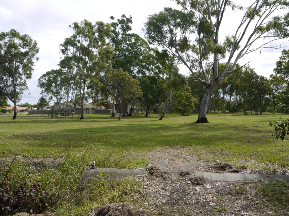
 Site of proposed Kippa Ring Railway Station
Frustrated by a lack of action by the Government, the Redcliffe City Council (now Moreton Bay Regional Council) unanimously moved on 4 July 2005 to support campaign to have the Petrie to Kippa-Ring railway built and write to the Minister for Transport to express concern over a recent decision by the Minister to not proceed with its construction.[12] In 2007, the Pine Rivers Shire Council (now a part of Moreton Bay Regional Council along with Redcliffe City Council) purchased the old Tulip Town shopping centre land at Kallangur for $6 million, with the potential for it to be used with the proposed Kippa-Ring railway line.[13] The site is nearby, but not immediately adjacent to, the location of a Murrumba Downs railway station. However, on 11 August 2008, the state Labor member for Murrumba, Dean Wells, whose electorate the proposed, unconstructed component of the line runs through entirely, said that there were no plans to construct the railway in the foreseeable future.[14]
Regardless, the South East Queensland Regional Plan 2009–2031, released in December 2008, identifies the preserved corridor in its Transport Infrastructure Network Plan as a "quality rapid transit route".[15] During the 2009 Queensland state election, the Liberal National Party of Queensland promised to start the construction of the line in its first term if it was elected, with the first stage of the line from Petrie to Mango Hill commissioned in 2014, and completed to Kippa-Ring by 2016.[16] However, the incumbent Labor government was subsequently returned to power.[17]
In July 2010, during the 2010 federal election, Prime Minister Julia Gillard announced that the Kippa-Ring railway line would be fast-tracked, with the project to be complete by 2016 at a cost of $1.15 billion dollars.[18] On 3 December 2010, the funding agreement for the project was formalised, after being announced the day before. The agreement was signed by Prime Minister Julia Gillard and Queensland Premier Anna Bligh and Moreton Bay mayor Allan Sutherland. [19]
Construction Timeline
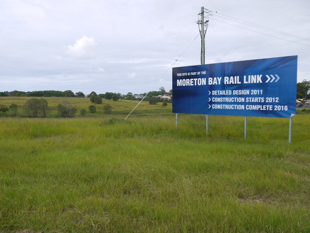
 Site of proposed Mango Hill Railway Station
Project schedule [20]
- October 2010 - Commence survey works
- 15 November 2010 - Community consultation
- February 2011 - Complete stakeholder and community consultation
- Mid 2011 - Complete the final business case
- 2012–2016 - Construction
- 2016 - Completion
Proposed New Line
In the last study report, planned stations were in Kallangur, Murrumba Downs, Mango Hill, Kinsellas Road in Mango Hill, Rothwell and Kippa-Ring.[3] Passengers for/from the Caboolture and Nambour and Gympie North lines would change at Petrie, Shorncliffe line at Northgate, Airport and Doomben lines at Eagle Junction, Ferny Grove line at Bowen Hills, and all other lines at Central.
Kippa-Ring railway line
showing distance from Central, ticket zone, and connecting or nearby bus services

Beenleigh, Cleveland, Gold Coast, Ipswich, Rosewood, Tennyson lines 

Exhibition line 
0.8 km Roma Street (1) See Roma Street railway station 
0.0 km CENTRAL (1) See Adelaide Street Bus Mall 

1.3 km Fortitude Valley (1) See Fortitude Valley railway station 
Exhibition line 2.7 km Bowen Hills (1) 301, 310, 315, 320, 393 
Follows Caboolture line 6.5 km Eagle Junction (2) 303, 304, 320, 321 Follows Caboolture line 9.9 km Northgate (2/3) 306, 307 Follows Caboolture line 27.4 km Petrie (6) 675, 680, 681, 682 
Caboolture line, Nambour and Gympie North line 
Kallangur (6) 675, 676 Murrumba Downs (6) 676, 680, 681, 682 
Bruce Highway Mango Hill (6) 680, 682 Kinsellas Road (6) 680, 682 
Saltwater Creek Rothwell (6) 660, 680, 682 
40.1 km Kippa-Ring (6) 660, 680, 682, 690, 695, 696/697 References
- ^ a b "Moreton Bay Rail Link (Department of Transport and Main Roads)". Queensland Government. 15 November 2010. http://www.tmr.qld.gov.au/moretonbayrail. Retrieved 24 November 2010.
- ^ "(Unknown title)". The Telegraph. 8 May 1895. http://backontrack.org/mbs/index.php?topic=7.msg3209#msg3209. Retrieved 19 January 2009.
- ^ a b c d e GHD Pty Ltd (October 2003) (PDF). Petrie to Kippa-Ring Public Transport Corridor Study – Final Impact Assessment Study Report. Queensland Transport. http://www.translink.com.au/qt/translin.nsf/ReferenceLookup/PKRPTCS_ExecutiveSummary.pdf/$file/PKRPTCS_ExecutiveSummary.pdf. Retrieved 20 January 2009.[dead link]
- ^ "BUDGET BRIEFS" (Press release). Government of Queensland. 15 September 1999. http://statements.cabinet.qld.gov.au/MMS/StatementDisplaySingle.aspx?id=27277. Retrieved 20 January 2009.
- ^ "Public transport corridor information days to assist residents" (Press release). Government of Queensland. 24 March 2000. http://statements.cabinet.qld.gov.au/MMS/StatementDisplaySingle.aspx?id=29719. Retrieved 20 January 2009.
- ^ a b "Petrie to Kippa-Ring Rail Corridor" (Press release). Government of Queensland. 17 December 2001. http://statements.cabinet.qld.gov.au/MMS/StatementDisplaySingle.aspx?id=11848. Retrieved 20 January 2009.
- ^ "Rail may not be an option for Petrie to Kippa-Ring" (Press release). Government of Queensland. 11 July 2003. http://statements.cabinet.qld.gov.au/MMS/StatementDisplaySingle.aspx?id=20672. Retrieved 20 January 2009.
- ^ "Talks underway over future of private Airtrain operation". Australian Associated Press. 15 June 2002. http://www.highbeam.com/doc/1P1-53656501.html. Retrieved 2009-01-20.
- ^ Bissett, Kelvin (18 December 2006). "Fast rail plan for Sydney". The Daily Telegraph. http://www.news.com.au/dailytelegraph/story/0,22049,20943198-5006009,00.html. Retrieved 20 January 2009.
- ^ (PDF) Petrie to Kippa-Ring PublicTransport Corridor Study Independent assessment of IAS Report. Queensland Transport. June 2004. http://www.wheresourrailway.org/qtassessment.pdf. Retrieved 20 January 2009.
- ^ "$3M FOR PETRIE TO KIPPA-RING PUBLIC TRANSPORT CORRIDOR" (Press release). Government of Queensland. 15 June 2004. http://statements.cabinet.qld.gov.au/MMS/StatementDisplaySingle.aspx?id=35845. Retrieved 20 January 2009.
- ^ "MINUTES OF GENERAL PURPOSES COMMITTEE 4 JULY 2005" (DOC). General Purposes Committee Meeting. Redcliffe City Council. 4 July 2005. http://www.wheresourrailway.org/rccminute.doc. Retrieved 20 January 2009.
- ^ Dowling, Bernie (21 November 2007). "Petrie-Redcliffe line hopes". Pine Rivers Press. http://www.news.com.au/couriermail/story/0,23739,22796158-3102,00.html. Retrieved 20 January 2009.[dead link]
- ^ "No rail link to Redcliffe". Redcliffe and Bayside Herald. 12 August 2008. http://redcliffe-and-bayside-herald.whereilive.com.au/news/story/no-rail-link-to-redcliffe/. Retrieved 20 January 2009.
- ^ (PDF) Draft regional plan 2009–2031 – Part D12: Integrated transport. Government of Queensland. 5 December 2008. http://www.dip.qld.gov.au/resources/plan/SEQ/draft-regional-plan/part-d-12-integrated-transport.pdf. Retrieved 20 January 2009.
- ^ Valentine, Alyce (28 February 2009). "Petrie to Kippa-Ring rail link promised by the LNP". The Courier Mail. http://www.news.com.au/couriermail/story/0,23739,25114184-3102,00.html. Retrieved 28 February 2009.[dead link]
- ^ "Queensland elects female premier". BBC News Online. 21 March 2009. http://news.bbc.co.uk/2/hi/asia-pacific/7956440.stm.
- ^ Balogh, Stefanie (27 July 2010). "Gillard fast-tracks the $1.15 billion Redcliffe rail connection linking Petrie to Kippa-Ring". The Courier Mail. http://www.couriermail.com.au/news/national/gillard-fast-tracks-the-115-billion-redcliffe-rail-connection-linking-petrie-to-kippa-ring/story-fn5z3z83-1225897194133. Retrieved 24 November 2010.
- ^ Moore, Tony (03 December 2010). "Moreton Bay Rail Link remains on track". The Brisbane Times (Fairfax Media). http://www.brisbanetimes.com.au/queensland/moreton-bay-rail-link-remains-on-track-20101203-18il0.html/story-fn5z3z83-1225897194133. Retrieved 03 December 2010.
- ^ "MBRL Newsletter Edition 1 November 2010". Moreton Bay Rail Link (Queensland Government, Department of Transport and Main Roads). 01 November 2010. http://www.tmr.qld.gov.au/~/media/b784801b-60b4-431a-9b4f-b24684182a70/mbrl%20newsletter%20november%202010.pdf. Retrieved 3 December 2010.
External links
- Petrie to Kippa-Ring public transport corridor study
- Moreton Bay Rail Link at State of Queensland (Department of Transport and Main Roads) 2010
Queensland Rail's city rail lines Northern Southern Inner city Categories:- Brisbane railway lines
- Public transport in Brisbane
- Proposed public transport in Australia
Wikimedia Foundation. 2010.