- North Burnett Regional Council
Infobox Australian Place | type = lga
name = North Burnett Regional Council
state = qld
imagesize= 180
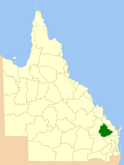
caption = Location inQueensland
pop = 10,688
area = 19708
est = 2008
seat = Gayndah
mayor = Joy Jensen
region = Wide Bay-Burnett
url = http://www.northburnett.qld.gov.au/
stategov = Callide
fedgov = Flynn, Hinkler
near-nw = Banana
near-n = Gladstone
near-ne = Gladstone
near-w = Banana
near-e = Bundaberg
near-sw = Dalby
near-s = South Burnett
near-se = Gympie, Fraser CoastNorth Burnett Regional Council is a Local Government in
Queensland ,Australia located in the northern catchment of theBurnett River Origins
Premier Peter Beattie's Queensland Government made the decision to form the North Burnett Regional Council, following recommendations made by the
Local Government Reform Commission in a public report released in July 2007 [ [http://www.northburnettltc.qld.gov.au North Burnett Regional Council - Local Transition Committee] Retrieved 17 April 2008] [ [http://www.localgovernment.qld.gov.au/?id=7348 Report of the Local Government Reform Commission (Queensland Department of Local Government, Sport, and Recreation Download Page)] Retrieved 17 April 2008]It was recommended, and the North Burnett Regional Council now contains within its boundaries, the entire area of six former Local Government Areas:
*
Shire of Biggenden ;
*Shire of Eidsvold ;
*Shire of Gayndah ;
*Shire of Monto ;
*Shire of Mundubbera ; and
*Shire of Perry .Area and Size
The North Burnett Regional Council is divided into six electoral divisions, covering an area of convert|19708|km2|sqmi|0|lk=on, with an estimated resident population of 10,668 (based on 2006 figures) and an estimated operating budget of
AUD 32m (as at 2008).Included within this Local Government's area are the towns of Biggenden, Eidsvold, Gayndah, Monto and Mundubbera and the villages/communities of Abercorn, Ban Ban Springs, Binjour, Byrnestown, Ceratodus, Coulston Lakes, Dallarnil, Degilbo, Gooroolba, Humphery, Ideraway, Kalpower, Moonford, Mount Perry, Mulgildie and Mungungo.
First Mayor and Councillors
On the 15 March 2008, Joy Esme JENSEN, was elected as this local government's first Mayor.
The first Councillors ever elected to the North Burnett Regional Council are as follows [ [http://www.ecq.qld.gov.au/elections/local/lg2008/NorthBurnettRegionalCouncil/results/councillor/summary.html North Burnett Region Councillor Election results] Retrieved 17 April 2008] :
* Division 1: LOBEGEIER, Paul
* Division 2: FRANCIS, Paul
* Division 3: WHELAN, Faye
* Division 4: HUTH, Peter
* Division 5: BAKER, Peter
* Division 6: WENDT, Kevin (Lofty)External links
* [http://www.localgovernment.qld.gov.au/?id=7348 Report of the Local Government Reform Commission (Queensland Department of Local Government, Sport, and Recreation Download Page)] Retrieved 17 April 2008
* [http://www.ecq.qld.gov.au/elections/2008/html/NorthBurnettRegionalCouncil.html Interactive Map of North Burnett Shire (from Electoral Commisiion Queensland website)] Retrieved 17 April 2008References
Wikimedia Foundation. 2010.