- Chalfont Historic District
-
Chalfont Historic District
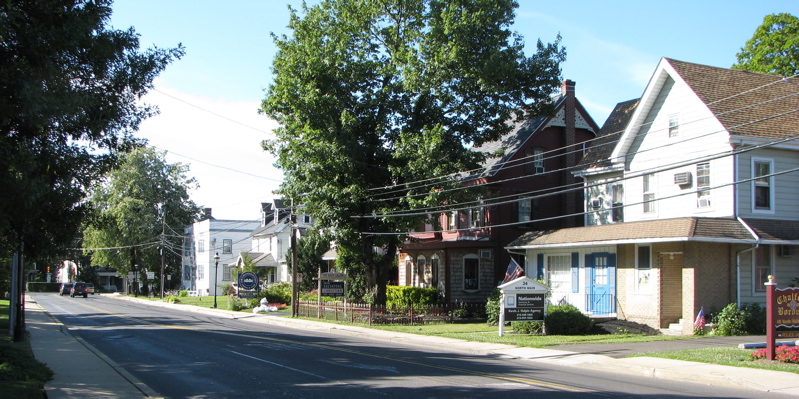
 Main Street in Chalfont
Location: Chalfont, Pennsylvania Built: 1856 Architect: Martin, A Oscar, Architectural style: Gothic Revival, Classical Revival Governing body: Private NRHP Reference#: 06001148[1] Added to NRHP: December 18, 2006 The Chalfont Historic District is a portion of the Borough of Chalfont, Pennsylvania that is listed on the National Register of Historic Places. The district encompasses Main Street (Pennsylvania Route 152) and Butler Avenue (U.S. Route 202) with their American colonial and Victorian-style homes. Historic buildings include the Simon Butler Mill House, built in 1730, and the Chalfont train station.
See also
- List of Registered Historic Places in Bucks County, Pennsylvania
References
- ^ "National Register Information System". National Register of Historic Places. National Park Service. 2007-01-23. http://nrhp.focus.nps.gov/natreg/docs/All_Data.html.
U.S. National Register of Historic Places Topics Lists by states Alabama • Alaska • Arizona • Arkansas • California • Colorado • Connecticut • Delaware • Florida • Georgia • Hawaii • Idaho • Illinois • Indiana • Iowa • Kansas • Kentucky • Louisiana • Maine • Maryland • Massachusetts • Michigan • Minnesota • Mississippi • Missouri • Montana • Nebraska • Nevada • New Hampshire • New Jersey • New Mexico • New York • North Carolina • North Dakota • Ohio • Oklahoma • Oregon • Pennsylvania • Rhode Island • South Carolina • South Dakota • Tennessee • Texas • Utah • Vermont • Virginia • Washington • West Virginia • Wisconsin • WyomingLists by territories Lists by associated states Other Categories:- Historic districts in Pennsylvania
- National Register of Historic Places in Pennsylvania
- Historic districts in Bucks County, Pennsylvania
- Pennsylvania Registered Historic Place stubs
- Pennsylvania stubs
Wikimedia Foundation. 2010.