- Oracle, Arizona
-
Oracle, Arizona — CDP — Central Oracle from atop a hill Location in Pinal County and the state of Arizona
Coordinates: 32°36′58″N 110°46′55″W / 32.61611°N 110.78194°WCoordinates: 32°36′58″N 110°46′55″W / 32.61611°N 110.78194°W Country United States State Arizona County Pinal Area – Total 16.4 sq mi (42.5 km2) – Land 16.4 sq mi (42.5 km2) – Water 0.0 sq mi (0.0 km2) Elevation 4,524 ft (1,379 m) Population (2010) – Total 3,686 – Density 224.67/sq mi (86.75/km2) Time zone MST (no DST) (UTC-7) ZIP code 85623 Area code(s) 520 FIPS code 04-51180 GNIS feature ID 0032541 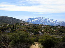 Oracle, AZ - Mt. Lemmon in background.
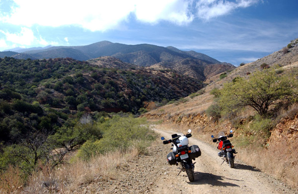
 Road from Oracle up the "backside" of Mount Lemmon
Oracle is a census-designated place (CDP) in Pinal County, Arizona, United States. The population was 3,686 at the 2010 census.
Buffalo Bill Cody owned a mine in Oracle briefly and, in 1911, appeared as "Santa" for a group of local children.[1] The community is the location of the Biosphere 2 experiment. Oracle was also the postal address for environmentalist author Edward Abbey, who never lived in the town but visited often. Oracle is becoming a bedroom community for Tucson, Arizona, but large-scale development is opposed by many residents.
Oracle State Park is adjacent. The Arizona Trail passes through the Park and community. Oracle is the gateway to the road up the "back side" of Mount Lemmon, which starts off of American Avenue and currently offers a secondary route to the top. Previous to the construction of the Catalina Highway on the opposite side of the Santa Catalina range, the Oracle Control Road was the only road access to the mountain community of Summerhaven. The term "control road" derives from the fact that the direction of traffic was restricted to one-way only, either up or down at alternate times of day, to prevent motorists from having to pass one another on the narrow, steep road. This route is now popular mainly with off-road 4x4 drivers and with off-road or dual-purpose motorcyclists, and should not be attempted by regular passenger cars or street motorcycles. This road ends at the Catalina Highway near Loma Linda.
Contents
History
The name "Oracle" comes from early prospectors. Albert Weldon came to the area looking for gold and silver. He and some other companions named their first mine The Oracle after the ship Weldon had traveled on. The community was later named after its first mine, and thus, indirectly, after a ship.
The community began to grow in the late 1870s, as gold and silver were discovered, and the Christmas and New Year mines opened. By 1880, a post office had been established.
The community also became a retreat for people suffering from tuberculosis. The Acadia Ranch – built in Oracle in 1882 by Edwin S. and Lillian Dodge – was, during this time, a sanitorium.
Climate
At an altitude of 4500 feet, Oracle's vegetation consists of mostly emory oak (Quercus emoryi) and grasses. In January, the average high temperature is 56°F (16°C) with a low of 35°F (-2°C). In July, the average high temperature is 92°F (37°C) with a low of 67°F (20°C). Annual precipitation is 24.96 inches. Rainfall increases during July and August, due to the monsoon effect. Snowfall varies. [2]
Climate data for Oracle, Arizona Month Jan Feb Mar Apr May Jun Jul Aug Sep Oct Nov Dec Year Average high °F (°C) 56
(13)60
(16)65
(18)72
(22)82
(28)92
(33)92
(33)89
(32)86
(30)76
(24)64
(18)56
(13)74.17 Average low °F (°C) 35
(2)37
(3)40
(4)45
(7)54
(12)64
(18)67
(19)66
(19)62
(17)51
(11)41
(5)35
(2)49.75 Precipitation inches (mm) 2.48
(63)2.60
(66)2.51
(63.8).91
(23.1).62
(15.7).40
(10)3.26
(82.8)4.09
(103.9)1.96
(49.8)2.01
(51.1)1.83
(46.5)2.25
(57.2)24.92
(633)Source: The Weather Channel[2] Geology
Oracle and the surrounding area sit largely on a slab of granite called "Oracle granite" that is visible as red or grey-and-white speckled "boulders" rising over the scrub and grass. It is mostly porphyritic biotite Precambrian granite with large microcline phenocrysts, and has occasional inclusions of white and milky quartz and pegmatite. The granite rarely contains ore and veins of gold or silver, and sometimes copper.
Geography
Oracle is located at 32°36′58″N 110°46′55″W / 32.61611°N 110.78194°W (32.616030, -110.781854).[3]
According to the United States Census Bureau, the CDP has a total area of 16.4 square miles (42 km2), all of it land.
Attractions and Events
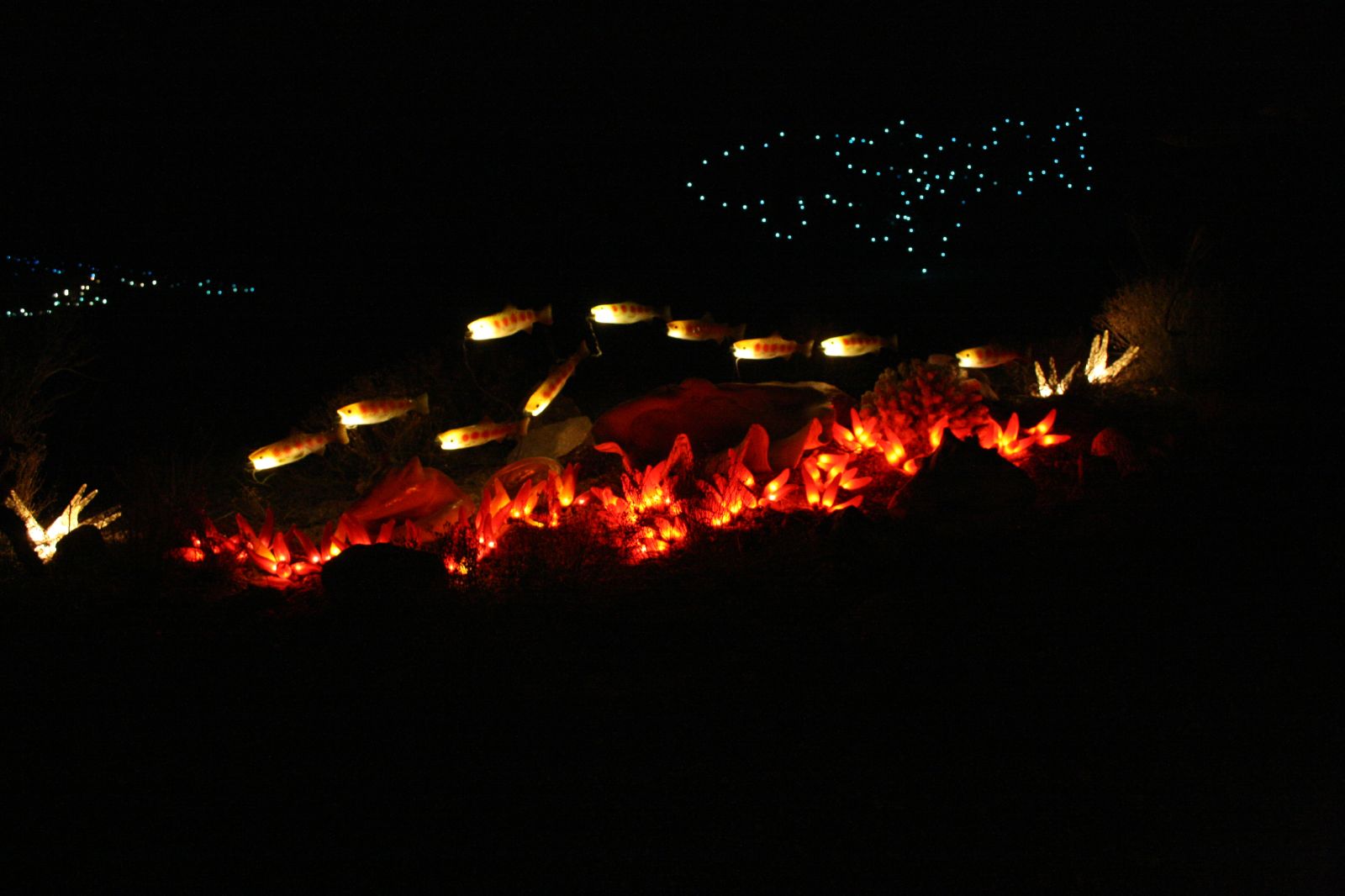
 GLOW 2007 exhibit
- Biosphere 2
- Oracle State Park
- GLOW,[4] an annual nighttime multimedia art event coinciding with the full moon.
- Peppersauce Cave, a limestone cave with approximately one mile of mapped passages.
Demographics
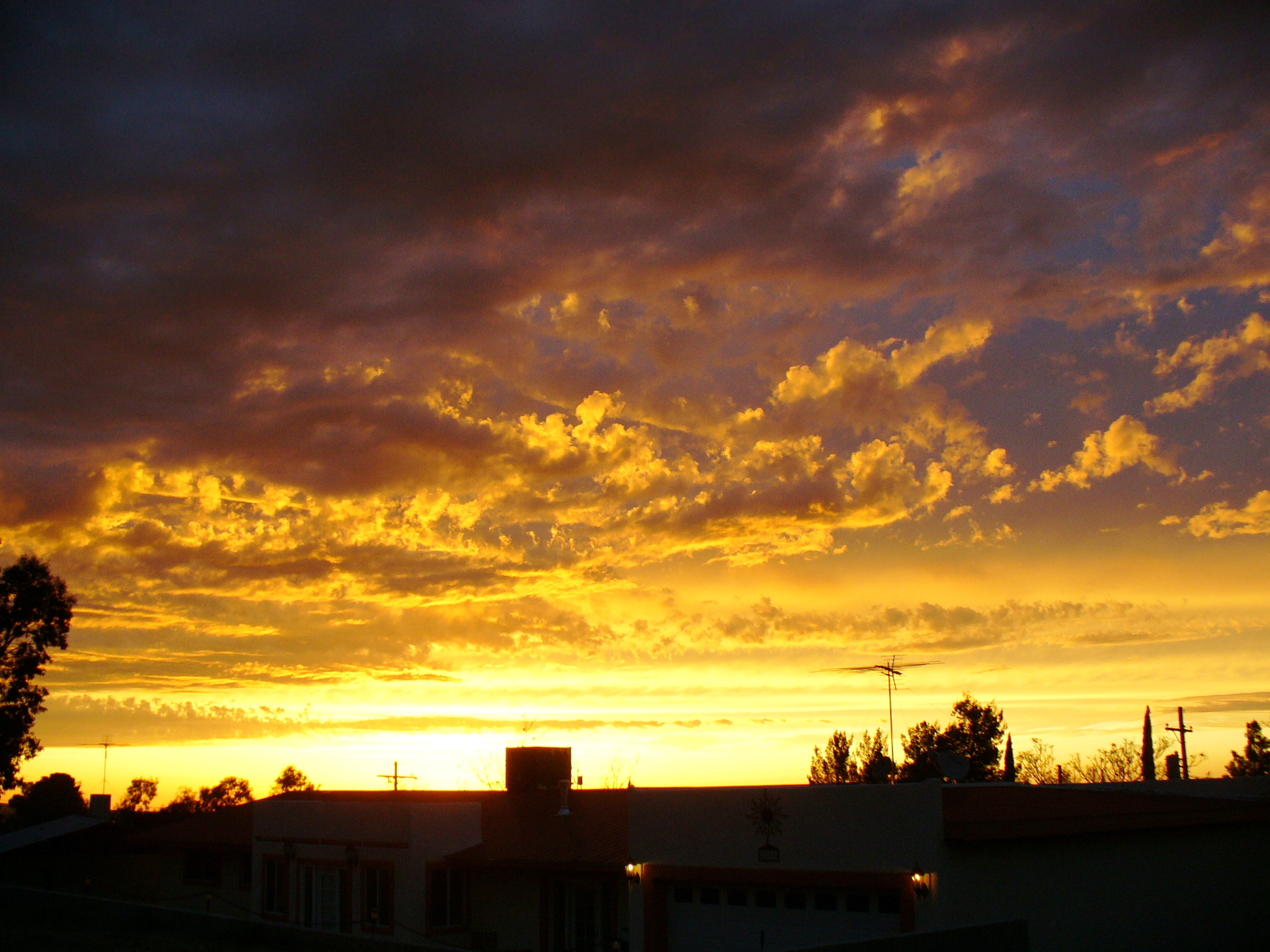
 Sunset in Oracle during the monsoon
As of the census[5] of 2000, there were 3,563 people, 1,384 households, and 1,004 families residing in the CDP. The population density was 313.0 people per square mile (120.9/km²). There were 1,534 housing units at an average density of 134.8 per square mile (52.0/km²). The racial makeup of the CDP was 77.01% White, 0.14% Black or African American, 1.52% Native American, 0.08% Asian, 0.20% Pacific Islander, 17.26% from other races, and 3.79% from two or more races. 38.31% of the population were Hispanic or Latino of any race.
There were 1,384 households out of which 31.5% had children under the age of 18 living with them, 57.0% were married couples living together, 10.4% had a female householder with no husband present, and 27.4% were non-families. 23.4% of all households were made up of individuals and 7.4% had someone living alone who was 65 years of age or older. The average household size was 2.57 and the average family size was 3.03.
In the CDP the population was spread out with 26.4% under the age of 18, 7.7% from 18 to 24, 24.6% from 25 to 44, 27.8% from 45 to 64, and 13.5% who were 65 years of age or older. The median age was 40 years. For every 100 females there were 97.5 males. For every 100 females age 18 and over, there were 95.8 males.
The median income for a household in the CDP was $38,267, and the median income for a family was $46,026. Males had a median income of $37,667 versus $30,667 for females. The per capita income for the CDP was $19,459. About 8.0% of families and 10.0% of the population were below the poverty line, including 10.8% of those under age 18 and 3.2% of those age 65 or over.
See also
References
- ^ Marriott,Barbara."Annie's Guests". Catymatt Productions. 2002.p.160.
- ^ a b "Monthly Averages for Safford, AZ". http://www.weather.com/weather/wxclimatology/monthly/graph/USAZ0193. Retrieved 2011-09-06.
- ^ "US Gazetteer files: 2010, 2000, and 1990". United States Census Bureau. 2011-02-12. http://www.census.gov/geo/www/gazetteer/gazette.html. Retrieved 2011-04-23.
- ^ GLOW art event website
- ^ "American FactFinder". United States Census Bureau. http://factfinder.census.gov. Retrieved 2008-01-31.
External links
Municipalities and communities of Pinal County, Arizona Cities Apache Junction‡ | Casa Grande | Coolidge | Eloy | Maricopa

Towns CDPs Ak-Chin Village | Arizona City | Blackwater | Cactus Forest | Campo Bonito | Casa Blanca | Chuichu | Dudleyville | Gold Canyon | Goodyear Village | Kohatk | Oracle | Picacho | Queen Valley | Red Rock | Sacaton | Sacaton Flats Village | Saddlebrooke | San Manuel | Santa Cruz | Santan | San Tan Valley | Stanfield | Stotonic Village | Sweet Water Village | Tat Momoli | Top-of-the-World‡ |
Unincorporated
communitiesBapchule | Chandler Heights‡ | Randolph | Valley Farms
Indian reservations Ghost towns American Flag | Cochran | Copper Creek | Pinal City | Ray | Reymert | Sasco | Tiger
Footnotes ‡This populated place also has portions in an adjacent county or counties
Notes
Categories:- Census-designated places in Pinal County, Arizona
- Santa Catalina Mountains


Wikimedia Foundation. 2010.