- Citronelle, Alabama
-
Citronelle — City — Location in Alabama.
 Citronelle
Coordinates: 31°5′33″N 88°14′39″W / 31.0925°N 88.24417°WCoordinates: 31°5′33″N 88°14′39″W / 31.0925°N 88.24417°W Country United States State Alabama County Mobile Area – Total 24.7 sq mi (63.9 km2) – Land 24.4 sq mi (63.2 km2) – Water 0.3 sq mi (0.7 km2) Elevation 312 ft (95 m) Population (2000) – Total 3,659 – Density 148.1/sq mi (57.3/km2) Time zone Central (CST) (UTC-6) – Summer (DST) CDT (UTC-5) ZIP code 36522 Area code(s) 251 FIPS code 01-15064 GNIS feature ID 0116155 Citronelle is a city in Mobile County, Alabama, United States. At the 2000 census the population was 3,659. It is included in the Mobile metropolitan statistical area.
Contents
History
This was long part of the territory of thousands of years of indigenous peoples. By the time of European contact, members of the historical tribes of Choctaw and Creek people hunted in the area.
The area now known as Citronelle was first explored by Europeans in the 18th century. The land was found to possess healing herbs and mineral springs. The area was settled in 1811 and established as a jurisdiction in 1892. The name "Citronelle" is derived from the citronella plant, which grows throughout the town. In the late 19th century, the town became a popular resort destination because of the climate, herbs, and healing waters. Many hotels were built to accommodate the surge of visitors.
On May 4, 1865, one of the last significant Confederate armies was surrendered by General Richard Taylor (general) under the "Surrender Oak". This was the third in a series of five major surrenders of the war. The two previous surrenders occurred at Appomattox Court House, Virginia between General Robert E. Lee and General Ulysses S. Grant; and the second and largest at Bennett Place near Durham, North Carolina between General William T. Sherman and General Joseph E. Johnston.
A living history/reenactment of the surrender occurs each year in Citronelle. The historic "Surrender Oak" no longer stands as it was destroyed by a hurricane in 1902.
In 1955, oil was discovered in the area. Today Citronelle is known as the oil capital of Alabama.[1][dead link]
Geology
"Citronelle Dome is a giant salt-cored anticline in the eastern Mississippi Interior Salt Basin of southwest Alabama. The dome forms an elliptical structural closure containing multiple opportunities for enhanced oil recovery (EOR) and saline reservoir CO2 sequestration. Citronelle Oil Field, located on the crest of the dome, has produced more than 169 MMbbl (million barrels) of 42-46° American Petroleum Institute (API) gravity oil from the Lower Cretaceous Donovan Sand."[2]
Geography
Citronelle is located at 31°05′34″N 88°14′40″W / 31.092653°N 88.244315°W[3] and is about 28 miles (45 km) north of Semmes.
According to the U.S. Census Bureau, the city has a total area of 24.7 square miles (64 km2), of which, 24.4 square miles (63 km2) is land and 0.2 square miles (0.52 km2) (1.01%) is water.
Demographics
As of 2010 Citronelle had a population of of 3,905. The racial and ethnic composition of the population was 70.7% white, 20.2% black or African American, 4.9% Native American, 0.5% Asian, 1.5% from some other race, 2.2% reporting two or more races and 2.6% Hispanic or Latino from any race.[4]
As of the census[5] of 2000, there were 3,659 people, 1,318 households, and 1,009 families residing in the city. The population density was 149.9 people per square mile (57.9/km2). There were 1,441 housing units at an average density of 59.0 per square mile (22.8/km2). The racial makeup of the city was 76.96% White, 18.61% Black or African American, 2.76% Native American, 0.14% Asian, 0.03% Pacific Islander, 0.25% from other races, and 1.26% from two or more races. 0.82% of the population were Hispanic or Latino of any race.
There were 1,318 households out of which 38.3% had children under the age of 18 living with them, 57.2% were married couples living together, 15.0% had a female householder with no husband present, and 23.4% were non-families. 22.3% of all households were made up of individuals and 10.8% had someone living alone who was 65 years of age or older. The average household size was 2.73 and the average family size was 3.19.
In the city the population was spread out with 28.3% under the age of 18, 9.9% from 18 to 24, 26.9% from 25 to 44, 21.7% from 45 to 64, and 13.1% who were 65 years of age or older. The median age was 35 years. For every 100 females there were 90.9 males. For every 100 females age 18 and over, there were 87.7 males.
The median income for a household in the city was $31,739, and the median income for a family was $39,922. Males had a median income of $32,200 versus $19,702 for females. The per capita income for the city was $16,455. About 12.0% of families and 15.4% of the population were below the poverty line, including 21.1% of those under age 18 and 19.1% of those age 65 or over.
Education
The city is served by the Mobile County Public School System and has public schools: Citronelle High School (9-12), Lott Middle School (6-8), and McDavid-Jones Elementary School (K-5).
References
- ^ Citronelle: History, Citronelle Chamber of Commerce
- ^ HILLS, Denise J.1; KOPASKA-MERKEL, David C.1; PASHIN, Jack2; WALSH, Peter M.3; and ESPOSITO, Richard A.4; GEOLOGIC CHARACTERIZATION SUPPORTING ENHANCED OIL RECOVERY PILOT, CITRONELLE OIL FIELD, SOUTHWEST ALABAMA, Geological Society of America, paper presented 12–13 March 2009, Southeastern Section Conference, accessed 3 November 2009
- ^ "US Gazetteer files: 2010, 2000, and 1990". United States Census Bureau. 2011-02-12. http://www.census.gov/geo/www/gazetteer/gazette.html. Retrieved 2011-04-23.
- ^ 2010 population by place by race or Hispanic and Latino origin for Alabama report from the US Census
- ^ "American FactFinder". United States Census Bureau. http://factfinder.census.gov. Retrieved 2008-01-31.
External links
- Data on metropolitan statistical areas and Mobile MSA
- City of Citronelle
- Citronelle Historical Preservation Society
Municipalities and communities of Mobile County, Alabama Cities 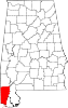
Towns CDPs Axis | Belle Fontaine | Bucks | Calvert | Chunchula | Grand Bay | Theodore | Tillmans Corner
Unincorporated
communitiesGhost town Categories:- Cities in Alabama
- Populated places in Mobile County, Alabama
- Populated places established in 1811


Wikimedia Foundation. 2010.