- Mott Haven, Bronx
-
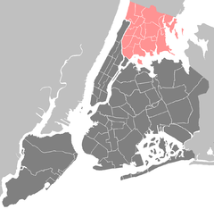
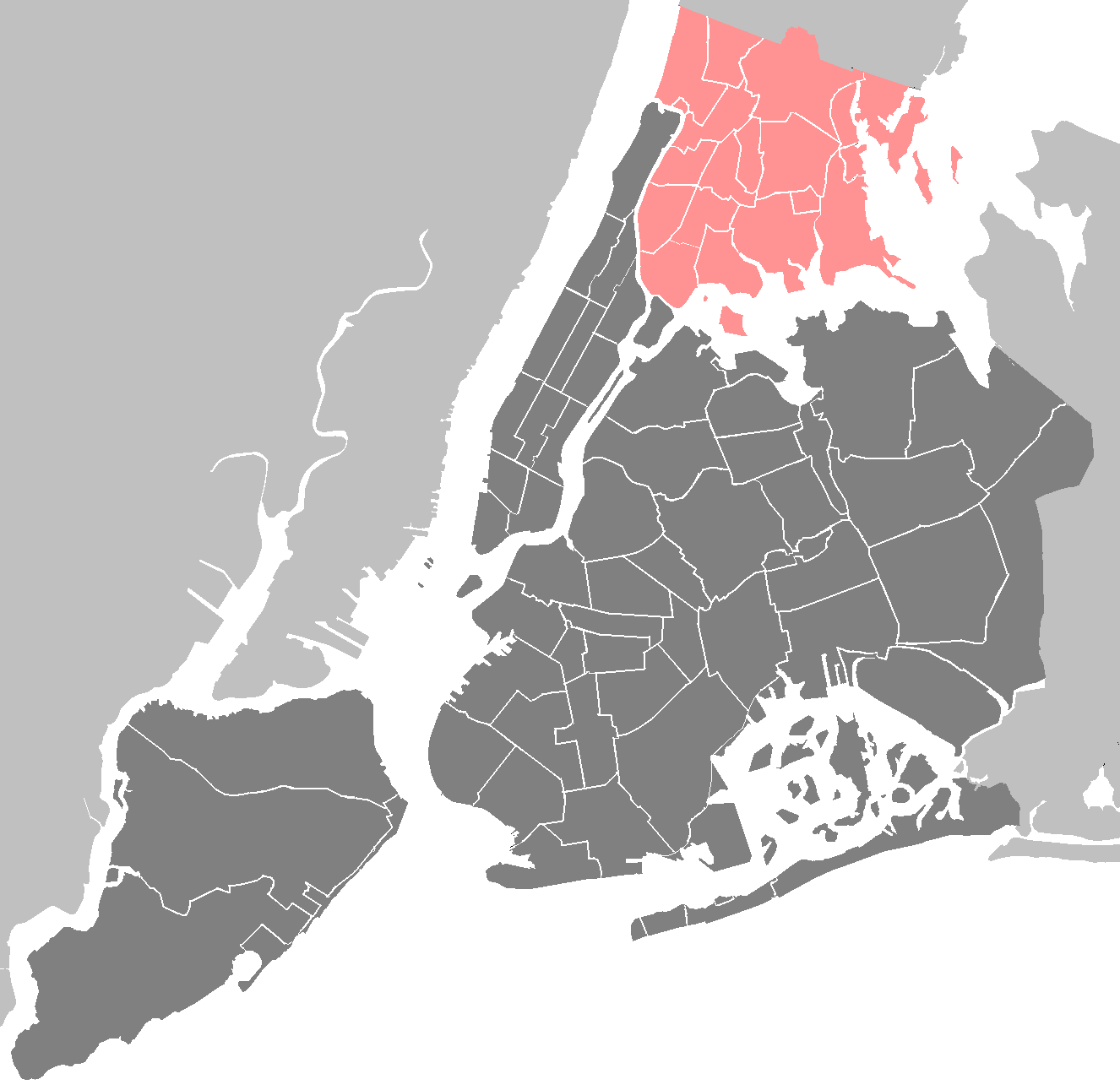
 Location of Mott Haven in New York City

Mott Haven is a primarily residential neighborhood in the Southwestern section of The Bronx in New York City. Zip codes include 10451, 10454, and 10455. The neighborhood is part of Bronx Community Board 1. Its boundaries, starting from the north and moving clockwise are: East 149th Street to the north, the Bruckner Expressway to the east, the Bronx Kill waterway to the south, and the Harlem River to the west. East 138th Street is the primary east-west thoroughfare through Mott Haven. The local subway is the IRT Lexington Avenue Line (4 5 6 <6> trains), operating along East 138th Street. The local buses are the Bx1, Bx2, Bx15, Bx17, Bx21, Bx32, Bx33. Mott Haven is served by the Triborough Bridge, the Third Avenue Bridge and the Willis Avenue Bridge. The closest Metro-North Railroad stops are Yankees – East 153rd Street and Harlem – 125th Street.
Contents
Demographics
Mott Haven is a high density neighborhood with a population roughly 50,000 within a square mile. The neighborhood consists primarily of Latin Americans, predominantly Puerto Ricans. Like most neighborhoods in New York City the vast majority of households are renter occupied. Over half the population lives below the poverty line and receives public assistance (AFDC, Home Relief, Supplemental Security Income, and Medicaid). However there is significant income diversity on a block by block basis. Around the turn of the century the non-Hispanic White population, consisting primarily of high income earners, has been on the rise along with a decline in the non-Hispanic Black population.
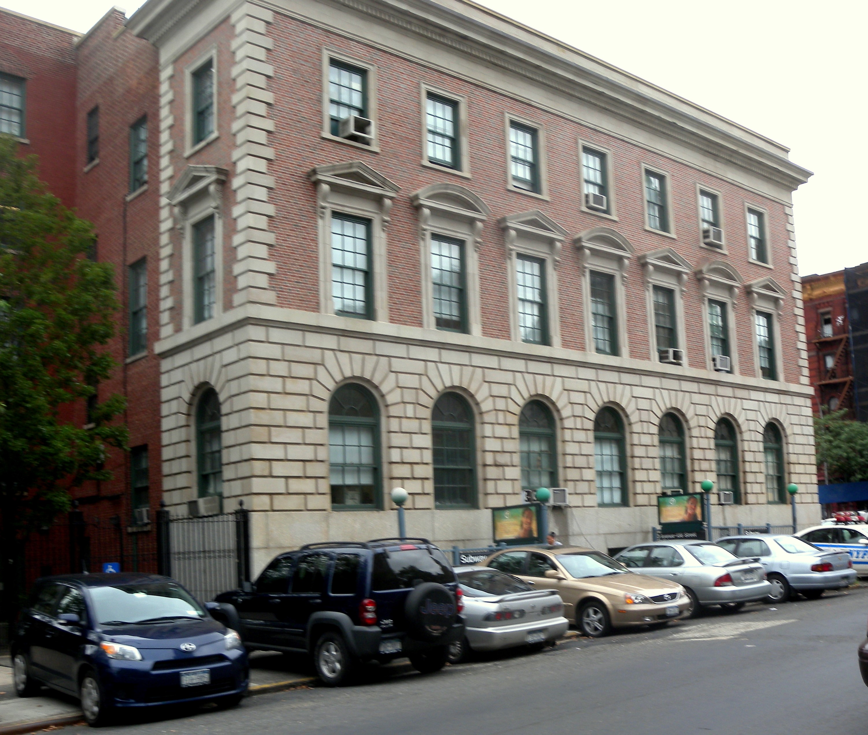
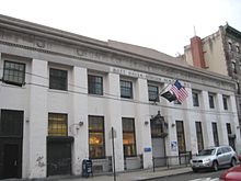 Post Office
 40th Precinct, NYPD
Land use and terrain
Mott Haven is dominated by tenement style apartment buildings and large public housing complexes. There are three historical district consisting of brownstone style rowhouses. In the last two decades, construction of modern 2 and 3 unit row-houses and apartment buildings have increased the percentage of owners versus renters. The neighborhood contains one of the highest concentrations of NYCHA projects in the Bronx. The total land area is roughly one square miles. The terrain is low laying and flat though somewhat hilly around St. Mary's Park.
Historical districts and landmarks
Three Historic Districts are located in Mott Haven: Mott Haven, Mott Haven East and the Bertine Block:
- The Mott Haven Historic District is located on Alexander Avenue between East 138th Street and East 141st Street.[1] The district contains the row of handsome brownstones known historically as Doctors Row and Irish Fifth Avenue as well as the police station, the 1905 neo-renaissance Mott Haven Branch of the New York Public Library and Saint Jerome's Roman Catholic Church.[2]
- The Mott Haven East Historic District is located on East 139th and East 140th Street between Brook and Willis Avenues. The district contains rows of handsome brownstones designed by William O'Gorman and William Hornum in 1883 combining Dutch and Flemish architectural aspects on the north side of E.140th Street and neo-Grecian aspects on the south side of E.140th Street and on E.139th Street..[3]
- The Bertine Block Historic District is located on East 136th Street between Brook and Willis Avenues. The district contains yellow-faced brick brownstones designed by Edward Bertine between 1891 and 1895. .[4][5]
- St. Ann's Episcopal Church
St. Ann's Episcopal Church is located on the west side of St.Ann's Avenue between East 139 and East 141st Streets. It is The Bronx' oldest church, having been built in 1841 and dedicated to Gouverneur Morris' mother Ann. Notable figures buried there include Lewis Morris, a signer of the Declaration of Independence, Goveurneur Morris, and former mayor of New York R.H.Morris.
Further information: St. Ann's Church Complex (Bronx, New York)Public housing projects
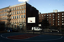
 NYCHA Betances Houses on Brook Avenue
The seventeen NYCHA developments in Mott Haven illustrate the various types of public housing initiatives in vogue in New York City over the decades.[6]
- There are seventeen NYCHA developments located in Mott Haven.
- Dr. Ramon E. Betances I; thirteen buildings, 3, 4, 11 and 19-stories tall.
- Dr. Ramon E. Betances II, 13; one 6-story building.
- Dr. Ramon E. Betances II, 18; two buildings, 4 and 6-stories tall.
- Dr. Ramon E. Betances II, 9A; one 4-story building.
- Dr. Ramon E. Betances III, 13; two rehabilitated tenement buildings, 5-stories tall.
- Dr. Ramon E. Betances III, 18; one rehabilitated and three abandoned tenement buildings 5-stories tall.
- Dr. Ramon E. Betances III, 9A; two rehabilitated tenement buildings 6-stories tall.
- Dr. Ramon E. Betances IV; eight buildings, 3, 4 and 5-stories tall with 282 apartments.
- Dr. Ramon E. Betances V; six rehabilitated tenement buildings, 5 and 6-stories tall
- Dr. Ramon E. Betances VI; three rehabilitated tenement buildings, 5 and 6-stories tall.
- Millbrook Houses; nine, 16-story buildings.
- Millbrook Extension; one 16-story building.
- Mitchel Houses; ten buildings, 17, 19, and 20-stories tall.
- Moore Houses; two, 20-story buildings.
- Mott Haven Houses; eight buildings, 20 and 22-stories tall.
- Patterson Houses; fifteen buildings 6 and 13-stories tall.
- Southern Boulevard M.H.O.P. (Multi Family Homeownership Program); One 7-story rehabilitated tenement building
History
 1 Bruckner Boulevard
The area that is now called Mott Haven was originally owned by the Morris family. A small part of the larger swath of land known as Morrisania, it was purchased by Jordan Lawrence Mott for his iron works in 1849. A vestige of the iron works can be seen just west of the Third Ave. bridge on E. 134th St. St. Ann's Church (ECUSA) on St. Ann's Avenue is the resting place of Lewis Morris, Gouverneur Morris and other members of that powerful colonial family, and a Registered Historic Place.
As the city below grew, the area quickly developed residentially. At the same time, an upper-middle class residential area, marked by brownstones built in an elaborate and architecturally daring fashion, started to grow along Alexander Avenue by the 1890s. (Doctors Row a/k/a the Irish Fifth Ave.) A series of brownstones on E. 134th St, east of Willis Ave., was known as Judges' Row. Soon after, the Bronx grew more quickly, especially with public transit into the area, including the IRT Ninth Avenue Line. By the early 20th century, the population density of the area supported the construction of many tenement style apartment buildings.
From the end of the 19th century through the 1940s, Mott Haven was a mixed German-American (north of E. 145th St.)and Irish-American neighborhood (south of E. 145th St), with an Italian enclave west of Lincoln Ave. The derogatory term "pig" for a policeman is thought to have originated here because of a tough Irish cop who wielded his night stick on Willis Ave. drunks without mercy, known as Paddy the Pig of the 40 Pct.
One of the largest parades in NYC took place here in the late 1940s and early 1950s. It was organized by Sean Oglaigh na hEirann, the veterans of the Irish Republican Army, who marched every Easter Sunday, down Willis Ave. from the Hub to E. 138th st., thence west to St. Jerome's. The Star of Munster Ballroom at the NE corner of Willis Ave. and E. 138th St., was a center of Irish music for decades. It was speculated at one time that there were more bars on Willis Ave than on any other city street, given its short distance. More recorded Irish musicians lived in Mott haven than in any place outside of Ireland.
The first Puerto Rican settlements came in the late 1940s along the length of Brook Ave. African-Americans came into the area when Patterson Houses were built.
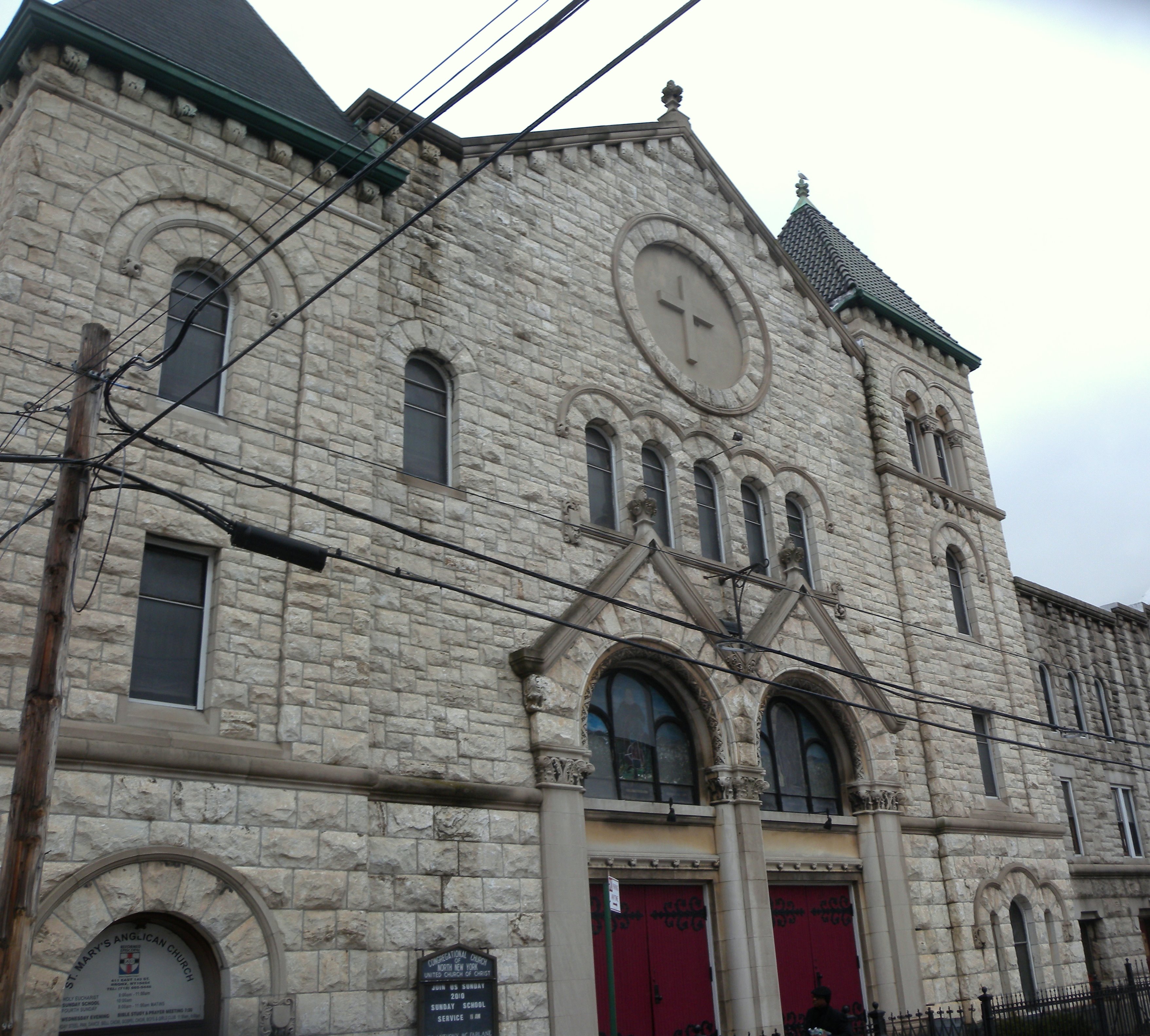
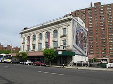 North Side Board of Trade
 North New York Congregationalist Church
Mott Haven and Port Morris were the first neighborhoods to give rise to the term "South Bronx". Together, they were originally known as the North Side or North New York. This area was part of New York County after the incorporation of Greater NY in 1898. The Chase Manhattan Bank at Third Ave. and E. 137th St., was originally the North Side Board of Trade Bldg (1912). It later became the North Side Savings Bank, which became Dollar Dry Dock, which became Chase.
In the 1940s when the Bronx was usually divided into the East Bronx and West Bronx, a group of social workers identified a pocket of poverty on East 134th Street, east of Brown Place and called it the South Bronx. This pocket of poverty would spread in part due to an illegal practice known as blockbusting and to Robert Moses building several housing projects in the neighborhood. The poverty greatly expanded northward, following the post-war phenomenon colloquially referred to as white flight, reaching a peak in the 1960s when the socioeconomic North Bronx-South Bronx boundary reached Fordham Road. At this time a wave of arson destroyed or damaged many of the residential, commercial, and industrial structures in the area.
Today the North Bronx-South Bronx distinction remains more common than the traditional East Bronx-West Bronx distinction, and some still regard Fordham Road as the boundary. Though crime has declined versus the highs of the crack epidemic and revitalization of former abandoned properties is taking place the neighborhood continues to deal with serious crime issues due to it's significant population in poverty. There have been significant strides to increase gentrification of the neighborhood by those in the real estate sector however the primary newcomers have been poor and working class. There have been increasing populations of young professional high income earners taking advantage of the more affordable properties, but not close in comparison to that of Northern Brooklyn. The area will likely continue to be lower income for some time due to the fact most of the new housing being built has income ceilings along with all the rest of rent controlled property that already exist.
However Mott Haven was home to the Bronx first organic market and has seen significant improvements in terms of quality of life.
The area is patrolled by the 40th Precinct located at 257 Alexander Avenue. NYCHA property in the area is patrolled by P.S.A. 7 at 737 Melrose Avenue located in the Melrose section of the Bronx.
Education
 PS 18, Morris Avenue
 JHS 149, Willis Avenue
Public:
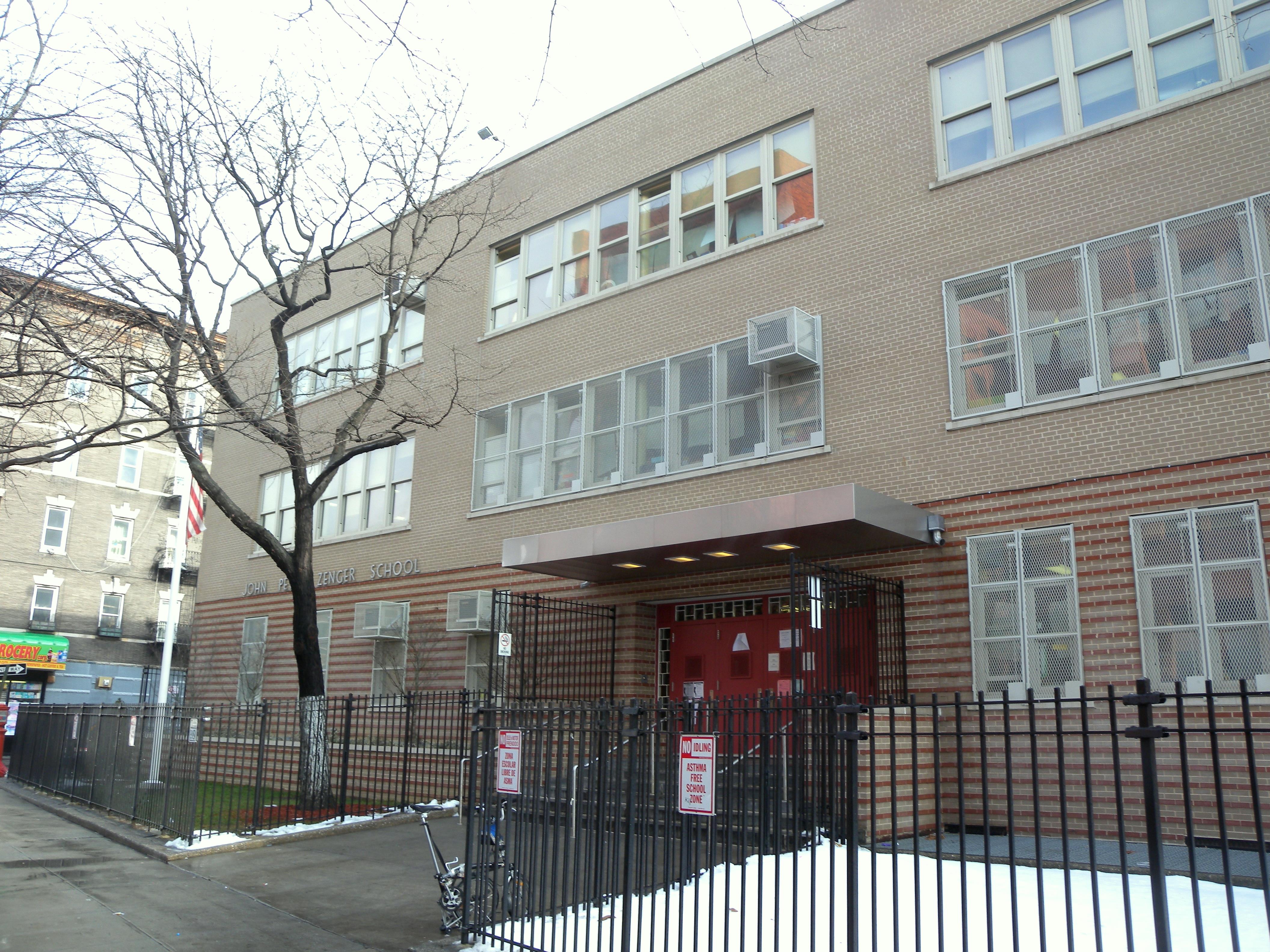
- P.S. 18 John Peter Zenger School (East 148th St and Morris Av)
- P.S. 277 Dr. Evelina Lopez Antonetty (East 147th St and St. Ann's Av)
- P.S. 30 Wilton School (East 141st St and Brook Av)
- P.S. 40 Mott Haven Village (East 140th St and Brook Av)
- P.S. 43 Jonas Bronck School (East 136th St and Brown Place)
- P.S. 49 Willis Avenue School (East 139th St and Willis Av)
- P.S. 65 Mother Hale Academy (East 141st St and Cypress Av)
- I.S. 139 A. Burger Intermediate School (East 143rd St and Brook Av)
- J.H.S. 149 E. D. Clark Junior High School (East 145th St and Willis Av)
- P.S. 154 Johnathan D. Hyatt School (East 135th St and Alexander Av)
- I.S. 183 Paul Robeson School (East 140th St and Morris Av)
- P.S. 754 School For Career Development/Foreign Language Academy Of Global Studies (East 147th St and Jackson Av)
- South Bronx Charter School for International Cultures and the Arts
- The Bronx Charter School for Children
- The Bronx Academy of Letters
- Bronx School For Law Government And Justice (Schools within Bronx School For Law Government And Justice are Health Opportunities Program)
- Samuel Gompers High School
- Euginio Maria De Hostos Community College (C.U.N.Y.) (Schools within Euginio Maria De Hostos Community College are Hostos Lincoln Academy.)
Parochial:
- Saint Jerome School
- Saint Luke School
- Saint Pius V School
- Saint Pius V High School
Transportation
- Bx1: to Riverdale (via Grand Concourse)
- Bx2: to Kingsbridge Heights (via Grand Concourse)
- Bx15: to Fordham Plaza or Manhattanville (via Third Avenue)
- Bx17: to Fordham Plaza (via Prospect-Crotona Avenues)
- Bx21: to Westchester Square – East Tremont Avenue (6 <6> trains) (via Boston Road–Morris Park Avenue)
- Bx32: to VA Hospital (via Morris Avenue-Jerome Avenue)
- Bx33: to Harlem or Port Morris, Bronx (via 138th Street)
- 138th Street – Grand Concourse (4 5 trains)
- Third Avenue – 138th Street (6 <6> trains)
- Brook Avenue (6 train)
- Cypress Avenue (6 train)
- East 143rd Street – St. Mary's Street (6 train)
- 149th Street – Grand Concourse (2 4 5 trains)
- Third Avenue – 149th Street (2 5 trains)
Notable natives
- Rapper A.G. of the duo Showbiz and A.G., was raised in the Patterson Houses.[citation needed]
- Rod Strickland, NBA Player was raised in Mitchel Houses.
- Former boxer Iran Barkley was raised in Patterson Houses.
- Former drug lord Guy Fisher is from Patterson Houses.
- Nate Archibald, former NBA Player was raised in Patterson Houses.
- Rapper Percee P was raised in Patterson Houses.
- ESG (band) are from Moore Houses.
- French Montana, rapper.
References
- ^ http://www.nyc.gov/html/lpc/downloads/pdf/maps/mott_haven.pdf
- ^ Mott Haven Landmarked District
- ^ Mott Haven East Landmarked District
- ^ Bertine Block Landmarked District
- ^ "To Have and Have Mott". Forgotten New York. http://www.forgotten-ny.com/STREET%20SCENES/motthaven/mott.html. Retrieved 2010-01-16.
- ^ NYCHA
External links
- The Mott Haven Herald - produced by the CUNY Graduate School of Journalism
- Forgotten-NY Discussion on Mott Haven
- History of Morrisania
- Pictures of Mott Haven Historic Districts
- http://www.bronxmall.com/commboards/needscb1.html Historical and demographic information on Mott Haven from Community Board 1
Neighborhoods in the New York City Borough of The Bronx Allerton · Baychester · Bedford Park · Belden Point · Belmont (Arthur Avenue) · Castle Hill · City Island · Clason Point · Crotona Park East · Co-op City · Country Club · East Bronx · Eastchester · East Tremont · Edenwald · Ferry Point Park · Fieldston · Fordham · Harding Park · Highbridge · Hudson Hill · Hunts Point · The Hub · Kingsbridge · Kingsbridge Heights · Locust Point · Longwood · Marble Hill · Melrose · Morrisania · Morris Heights · Morris Park · Mott Haven · North Bronx · North Riverdale · Norwood · Olinville · Parkchester · Pelham Bay · Pelham Gardens · Pelham Parkway · Port Morris · Riverdale · Silver Beach · Soundview · South Bronx · Spuyten Duyvil · Throggs Neck · Tremont · University Heights · Van Cortlandt Village · Van Nest · Wakefield · West Bronx · West Farms · Williamsbridge Woodlawn

Community Boards: 1 · 2 · 3 · 4 · 5 · 6 · 7 · 8 · 9 · 10 · 11 · 12 Coordinates: 40°48′32″N 73°55′22″W / 40.8089897°N 73.9229147°W
Categories:- Neighborhoods in the Bronx
- Populated places in the United States with Hispanic majority populations


Wikimedia Foundation. 2010.