- Henry Hudson Parkway
-
Henry Hudson Parkway
Route information Length: 11.05 mi[2] (17.78 km) Existed: 1933–1936[1] – present Major junctions South end:  NY 9A/West Side Highway in Manhattan
 I-95 in Fort Washington Park
 US 9 / NY 9A in Riverdale
North end:  Saw Mill Parkway at the Bronx-Westchester county line
Location Counties: New York, Bronx Highway system Numbered highways in New York
Interstate • U.S. • N.Y. (former) • Reference • CountyThe Henry Hudson Parkway is an 11.05-mile (17.78 km) long parkway in New York City. The southern terminus is at West 72nd Street in Manhattan, where the parkway continues south as the West Side Highway. It is often erroneously referred to as the West Side Highway throughout its entire course in Manhattan. The northern terminus is at the Bronx-Westchester County boundary, where it continues north as the Saw Mill River Parkway. All of the parkway is designated New York State Route 907V, an unsigned reference route; however, all but the northernmost mile of the road is also designated as part of the signed New York State Route 9A.
The owners of the parkway are the New York State Department of Transportation, New York City Department of Transportation, New York City Department of Parks and Recreation, Metropolitan Transportation Authority, Amtrak, and Port Authority of New York and New Jersey. The Henry Hudson Parkway was created by the Henry Hudson Parkway Authority, which was run by "master builder" Robert Moses. The highway itself was constructed from 1934–1937.
Contents
Route description
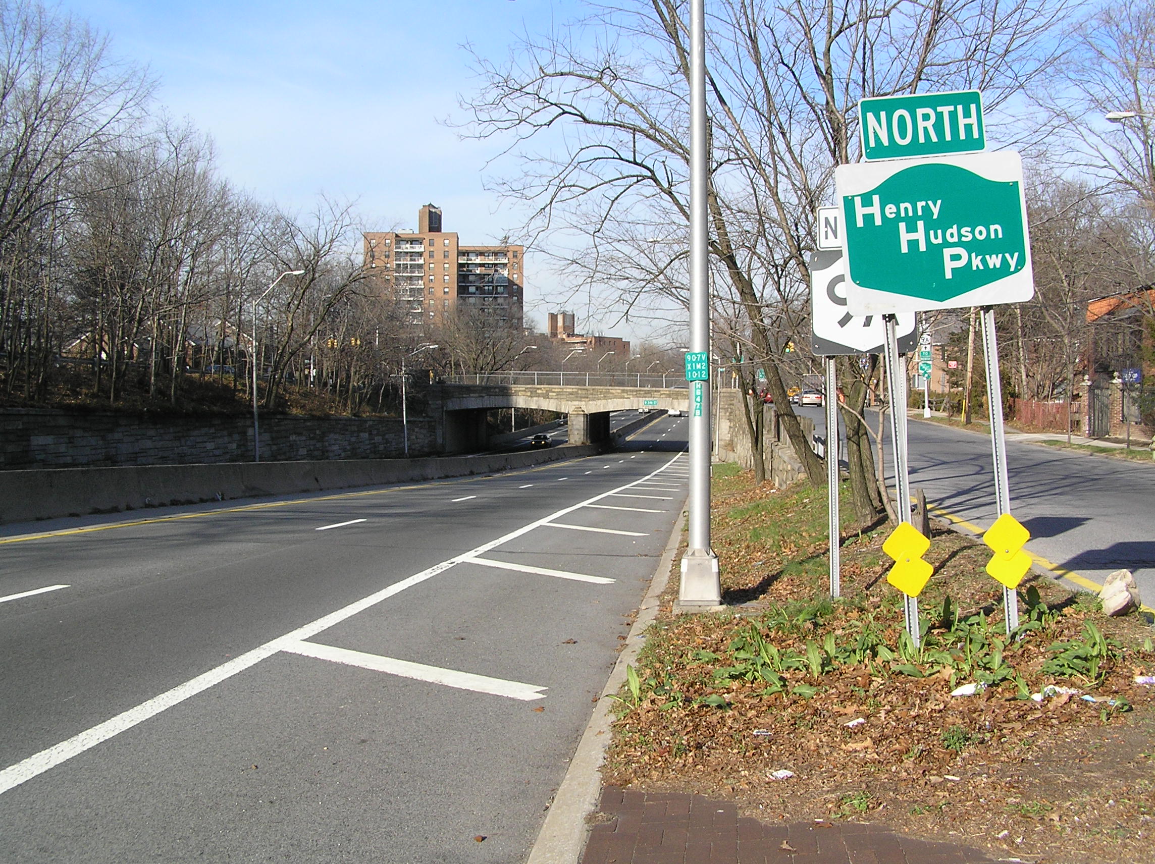
 The Henry Hudson Parkway in Riverdale
The Henry Hudson Parkway begins at an interchange with West 72nd Street in Riverside Park. It is connected by a short remnant of the Miller Highway to the West Side Highway, heading in a northward direction along the west side of Manhattan. It has a large interchange with West 79th Street, with more intermittent exits onto surface streets along the way. The parkway continues in a northerly direction, running almost parallel to Riverside Drive north of West 158th Street. It passes under I-95 and the George Washington Bridge as it continues its progression through Fort Washington Park, Fort Tryon Park, and Inwood Hill Park. It is in Inwood Hill Park that the parkway meets NY 9A and runs concurrently with it northward across the Henry Hudson Bridge into the Bronx.
Upon entering the Bronx, the parkway passes through Spuyten Duyvil and Riverdale as it continues northward, edging slightly to the northeast. At exit 23, NY 9A leaves the parkway for US 9 while the parkway enters Van Cortlandt Park. Soon after it enters the park, the parkway has an interchange with the Mosholu Parkway, which connects it to I-87. Less than a mile further, the parkway merges with the Saw Mill Parkway and terminates at this point.
History
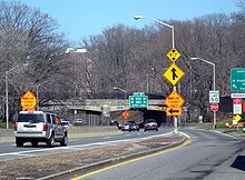 Exit 20, West 237/239th Street
The Parkway was completed on October 12, 1937, under New York master builder Robert Moses. It cost $109 million, twice as expensive as the $49 million Hoover Dam that was built in the same period. The Parkway was part of Moses's "West Side Improvement" and included covering the New York Central Railroad's West Side Line, creating the Freedom Tunnel. The covered portion is partially used for the highway and also expands the Riverside Park designed by Frederick Law Olmsted.[1]
On May 12, 2005 part of a retaining wall at Castle Village collapsed onto the northbound lanes of the parkway, just north of the George Washington Bridge, shutting it down shortly before rush hour. The clean-up began quickly, and the road re-opened on May 15.[3]
Future
The Henry Hudson Parkway is a candidate for designation as a New York State Scenic Byway, the first in New York City. At the request of the Henry Hudson Parkway Task Force, in 2005 the New York Metropolitan Transportation Council approved funding to develop a comprehensive corridor management plan, a requirement for its designation.[1]
Exit list
County Location Mile[2] Exit Destinations Notes New York Riverside Park 0.00 9 West 72nd Street, Riverside Drive Northbound entrance only; the former northbound exit was permanently closed on July 8, 2007[4] 0.35 10 West 79th Street - Boat Basin Signed as exit 10A (West 79th Street) and exit 10B (Boat Basin) on northbound; Signed as 79th Street on southbound parkway 1.29 West 95th Street (south) / West 96th Street (north) 2.47 12 West 125th Street Signed as 125th Street on northbound parkway 4.22 13 West 158th Street Fort Washington Park 4.92 14 I-95 (George Washington Bridge, Cross Bronx Expressway, US 1 / US 9) / West 178th StreetWest 178th Street not signed on southbound parkway 15 Riverside Drive No access to northbound Riverside Drive from northbound parkway 16 Fort Tryon Park, Cloisters At-grade intersection; Access from northbound parkway only Inwood Hill Park 6.78 17 Dyckman Street Henry Hudson Bridge over the Harlem River- Toll: $4.00 in both directions Bronx Spuyten Duyvil 18 Kappock Street No entrance ramps 19 West 232nd Street Riverdale 20 West 237th Street (south) / West 239th Street (north) 21 West 246th Street / West 250th Street No southbound entrance; no access to West 250th Street from southbound parkway 9.64 22 West 254th Street (south) / West 253rd Street (north) / Riverdale Avenue 10.05 23 US 9 / NY 9A north (Broadway)North end of NY 9A overlap; signed as exits 23A (south) and 23B (north) northbound; NY 9A not signed Van Cortlandt Park 10.62 24 
 Mosholu Parkway to I-87 south (Deegan Expressway)
I-87 not signed on northbound parkway 11.05 Saw Mill Parkway northContinuation into Westchester County 1.000 mi = 1.609 km; 1.000 km = 0.621 mi References
- ^ a b c Anderson, Steve. "Henry Hudson Parkway (NY 9A)". NYCRoads. http://www.nycroads.com/roads/henry-hudson/. Retrieved March 18, 2010.
- ^ a b "2007 Traffic Data Report for New York State" (PDF). New York State Department of Transportation. July 25, 2008. https://www.nysdot.gov/divisions/engineering/technical-services/hds-respository/NYSDOT_Traffic_Data_Report_2007.pdf. Retrieved July 17, 2009.
- ^ "Board of Inquiry Report – Castle Village Retaining Wall Collapse" (PDF). New York City Department of Buildings. April 2007. http://nyc.gov/html/dob/downloads/pdf/castle_village_report.pdf. Retrieved April 2, 2010.
- ^ "Henry Hudson Exit Ramp at 72nd Street to be Closed" (Press release). New York City Department of Transportation. July 5, 2007. http://www.nyc.gov/html/dot/html/pr2007/pr07_54.shtml. Retrieved April 1, 2010.
External links
Parkways in New York City Manhattan FDR Drive - Harlem River Drive - Henry Hudson ParkwayThe Bronx Brooklyn-Queens Belt Parkway system: Cross Island - Laurelton - Shore - Southern
Others: Grand Central - Jackie Robinson (Interborough)
Former: Gowanus - Whitestone - Long Island Motor ParkwayStaten Island Korean War Veterans (Richmond)
Former: Willowbrook - Proposed: Wolfe's PondCategories:- Parkways in New York City
- Robert Moses projects
- Riverdale, Bronx
- Transportation in the Bronx


Wikimedia Foundation. 2010.