- Greene County, Arkansas
Infobox U.S. County
county = Greene County
state = Arkansas
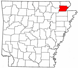
map size = 225
founded = 5 November 1833
seat = Paragould | area_total_sq_mi =580
area_land_sq_mi =578
area_water_sq_mi =2
area percentage = 0.37%
census yr = 2000
pop = 37331
density_km2 =25
web =
|Greene County is a
county located in theU.S. state ofArkansas . As of 2000, the population was 37,331. Thecounty seat is Paragould,GR|6 which sits atopCrowley's Ridge .The Paragould
Micropolitan Statistical Area includes all of Greene County. The Paragould Micropolitan Statistical Area is also part of the larger Jonesboro–Paragould Combined Statistical Area.History
The first settler to the area was Benjamin Crowley of
Kentucky who arrived in1821 and established a home about 12 miles west of Paragould.Greene County was formed on
5 November 1833 out of portions of Lawrence County and contained portions of present Clay and Craighead counties. The county was named afterRevolutionary War heroNathanael Greene . The original county seat was in Benjamin Crowley's home. By 1836, when Arkansas became a state, the county seat was located at a settlement called "Paris" (not to be confused with present-dayParis, Arkansas ).In 1848 a national highway was put through and the county seat was moved to the community of Gainesville, Arkansas which had a reputation as a relatively lawless town. The county seat remained there until 1883 when it was moved to the new town of Paragould. The residents of Gainesville opposed the move and it is reported that shots were fired and tempers were high. A new courthouse was built in 1888 and the building still survives in downtown Paragould.
Geography
According to the
U.S. Census Bureau , the county has a total area of 580square mile s (1,501km² ), of which, 578 square miles (1,496 km²) of it is land and 2 square miles (6 km²) of it (0.37%) is water.Major Highways
*
*
*
*Adjacent counties
*Clay County (north)
*Dunklin County, Missouri (east)
*Craighead County (south)
*Lawrence County (southwest)
*Randolph County (northwest)Demographics
As of the
census GR|2 of 2000, there were 37,331 people, 14,750 households, and 10,708 families residing in the county. Thepopulation density was 65 people per square mile (25/km²). There were 16,161 housing units at an average density of 28 per square mile (11/km²). The racial makeup of the county was 97.45% White, 0.13% Black or African American, 0.42% Native American, 0.17% Asian, 0.02% Pacific Islander, 0.47% from other races, and 1.34% from two or more races. 1.16% of the population were Hispanic or Latino of any race.There were 14,750 households out of which 33.10% had children under the age of 18 living with them, 59.20% were married couples living together, 9.70% had a female householder with no husband present, and 27.40% were non-families. 24.00% of all households were made up of individuals and 11.00% had someone living alone who was 65 years of age or older. The average household size was 2.49 and the average family size was 2.95.
In the county the population was spread out with 25.20% under the age of 18, 9.10% from 18 to 24, 28.70% from 25 to 44, 23.10% from 45 to 64, and 13.90% who were 65 years of age or older. The median age was 36 years. For every 100 females there were 95.30 males. For every 100 females age 18 and over, there were 91.90 males.
The median income for a household in the county was $30,828, and the median income for a family was $37,316. Males had a median income of $27,535 versus $20,375 for females. The
per capita income for the county was $16,403. About 9.90% of families and 13.30% of the population were below thepoverty line , including 15.40% of those under age 18 and 12.80% of those age 65 or over.Cities and towns
References
Wikimedia Foundation. 2010.