- City of Kalgoorlie-Boulder
-
This article is about a local government area. For the city, see Kalgoorlie, Western Australia.
City of Kalgoorlie-Boulder
Western Australia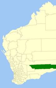
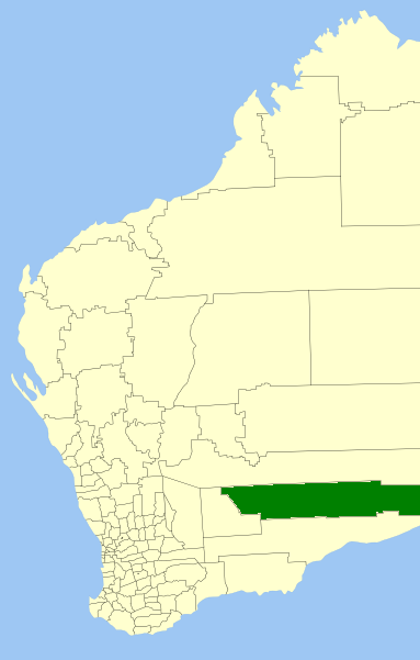
Location in Western AustraliaPopulation: 32,620(2010)[1] Area: 95575.1 km² (36,901.8 sq mi) Mayor: Ron Yuryevich Council Seat: Kalgoorlie Region: Goldfields-Esperance State District: Kalgoorlie, Eyre Federal Division: O'Connor LGAs around City of Kalgoorlie-Boulder: Menzies Menzies Outback Areas (SA) Coolgardie City of Kalgoorlie-Boulder Outback Areas (SA) Coolgardie Dundas Outback Areas (SA) The City of Kalgoorlie-Boulder is a Local Government Area in the Goldfields-Esperance region of Western Australia, about 550 kilometres (342 mi) east of the state capital, Perth. The City covers an area of 95,575 square kilometres (36,902 sq mi), and its seat of government is the town of Kalgoorlie; all but 244 of the city's population live either in Kalgoorlie or in Boulder. In terms of area, Kalgoorlie-Boulder is the largest city in Australia, and the third-largest city in the world, with a total area of 95,575km2.
Contents
History
In the years immediately after discovery of gold in the region, a variety of local government entities sprang up around the often-temporary settlements on the Kalgoorlie goldfields. Only three persisted beyond the early 20th century:
- Boulder Municipal Council (1897–1961) - later Town of Boulder (1961-1969)
- Kalgoorlie Roads Board (1896–1961) - later Shire of Kalgoorlie (1961-1969)
- Kalgoorlie Municipal Council (1895–1961) - later Town of Kalgoorlie (1961-1989)
- Shire of Boulder (1969-1989)
The others were:
- Broad Arrow Municipal Council (1897–1903)
- Broad Arrow Roads Board (1899–1922)
- Broad Arrow-Paddington Municipal Council (1903–1910)
- Bulong Municipal Council (1896–1909)
- Bulong Roads Board (1899–1911)
- East Coolgardie Roads Board (1895–1897)
- Kanowna Municipal Council (1896–1917)
- North East Coolgardie Roads Board (1896–1922)
- Paddington Municipal Council (1901–1903)
Major Roads in the region
- Goldfields Highway
- Boulder Road
- Anzac Drive
- Gatacre Drive
- Picadilly Street
- Hannan Street
- Graeme Street
- Maritana Street
- Federal Road
- Great Eastern Highway
Origins of the City

Key dates
- 1 July 1961 - Boulder and Kalgoorlie municipalities became Town Councils, and Kalgoorlie Roads Board became a Shire Council, following changes to the Local Government Act
- 1 July 1969 - Town of Boulder was amalgamated into the Shire of Kalgoorlie, which was renamed Shire of Boulder.
- 1 February 1989 - The Shire of Boulder and Town of Kalgoorlie amalgamated to form the City of Kalgoorlie-Boulder.[2]
Wards
The City is not divided into wards and the 12 councillors sit at large. The mayor is elected by popular vote.
Suburbs
- Kalgoorlie
- Boulder
- Binduli
- Broadwood
- Brown Hill
- Fimiston
- Hannans
- Ivanhoe
- Karlkurla
- Lamington
- Mullingar
- Parkeston
- Piccadilly
- Somerville
- South Boulder
- South Kalgoorlie
- Trafalgar
- Victory Heights
- West Kalgoorlie
- West Lamington
- Williamstown
- Yilkari
Towns
- Balagundi
- Balgarri
- Bardoc
- Black Flag
- Boorara
- Broad Arrow
- Bulong
- Coonana
- Cundeelee
- Emu Flat
- Feysville
- Forrest
- Gindalbie
- Golden Ridge
- Gudarra (formerly Paddington)
- Kanowna
- Kurnalpi
- Lakewood
- Loongana
- Mount Monger
- Mulgarrie
- Ora Banda
- Rawlinna
- Waverley
- Windanya
- Zanthus
References
- ^ Australian Bureau of Statistics (31 March 2011). "Regional Population Growth, Australia, 2009–10 - Western Australia". http://www.abs.gov.au/ausstats/abs@.nsf/Products/3218.0~2009-10~Main+Features~Western+Australia?OpenDocument. Retrieved 10 May 2011.
- ^ WA Electoral Commission, Municipality Boundary Amendments Register (release 2.0), 31 May 2003.
External links
Categories:- Local Government Areas of Western Australia
- Goldfields-Esperance
- Kalgoorlie-Boulder

Wikimedia Foundation. 2010.