- Monona County, Iowa
-
Monona County, Iowa 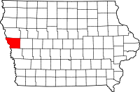
Location in the state of Iowa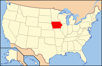
Iowa's location in the U.S.Founded 1851 Seat Onawa Area
- Total
- Land
- Water
698.85 sq mi (1,810 km²)
693.12 sq mi (1,795 km²)
5.73 sq mi (15 km²), 0.82%Population
- (2010)
- Density
9,243
13/sq mi (5/km²)Time zone Central: UTC-6/-5 Footnotes: Population [1] Monona County is a county located in the U.S. state of Iowa. The population was 9,243 in the 2010 census, a decline from 10,020 in the 2000 census.[1][2] The county seat is Onawa. [3]
Contents
Geography
According to the 2000 census, the county has a total area of 698.85 square miles (1,810.0 km2), of which 693.12 square miles (1,795.2 km2) (or 99.18%) is land and 5.73 square miles (14.8 km2) (or 0.82%) is water.[4]
Major highways
Adjacent counties
- Woodbury County (north)
- Crawford County (east)
- Harrison County (south)
- Burt County, Nebraska (southwest)
- Thurston County, Nebraska (west)
History
Monona County was formed in 1851. It was perhaps named for the Indian word meaning "beautiful valley."[5]
Demographics
Historical populations Census Pop. %± 1860 832 — 1870 3,654 339.2% 1880 9,055 147.8% 1890 14,515 60.3% 1900 17,980 23.9% 1910 16,633 −7.5% 1920 17,125 3.0% 1930 18,213 6.4% 1940 18,238 0.1% 1950 16,303 −10.6% 1960 13,916 −14.6% 1970 12,069 −13.3% 1980 11,692 −3.1% 1990 10,034 −14.2% 2000 10,020 −0.1% 2010 9,243 −7.8% Iowa Data Center [2] 2010 census
The 2010 census recorded a population of 9,243 in the county, with a population density of 13.3354/sq mi (5.14881/km2). There were 4,697 housing units, of which 4,050 were occupied.[1]
2000 census
 2000 Census Age Pyramid for Monona County
As of the census[6] of 2000, there were 10,020 people, 4,211 households, and 2,737 families residing in the county. The population density was 14 people per square mile (6/km²). There were 4,660 housing units at an average density of 7 per square mile (3/km²). The racial makeup of the county was 98.34% White, 0.08% Black or African American, 0.76% Native American, 0.12% Asian, 0.04% Pacific Islander, 0.08% from other races, and 0.58% from two or more races. 0.70% of the population were Hispanic or Latino of any race.
There were 4,211 households out of which 26.70% had children under the age of 18 living with them, 54.50% were married couples living together, 7.10% had a female householder with no husband present, and 35.00% were non-families. 31.00% of all households were made up of individuals and 17.50% had someone living alone who was 65 years of age or older. The average household size was 2.31 and the average family size was 2.88.
In the county the population was spread out with 23.20% under the age of 18, 6.20% from 18 to 24, 23.30% from 25 to 44, 23.30% from 45 to 64, and 23.90% who were 65 years of age or older. The median age was 43 years. For every 100 females there were 94.20 males. For every 100 females age 18 and over, there were 90.50 males.
The median income for a household in the county was $33,235, and the median income for a family was $41,172. Males had a median income of $27,349 versus $19,607 for females. The per capita income for the county was $17,477. About 6.60% of families and 9.40% of the population were below the poverty line, including 8.90% of those under age 18 and 9.50% of those age 65 or over.
Cities and towns
See also
References
- ^ a b c "Population & Housing Occupancy Status 2010". United States Census Bureau American FactFinder. http://factfinder2.census.gov/faces/tableservices/jsf/pages/productview.xhtml?pid=DEC_10_PL_GCTPL2.ST05&prodType=table. Retrieved May 31, 2011.
- ^ a b "Data from the 2010 Census". State Data Center of Iowa. http://www.iowadatacenter.org/archive/2011/02/feb10. Retrieved May 31, 2011.
- ^ "Find a County". National Association of Counties. http://www.naco.org/Counties/Pages/FindACounty.aspx. Retrieved 2011-06-07.
- ^ "Census 2000 U.S. Gazetteer Files: Counties". United States Census. http://www.census.gov/tiger/tms/gazetteer/county2k.txt. Retrieved 2011-02-13.
- ^ Monona County
- ^ "American FactFinder". United States Census Bureau. http://factfinder.census.gov. Retrieved 2008-01-31.
External links
- Discover Monona County Portal style website, The Communities, Recreation and more

Woodbury County Thurston County, Nebraska 
Crawford County  Monona County, Iowa

Burt County, Nebraska Harrison County Municipalities and communities of Monona County, Iowa County seat: Onawa Cities 
Indian reservations Footnotes ‡This populated place also has portions in an adjacent county or counties
Coordinates: 42°02′50″N 95°58′07″W / 42.04722°N 95.96861°W
Categories:- Iowa counties
- Monona County, Iowa
- 1851 establishments in the United States
- Iowa counties on the Missouri River


Wikimedia Foundation. 2010.