- Oktibbeha County, Mississippi
-
Oktibbeha County, Mississippi 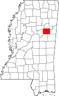
Location in the state of Mississippi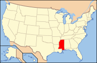
Mississippi's location in the U.S.Founded 1833 Seat Starkville Largest city Starkville Area
- Total
- Land
- Water
461.90 sq mi (1,196 km²)
457.71 sq mi (1,185 km²)
4.19 sq mi (11 km²), 0.91%Population
- (2010)
- Density
47,671
104/sq mi (40/km²)Website www.gtpdd.com/counties/oktibbeha Oktibbeha County is a county located in the U.S. state of Mississippi. As of 2010, the population was 47,671. Its county seat is Starkville[1]. Oktibbeha is a Native American word meaning either bloody water (because of a battle fought on the banks) or possibly icy creek. Indian artifacts over 2000 years old have been found near the Indian mounds adjacent to Indian Mound Campground, just east of Starkville.
The Starkville Micropolitan Statistical Area includes all of Oktibbeha County.
Contents
Geography
According to the 2000 census, the county has a total area of 461.90 square miles (1,196.3 km2), of which 457.71 square miles (1,185.5 km2) (or 99.09%) is land and 4.19 square miles (10.9 km2) (or 0.91%) is water.[2]
Major highways
 U.S. Highway 82
 Mississippi Highway 12
 Mississippi Highway 25
 Mississippi Highway 182
Adjacent counties
- Noxubee County (southeast)
- Winston County (south)
- Choctaw County (west)
- Webster County (northwest)
- Clay County (north)
- Lowndes County (east)

Webster County Clay County Choctaw County 
Lowndes County  Oktibbeha County, Mississippi

Winston County Noxubee County National protected areas
- Noxubee National Wildlife Refuge (part)
- Tombigbee National Forest (part)
Demographics
Historical populations Census Pop. %± 1840 4,276 — 1850 9,171 114.5% 1860 12,977 41.5% 1870 14,891 14.7% 1880 15,978 7.3% 1890 17,694 10.7% 1900 20,183 14.1% 1910 19,676 −2.5% 1920 16,872 −14.3% 1930 19,119 13.3% 1940 22,151 15.9% 1950 24,569 10.9% 1960 26,175 6.5% 1970 28,752 9.8% 1980 36,018 25.3% 1990 38,375 6.5% 2000 42,902 11.8% 2010 47,671 11.1% MS Counties 1900-1990
GeoHive - 2000 & 2010 statisticsAs of the census[3] of 2000, there were 42,902 people, 15,945 households, and 9,264 families residing in the county. The population density was 94 people per square mile (36/km²). There were 17,344 housing units at an average density of 38 per square mile (15/km²). The racial makeup of the county was 58.66% White, 37.43% Black or African American, 0.16% Native American, 2.53% Asian, 0.03% Pacific Islander, 0.47% from other races, and 0.71% from two or more races. 1.07% of the population were Hispanic or Latino of any race.
There were 15,945 households out of which 28.20% had children under the age of 18 living with them, 39.90% were married couples living together, 14.80% had a female householder with no husband present, and 41.90% were non-families. 27.70% of all households were made up of individuals and 6.70% had someone living alone who was 65 years of age or older. The average household size was 2.42 and the average family size was 3.03.
In the county the population was spread out with 21.00% under the age of 18, 29.60% from 18 to 24, 24.80% from 25 to 44, 16.00% from 45 to 64, and 8.60% who were 65 years of age or older. The median age was 25 years. For every 100 females there were 99.90 males. For every 100 females age 18 and over, there were 99.20 males.
The median income for a household in the county was $24,899, and the median income for a family was $36,914. Males had a median income of $32,162 versus $20,622 for females. The per capita income for the county was $14,998. About 18.00% of families and 28.20% of the population were below the poverty line, including 30.30% of those under age 18 and 17.80% of those age 65 or over.
Government and politics
In 2004 Republican George Bush won Oktibbeha County over Democrat John Kerry 55% to 43%. In 2008 Democrat Barack Obama defeated Republican John McCain by only 6 votes[1] becoming the first Democrat to win the county since 1956.
- External Links
- Greater Starkville Development Partnership Website
Communities
- Cities
- Unincorporated places
- Bradley
- Hickory Grove
- Hickory Grove Estates
- Longview
- Mississippi State
- Oktoc
- Osborn
- Sessums
- Clayton Village
Education
Oktibbeha County is within the service area of the East Mississippi Community College system.[4]
The campus of Mississippi State University is located in Oktibbeha County, partially in Starkville and partially in an unincorporated area.[5][6]
See also
References
- ^ "Find a County". National Association of Counties. http://www.naco.org/Counties/Pages/FindACounty.aspx. Retrieved 2011-06-07.
- ^ "Census 2000 U.S. Gazetteer Files: Counties". United States Census. http://www.census.gov/tiger/tms/gazetteer/county2k.txt. Retrieved 2011-02-13.
- ^ "American FactFinder". United States Census Bureau. http://factfinder.census.gov. Retrieved 2008-01-31.
- ^ "CATALOG 2007-2009." East Mississippi Community College. 3 (3/147). Retrieved on March 1, 2011.
- ^ "Zoning Map." Town of Starkville. Retrieved on March 1, 2011.
- ^ "Campus Map." Mississippi State University. Retrieved on March 1, 2011.
Municipalities and communities of Oktibbeha County, Mississippi City 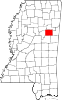
Towns Unincorporated
communitiesBradley | Clayton Village | Hickory Grove | Hickory Grove Estates | Longview | Oktoc | Osborn | Sessums
Footnotes ‡This populated place also has portions in an adjacent county or counties
Categories:- Mississippi counties
- Oktibbeha County, Mississippi


Wikimedia Foundation. 2010.