- Cleveland County, North Carolina
-
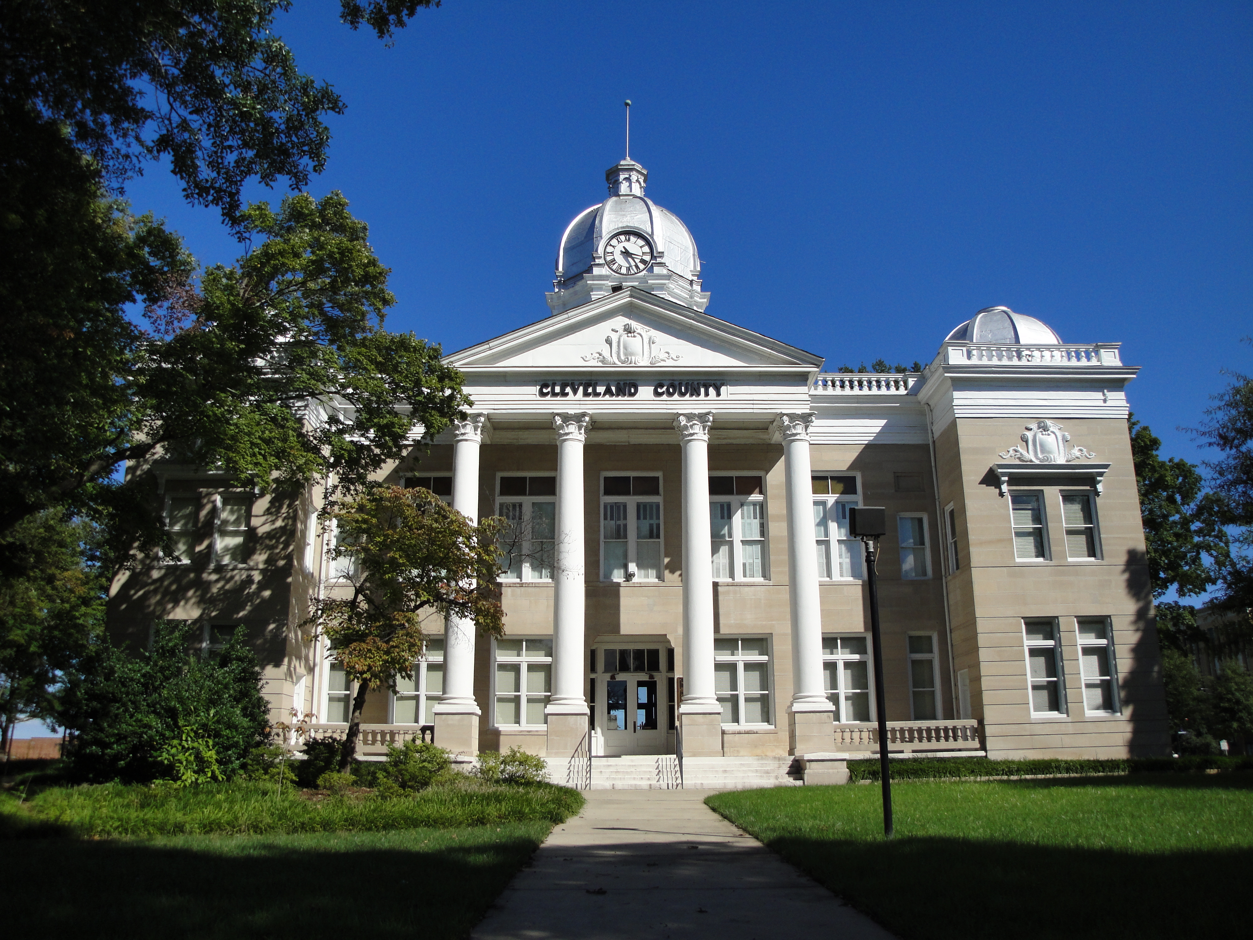
Cleveland County, North Carolina  The west side of the old Cleveland County Courthouse, Shelby
Seal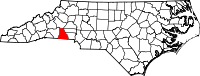
Location in the state of North Carolina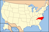
North Carolina's location in the U.S.Founded 1841 Seat Shelby Area
- Total
- Land
- Water
469 sq mi (1,215 km²)
465 sq mi (1,204 km²)
4 sq mi (10 km²), 0.85%Population
- (2010)
- Density
98,078
207/sq mi (80/km²)Website www.clevelandcounty.com Cleveland County is a county located in the U.S. state of North Carolina. As of 2010, the population was 98,078. Its county seat is Shelby[1].
Cleveland County grew in population 1.9% since the 2000 census.
Contents
History
The county was formed in 1841 from parts of Lincoln County and Rutherford County. It was named for Benjamin Cleveland, a colonel in the American Revolutionary War, who took part in the Battle of King's Mountain. From 1841 to 1887 "Cleaveland" was the spelling used; the present spelling was adopted in 1887.[2]
Law and government
Cleveland County is a member of the Isothermal Planning and Development Commission regional council of governments.
Geography
According to the U.S. Census Bureau, the county has a total area of 469 square miles (1,214.7 km2), of which 465 square miles (1,204.3 km2) is land and 4 square miles (10.4 km2) (0.85%) is water.
Townships
The county is divided into eleven townships, which are both numbered and named: 1 (River), 2 (Boiling Springs), 3 (Rippy), 4 (Kings Mountain), 5 (Warlick), 6 (Shelby), 7 (Sandy Run), 8 (Polkville), 9 (Double Shoals), 10 (Knob Creek), and 11 (Casar).
Adjacent counties
- Burke County, North Carolina - north
- Lincoln County, North Carolina - east-northeast
- Gaston County, North Carolina - east-southeast
- York County, South Carolina - southeast
- Cherokee County, South Carolina - south
- Rutherford County, North Carolina - west

Burke County Lincoln County Rutherford County 
Gaston County  Cleveland County, North Carolina

Cherokee County, South Carolina York County, South Carolina Demographics
As of the census[3] of 2010, there were 98,078 people, 37,046 households, and 27,006 families residing in the county. The population density was 207 people per square mile (80/km²). There were 40,317 housing units at an average density of 87 per square mile (34/km²). The racial makeup of the county was 74% White, 21% Black or African American, 0.15% Native American, 0.69% Asian, 0.01% Pacific Islander, 0.68% from other races, and 0.72% from two or more races. 3% of the population were Hispanic or Latino of any race.
There were 37,046 households out of which 32.20% had children under the age of 18 living with them, 55.00% were married couples living together, 13.70% had a female householder with no husband present, and 27.10% were non-families. 23.60% of all households were made up of individuals and 9.60% had someone living alone who was 65 years of age or older. The average household size was 2.53 and the average family size was 2.98.
In the county the population was spread out with 25.20% under the age of 18, 8.80% from 18 to 24, 28.80% from 25 to 44, 23.70% from 45 to 64, and 13.50% who were 65 years of age or older. The median age was 36 years. For every 100 females there were 92.60 males. For every 100 females age 18 and over, there were 88.60 males.
The median income for a household in the county was $35,283, and the median income for a family was $41,733. Males had a median income of $30,882 versus $21,995 for females. The per capita income for the county was $17,395. About 10.10% of families and 13.30% of the population were below the poverty line, including 17.90% of those under age 18 and 14.00% of those age 65 or over.
Local Schools
- Ambassador Bible College
- Cleveland Community College
- Cleveland County School System
- Gardner-Webb University
Cities and towns
 Map of Cleveland County, North Carolina With Municipal and Township Labels
- Belwood
- Boiling Springs
- Casar
- Earl
- Fallston
- Grover
- Kings Mountain (part also in Gaston County)
- Kingstown
- Lattimore
- Lawndale
- Light Oak
- Mooresboro
- Patterson Springs
- Polkville
- Shelby
- Waco
In Popular Culture
The mysterious disappearance of Asha Degree, a Cleveland County child missing since February 14, 2000, has been profiled on several television shows, including; America’s Most Wanted, The Oprah Winfrey Show, Good Morning America and The Montel Williams Show [4]
Cleveland County Fair has been home to what has become North Carolina’s largest agricultural fair and a highlight of traditional activities held annually in Cleveland County.
Notable people
- Bobby Bell, NFL Hall of Famer
- Alicia Bridges, disco singer
- W. J. Cash, Author of The Mind of the South
- Bill Champion, MLB player.[5]
- Morris Davis, Colonel in US Air Force
- Thomas Dixon, Jr., minister, author
- Manny Fernandez, "The Raging Bull", professional wrestler, former NFL player
- David Flair, Professional Wrestler
- Alvin Gentry, National Basketball Association NBA Coach
- Don Gibson, Country Music Hall of Famer
- Kay Hagan, current junior Senator from North Carolina.[6]
- Robert Harrill, The Fort Fisher Hermit
- Keith E. Haynes, Maryland Statesman, Lawyer
- Trey Hill, Grammy-nominated Guitarist, Songwriter and Producer. See SONICFLOOd.
- Norris Hopper, MLB player
- Hatcher Hughes, Pulitzer Prize winner
- Charlie Justice, NFL player, two-time Heisman Trophy runner-up
- Doug Limerick, ABC radio newscaster
- Patty Loveless, country music singer
- Nick Maddox, NFL running back
- Scottie Montgomery, NFL wide receiver, Oakland Raiders, Arena Football League player
- Travis Padgett, Olympic athlete in Track & Field
- Floyd Patterson, heavyweight boxing champion, Boxing Hall Of Famer
- Omar Porter, Actor
- Rodney Allen Rippy, former child actor
- Earl Scruggs, banjo player and composer on Hollywood Walk Of Fame
- Isaac Shelby, soldier, governor
- Charlotte Smith, WNBA basketball player
- Brandon Spikes, Florida Gators Linebacker
- Billy Standridge, NASCAR driver
- Tim Steele, 3-time ARCA champion, NASCAR driver
- David Thompson, NBA Hall of Famer
- Cliff Washburn, NFL offensive tackle, Houston Texans
- Tim Peeler, Corn liquor enthusiast, Bigfoot whisperer
- Tim Wilkison, Tennis
- Tom Wright, MLB player.[7]
See also
References
- ^ "Find a County". National Association of Counties. http://www.naco.org/Counties/Pages/FindACounty.aspx. Retrieved 2011-06-07.
- ^ Cleaveland County, North Carolina. Retrieved 2010-12-30.
- ^ "American FactFinder". United States Census Bureau. http://factfinder.census.gov. Retrieved 2008-01-31.
- ^ http://www.shelbystar.com/articles/morning-49662-degree-america.html
- ^ "Bill Champion's career statistics". baseball-reference.com. http://www.baseball-reference.com/c/champbi01.shtml. Retrieved 2009-03-29.
- ^ "About Kay Hagan". United States Senate. http://hagan.senate.gov/?p=biography. Retrieved 2009-05-12.
- ^ "Tom Wright's career statistics". retrosheet.org. http://www.retrosheet.org/boxesetc/W/Pwrigt101.htm. Retrieved 2008-09-08.
External links
- Cleveland County government official website
- Cleveland County Online Taxes web site
- Cleveland Community College Official Website
Charlotte Metropolitan Area Counties 
Major city Cities and towns
20k-99kConcord • Gastonia • Huntersville • Kannapolis • Matthews • Monroe • Hickory • Mooresville • Rock Hill • Salisbury • Shelby • StatesvilleCities and towns
5k-20kAlbemarle • Belmont • Bessemer City • Chester • Cherryville • Conover • Cornelius • Davidson • Fort Mill • Indian Trail • Kings Mountain • Lancaster • Lincolnton • Mint Hill • Mount Holly • South Gastonia • Unionville • Wadesboro • Weddington • YorkFootnotes Bold = principal metro cities • Italic = places and counties part of CSAMunicipalities and communities of Cleveland County, North Carolina Cities 
Towns Belwood | Boiling Springs | Casar | Earl | Fallston | Grover | Kingstown | Lattimore | Lawndale | Mooresboro | Patterson Springs | Waco
CDP Unincorporated
communitiesFootnotes ‡This populated place also has portions in an adjacent county or counties
Categories:- North Carolina counties
- Cleveland County, North Carolina
- 1841 establishments in the United States
- Populated places established in 1841


Wikimedia Foundation. 2010.