- Admiralty Mountains
-
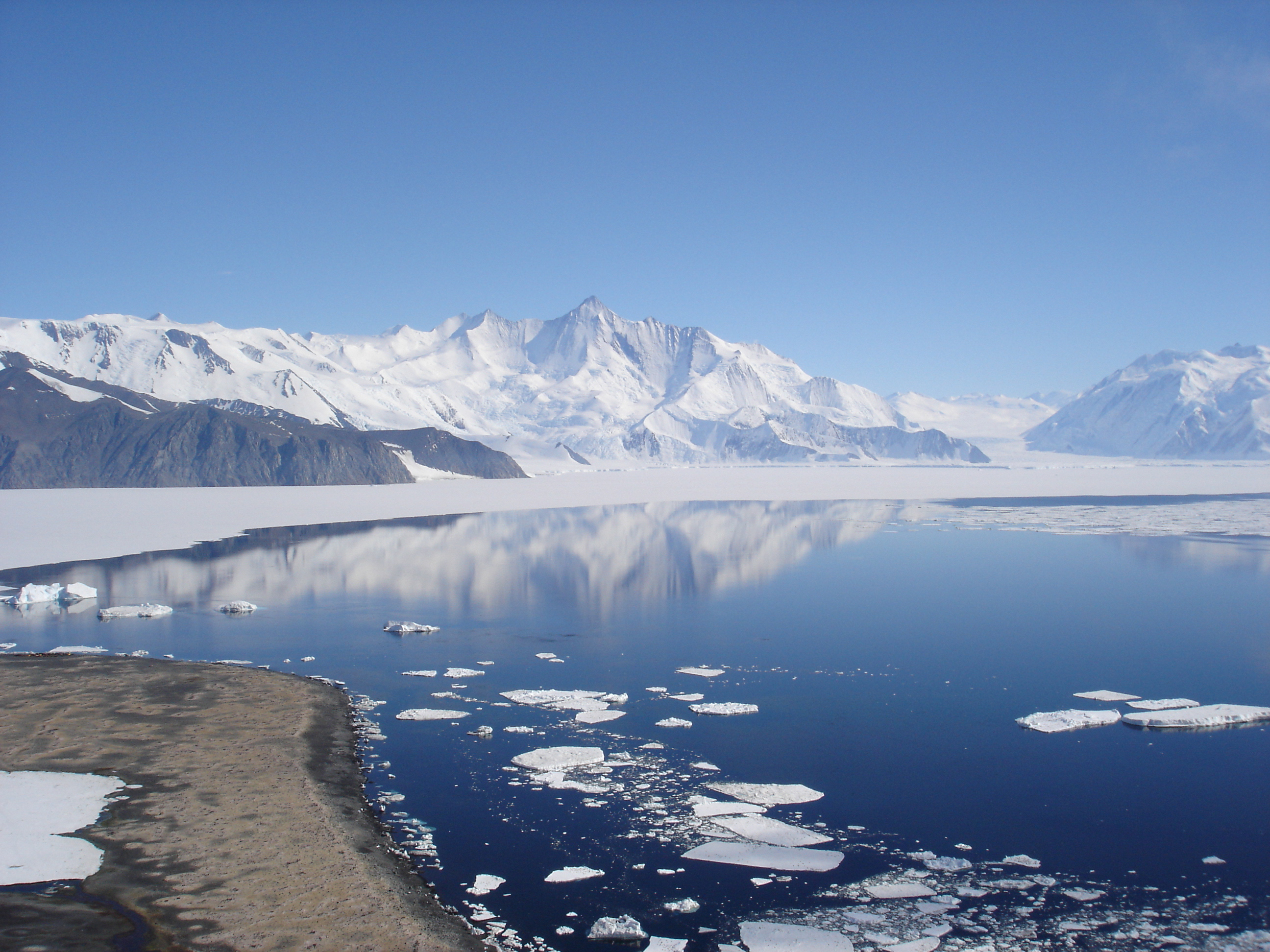
Admiralty Mountains Range  Mount Herschel (3,335 m) in the Admiralty Mountains as seen from Cape Hallett
Continent Antarctica Region Victoria Land Part of Transantarctic Mountains Highest point Mount Minto - elevation 4,165 m (13,665 ft) - coordinates 71°47′S 168°45′E / 71.783°S 168.75°E Coordinates: 71°45′S 168°30′E / 71.75°S 168.5°E The Admiralty Mountains (alternatively Admiralty Range) is a large group of high mountains and individually-named ranges and ridges in northeastern Victoria Land of Antarctica. This mountain group is bounded by the Ross Sea, the Southern Ocean, and by the Dennistoun, Ebbe, and Tucker glaciers.[1]
Discovered in January 1841 by Captain James Ross who named them for the Lords Commissioners of the Admiralty under whose orders he served.[1]
The Admiralty Mountains is divided into the Dunedin Range, Homerun Range, and Lyttelton Range.
Mountains and peaks
This range includes the following mountains and peaks:
Mountain/Peak metres feet coordinates Mount Minto 4,165 13,665 71°47′S 168°45′E / 71.783°S 168.75°E Mount Adam 4,010 13,156 71°47′S 168°37′E / 71.783°S 168.617°E Mount Ajax 3,770 12,369 71°48′S 168°27′E / 71.8°S 168.45°E Mount Sabine 3,720 12,205 71°55′S 169°33′E / 71.917°S 169.55°E Mount Royalist 3,640 11,942 71°47′S 168°30′E / 71.783°S 168.5°E Mount Bevin 3,490 11,450 71°54′S 169°27′E / 71.9°S 169.45°E Mount Black Prince 3,405 11,171 71°47′S 168°15′E / 71.783°S 168.25°E Mount Peacock 3,210 10,531 72°13′S 169°27′E / 72.217°S 169.45°E Mount Gilruth 3,160 10,367 71°44′S 168°48′E / 71.733°S 168.8°E Mount Achilles 2,880 9,449 71°53′S 168°08′E / 71.883°S 168.133°E Mount Parker 1,260 4,134 71°15′S 168°05′E / 71.25°S 168.083°E Mount Achilles
Mount Achilles is a prominent pyramidal mountain rising from the divide between Fitch Glacier and Man-o-War Glacier. Named by New Zealand Geological Survey Antarctic Expedition (NZGSAE), 1957–58, after the former New Zealand cruiser HMNZS Achilles.[2]
Mount Adam
Mount Adam is situated 4 km (2.5 mi) WNW of Mount Minto. Discovered in January 1841 by Captain Ross who named this feature for Vice Admiral Sir Charles Adam, a senior naval lord of the Admiralty.[3]
Mount Ajax
Mount Ajax rises 1.5 km (1 mi) WSW of Mount Royalist. Named by the New Zealand GSAE, 1957–58, after HMNZS Ajax. The mountain is one of several in this area named for New Zealand ships.[4]
Mount Bevin
Mount Bevin is a prominent sharply pointed mountain at the western side of the head of Murray Glacier. The mountain stands 2 miles (3.2 km) west-northwest of Mount Sabine. Named by Advisory Committee on Antarctic Names (US-ACAN) (2004) after Anthony (Tony) J. Bevin, Surveyor-General of New Zealand, and Chairman of the New Zealand Geographic Board, 1996–2004, with responsibility for New Zealand surveying and place naming in Antarctica.[5]
Mount Black Prince
Mount Black Prince is composed of dark colored rock, which tends to create an imposing appearance. Located 6 km (3.7 mi) west of Mount Ajax. Named by the New Zealand Geological Survey Antarctic Expedition (NZ GSAE), 1957–58, for its appearance and also for the New Zealand Cruiser HMNZS Black Prince.[6]
Mount Gilruth
Mount Gilruth is a mostly ice-covered mountain (3,160 m) 4.5 nautical miles (8 km) east-northeast of Mount Adam. Mapped by United States Geological Survey (USGS) from surveys and U.S. Navy air photos, 1960-63. Named by Advisory Committee on Antarctic Names (US-ACAN) for Robert R. Gilruth of the National Aeronautics and Space Administration, a visitor at McMurdo Station, 1966-67.[7]
Mount Minto
Mount Minto is a lofty, mostly ice-free mountain located 4 km (2.5 mi) E of Mount Adam in the central portion of the range. Discovered in January 1841 by Captain James Ross, who named it for the Earl of Minto, then First Lord of the Admiralty.[8] The first ascent was made in 1988 by the Australian Bicentennial Antarctic Expedition led by Greg Mortimer and included Lincoln Hall.[9]
Mount Parker
Mount Parker is a bluff-type mountain along the western side of Nash Glacier. The area was mapped by the USGS from surveys and U.S. Navy air photos, 1960-63. The name Mount Parker was given to a mountain in this general vicinity by Captain James Ross, in 1840, honoring Vice Admiral Sir William Parker, a senior naval lord of the Admiralty, 1834-41. For the sake of historical continuity US-ACAN has retained the name for this mountain.[10]
Mount Peacock
Mount Peacock is a high peak standing directly at the head of Kelly Glacier, 2.6 km (1.6 mi) southwest of Mount Herschel. It was discovered in January 1841 by Captain Ross who named it for the Very Reverend Dr. George Peacock, Dean of Ely.[11]
Mount Royalist
Mount Royalist is a prominent mountain standing 3 km (1.9 mi) west of Mount Adam. Named by the New Zealand GSAE, 1957–58, for its impressive appearance and also for the New Zealand cruiser HMNZS Royalist. Several adjacent peaks are named for New Zealand ships including Mount Ajax and Mount Black Prince.[12]
Mount Sabine
Mount Sabine is a prominent, relatively snow-free mountain rising between the heads of Murray Glacier and Burnette Glacier. Discovered on January 11, 1841 by Captain James Ross, Royal Navy, who named this feature for Lieutenant Colonel Edward Sabine of the Royal Artillery, Foreign Secretary of the Royal Society, one of the most active supporters of the expedition.[13]
References
- ^ a b "Admiralty Mountains". Geographic Names Information System, U.S. Geological Survey. http://geonames.usgs.gov/pls/gnispublic/f?p=gnispq:5:::NO::P5_ANTAR_ID:94. Retrieved 2004-10-31.
- ^ "Mount Achilles". Geographic Names Information System, U.S. Geological Survey. http://geonames.usgs.gov/pls/gnispublic/f?p=gnispq:5:::NO::P5_ANTAR_ID:45. Retrieved 2008-03-23.
- ^ "Mount Adam". Geographic Names Information System, U.S. Geological Survey. http://geonames.usgs.gov/pls/gnispublic/f?p=gnispq:5:::NO::P5_ANTAR_ID:61. Retrieved 2004-11-04.
- ^ "Mount Ajax". Geographic Names Information System, U.S. Geological Survey. http://geonames.usgs.gov/pls/gnispublic/f?p=gnispq:5:::NO::P5_ANTAR_ID:162. Retrieved 2004-11-02.
- ^ "Mount Bevin". Geographic Names Information System, U.S. Geological Survey. http://geonames.usgs.gov/pls/gnispublic/f?p=gnispq:5:::NO::P5_ANTAR_ID:18690. Retrieved 2007-03-12.
- ^ "Mount Black Prince". Geographic Names Information System, U.S. Geological Survey. http://geonames.usgs.gov/pls/gnispublic/f?p=gnispq:5:::NO::P5_ANTAR_ID:1465. Retrieved 2004-11-02.
- ^ "Mount Gilruth". Geographic Names Information System, U.S. Geological Survey. http://geonames.usgs.gov/pls/gnispublic/f?p=gnispq:5:::NO::P5_ANTAR_ID:5695. Retrieved 2009-02-19.
- ^ "Mount Minto". Geographic Names Information System, U.S. Geological Survey. http://geonames.usgs.gov/pls/gnispublic/f?p=gnispq:5:::NO::P5_ANTAR_ID:10047. Retrieved 2007-01-29.
- ^ "Half Sledge - Greg Mortimer, Mt Minto, 1988". Museum Victoria. http://museumvictoria.com.au/learning-federation/antarctic-collection/half-sledge---greg-mortimer-mt-minto/. Retrieved 2010-05-12.
- ^ "Mount Parker". Geographic Names Information System, U.S. Geological Survey. http://geonames.usgs.gov/pls/gnispublic/f?p=gnispq:5:::NO::P5_ANTAR_ID:11368. Retrieved 2004-10-31.
- ^ "Mount Peacock". Geographic Names Information System, U.S. Geological Survey. http://geonames.usgs.gov/pls/gnispublic/f?p=gnispq:5:::NO::P5_ANTAR_ID:11477. Retrieved 2007-03-12.
- ^ "Mount Royalist". Geographic Names Information System, U.S. Geological Survey. http://geonames.usgs.gov/pls/gnispublic/f?p=gnispq:5:::NO::P5_ANTAR_ID:12984. Retrieved 2004-11-02.
- ^ "Mount Sabine". Geographic Names Information System, U.S. Geological Survey. http://geonames.usgs.gov/pls/gnispublic/f?p=gnispq:5:::NO::P5_ANTAR_ID:13115. Retrieved 2007-03-12.
Categories:- Admiralty Mountains
- Mountain ranges of Victoria Land
- Pennell Coast
Wikimedia Foundation. 2010.