- Colleton County, South Carolina
-
"Colleton" redirects here. For other uses, see Colleton (disambiguation).
Colleton County, South Carolina 
Location in the state of South Carolina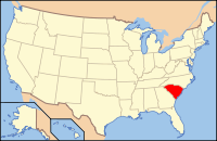
South Carolina's location in the U.S.Founded 1798 Seat Walterboro Area
- Total
- Land
- Water
1,133 sq mi (2,934 km²)
1,056 sq mi (2,735 km²)
77 sq mi (199 km²), 6.78%Population
- (2000)
- Density
38,264
36/sq mi (14/km²)Website www.colletoncounty.org Colleton County is a county located in the U.S. state of South Carolina. In 2000, its population was 38,264 (estimated 2005 pop.: 39,605). Its county seat is Walterboro.[1] It is named after Sir John Colleton, 1st Baronet, one of the eight Lords Proprietor of the Province of Carolina.
Contents
History
In 1682 Colleton was created as one of the three original proprietary counties, located in the southwestern coastal portion of the new South Carolina Colony, bordering on the Combahee River. In 1706 the county was divided between the new Saint Bartholomew's and Saint Paul's Parishes. In 1734 most of the coastal portion of Saint Paul's Parish was separated to form the new Saint John's Colleton Parish. In 1769 the three parishes were absorbed into the Charleston Judicial District, the southwestern portion of which was referred to as Saint Bartholomew's.
In 1800 the new Colleton District was formed from the western half of the Charleston District. In 1816 it annexed a small portion of northwestern Charleston District.
In 1868, under the revised state constitution, South Carolina districts became counties, with officials elected by the resident voters rather than by state officials as done previously.
In 1897 the northeastern portion of the county was separated to form the new Dorchester County, with its seat at Saint George. In 1911 the portion of the county east of the Edisto River was annexed to Charleston County. In 1919 and again in 1920, tiny portions of northwestern Colleton County were annexed to Bamberg County, thus bringing the county down to its present size.
Geography
According to the U.S. Census Bureau, the county has a total area of 1,133 square miles (2,934.5 km2), of which 1,056 square miles (2,735.0 km2) is land and 77 square miles (199.4 km2) (6.78%) is water.[2]
Adjacent counties
- Orangeburg County, South Carolina - north
- Dorchester County, South Carolina - northeast
- Charleston County, South Carolina - east
- Beaufort County, South Carolina - south
- Hampton County, South Carolina - west
- Allendale County, South Carolina - west
- Bamberg County, South Carolina - northwest
National protected area
Demographics
As of the census[3] of 2000, there were 38,264 people, 14,470 households, and 10,490 families residing in the county. The population density was 36 people per square mile (14/km²). There were 18,129 housing units at an average density of 17 per square mile (7/km²). The racial makeup of the county was 55.52% White, 42.18% Black or African American, 0.63% Native American, 0.25% Asian, 0.04% Pacific Islander, 0.56% from other races, and 0.82% from two or more races. 1.44% of the population were Hispanic or Latino of any race.
There were 14,470 households out of which 33.10% had children under the age of 18 living with them, 51.10% were married couples living together, 16.80% had a female householder with no husband present, and 27.50% were non-families. 24.00% of all households were made up of individuals and 10.10% had someone living alone who was 65 years of age or older. The average household size was 2.62 and the average family size was 3.11.
In the county, the population was spread out with 27.50% under the age of 18, 8.00% from 18 to 24, 26.90% from 25 to 44, 24.70% from 45 to 64, and 12.90% who were 65 years of age or older. The median age was 36 years. For every 100 females there were 91.90 males. For every 100 females age 18 and over, there were 87.90 males.
The median income for a household in the county was $29,733, and the median income for a family was $34,169. Males had a median income of $28,518 versus $19,228 for females. The per capita income for the county was $14,831. About 17.30% of families and 21.10% of the population were below the poverty line, including 28.70% of those under age 18 and 19.10% of those age 65 or over.
According to the 2000 Census, the Colleton County population is nearly 75% rural, with the exception of the Walterboro Urban Cluster (2000 pop.: 10,064). The total county population is also designated as the Walterboro Micropolitan Statistical Area.
Cities and towns
- Cottageville
- Edisto Beach
- Green Pond
- Lodge
- Round O
- Ruffin
- Smoaks
- Walterboro
- Williams
- Jacksonboro
See also
References
- ^ "Find a County". National Association of Counties. http://www.naco.org/Counties/Pages/FindACounty.aspx. Retrieved 2011-06-07.
- ^ "US Gazetteer files: 2010, 2000, and 1990". United States Census Bureau. 2011-02-12. http://www.census.gov/geo/www/gazetteer/gazette.html. Retrieved 2011-04-23.
- ^ "American FactFinder". United States Census Bureau. http://factfinder.census.gov. Retrieved 2008-01-31.
External links

Bamberg County Orangeburg County Dorchester County Allendale County and Hampton County 
Charleston County  Colleton County, South Carolina

Beaufort County Municipalities and communities of Colleton County, South Carolina County seat: Walterboro City 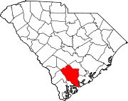
Towns Cottageville | Edisto Beach | Lodge | Smoaks | Williams
Unincorporated
communityThe Lowcountry of South Carolina Counties 
Major communities Beaufort • Bluffton • Estill • Hampton • Hardeeville • Hilton Head Island • Port Royal • Ridgeland • Walterboro • Varnville • YemasseeSea Islands Daufuskie Island • Edisto Island • Fripp Island • Harbor Island • Hilton Head Island • Hunting Island • Lady's Island • St. Helena IslandHistory & culture Historic places • Beaufort (history of - historic district) • Cuisine • Gullah culture • Port Royal Experiment • Sea Islands HurricaneMilitary installations Natural areas ACE Basin • Hunting Island State Park & Lighthouse • Pinckney Island NWR • Savannah NWR • Sea IslandsOther articles Categories:- South Carolina counties
- Colleton County, South Carolina
- 1798 establishments in the United States
- Populated places established in 1798


Wikimedia Foundation. 2010.